| Memorials | : | 0 |
| Location | : | Lyerly, Chattooga County, USA |
| Coordinate | : | 34.3820670, -85.4269620 |
| Description | : | This cemetery has 4-5 grave covers (slabs) that have legible names carved on them. There are several other unmarked rocks that seem to have been used to mark the location of graves, but these contain no cravings so it is not possible to know the identify of the additional persons buried. Additionally, there are other depressions in the ground that seem like they may be unmarked graves. This cemetery is no longer in use and is located on private property. |
frequently asked questions (FAQ):
-
Where is Moore Cemetery?
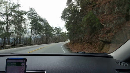
Moore Cemetery is located at Hwy 114 Lyerly, Chattooga County ,Georgia ,USA.
-
Moore Cemetery cemetery's updated grave count on graveviews.com?
0 memorials
-
Where are the coordinates of the Moore Cemetery?
Latitude: 34.3820670
Longitude: -85.4269620
Nearby Cemetories:
1. Lyerly Cemetery #02
Lyerly, Chattooga County, USA
Coordinate: 34.3964750, -85.4162380
2. Sardis Baptist Church Cemetery
Chattooga County, USA
Coordinate: 34.3523880, -85.4434500
3. Pond Spring Church AME Zion Cemetery
Lyerly, Chattooga County, USA
Coordinate: 34.3607150, -85.3948050
4. Lyerly Cemetery
Lyerly, Chattooga County, USA
Coordinate: 34.4094009, -85.3966980
5. Finley Chapel Church Cemetery
Lyerly, Chattooga County, USA
Coordinate: 34.3459237, -85.4027353
6. Oak Hill Cemetery
Lyerly, Chattooga County, USA
Coordinate: 34.4093000, -85.4671100
7. Adams Cemetery
Chattooga County, USA
Coordinate: 34.3386002, -85.4291992
8. Johnson Cemetery
Lyerly, Chattooga County, USA
Coordinate: 34.3418999, -85.4602966
9. South Carolina Campground Cemetery
Holland, Chattooga County, USA
Coordinate: 34.3838120, -85.3644791
10. Price's Bridge Road Cemetery
Chattoogaville, Chattooga County, USA
Coordinate: 34.3314000, -85.4514600
11. New Hope South Baptist Church Cemetery
Holland, Chattooga County, USA
Coordinate: 34.3342800, -85.3763100
12. Perennial Springs Baptist Church Cemetery
Summerville, Chattooga County, USA
Coordinate: 34.4530620, -85.4198440
13. Mount Bethel Cemetery
Broomtown, Cherokee County, USA
Coordinate: 34.3722000, -85.5147018
14. Berea Cemetery
Cherokee County, USA
Coordinate: 34.4122009, -85.5130997
15. Berryton Cemetery
Summerville, Chattooga County, USA
Coordinate: 34.4569016, -85.3852997
16. Alexander Cemetery
Berry Springs, Cherokee County, USA
Coordinate: 34.4294014, -85.5158005
17. Alpine Community Church Cemetery
Menlo, Chattooga County, USA
Coordinate: 34.4614520, -85.4838770
18. Mill Creek Cemetery
Gaylesville, Cherokee County, USA
Coordinate: 34.3036003, -85.4944000
19. Dodd Cemetery
Chattooga County, USA
Coordinate: 34.4508895, -85.3449147
20. Old Johnson Cemetery
Summerville, Chattooga County, USA
Coordinate: 34.4606018, -85.3555984
21. Hopewell Cemetery
Hopewell, Cherokee County, USA
Coordinate: 34.3097600, -85.5121300
22. Pleasant Green Church Memorial Monument
Chattooga County, USA
Coordinate: 34.4818993, -85.4067001
23. Antioch Old Cemetery
Floyd County, USA
Coordinate: 34.3671650, -85.3016710
24. Mount Zion Cemetery
Cherokee County, USA
Coordinate: 34.3678017, -85.5524979

