
| Memorials | : | 0 |
| Location | : | Blue Springs, Jackson County, USA |
| Coordinate | : | 39.0480003, -94.2730026 |
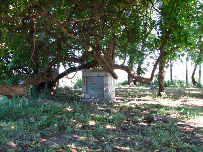
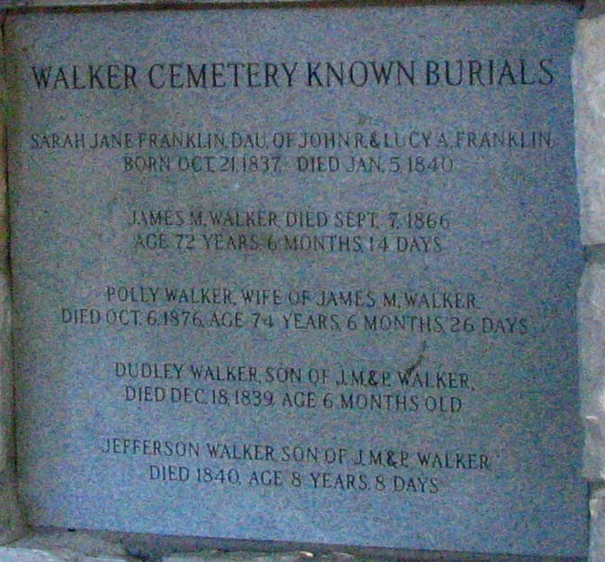
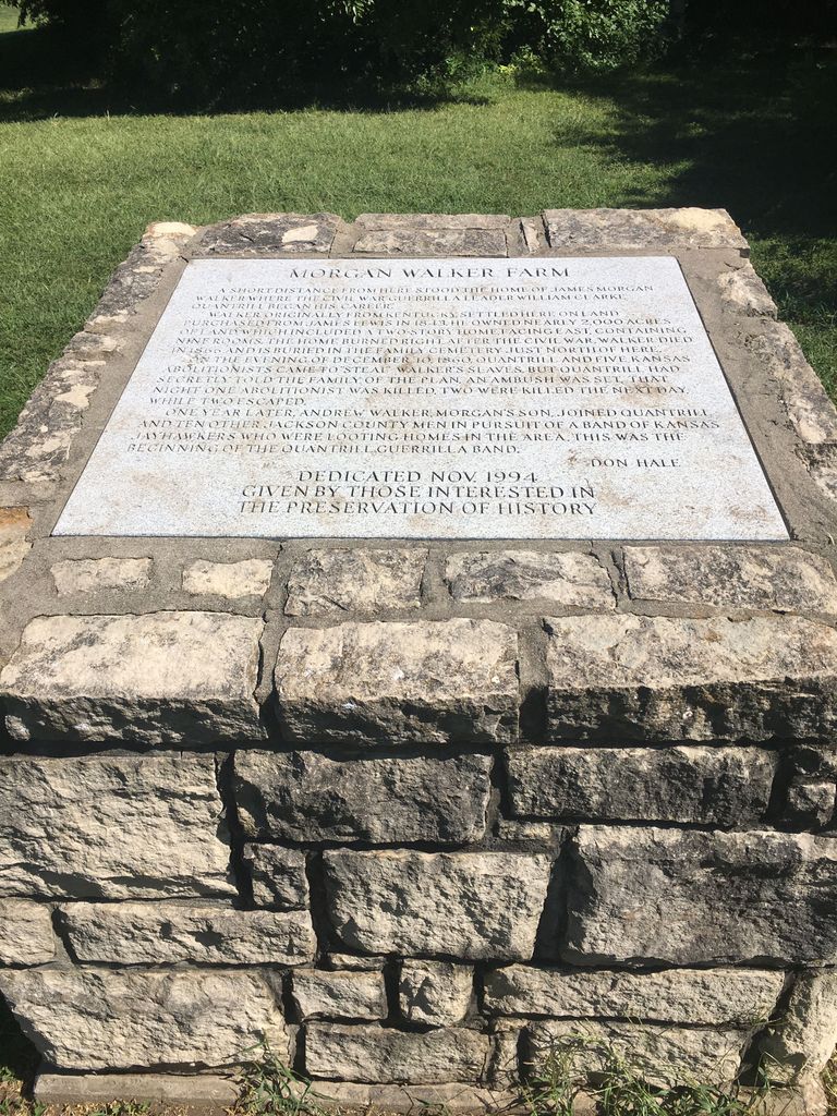
| Description | : | All of the original stones are gone. This cemetery lies adjacent to the property of the James Walker Elementary School in Blue Springs, Missouri. There are two monuments at the entrance to a small grove of trees. One marker has a list of the known five burials here, although it is believed there are more than five actually here. The inscription on the other monument reads: MORGAN WALKER FARM A short distance from here stood the house of James Morgan Walker. Where the Civil War guerilla leader William Clarke Quantrell began his career. Walker originally from Kentucky, settled here on land... Read More |
frequently asked questions (FAQ):
-
Where is Morgan Walker Cemetery?
Morgan Walker Cemetery is located at Blue Springs, Jackson County ,Missouri ,USA.
-
Morgan Walker Cemetery cemetery's updated grave count on graveviews.com?
0 memorials
-
Where are the coordinates of the Morgan Walker Cemetery?
Latitude: 39.0480003
Longitude: -94.2730026
Nearby Cemetories:
1. Lobb Cemetery
Independence, Jackson County, USA
Coordinate: 39.0710983, -94.2889023
2. Blue Springs Cemetery
Blue Springs, Jackson County, USA
Coordinate: 39.0158005, -94.2941971
3. Swan Lake Memorial Gardens
Grain Valley, Jackson County, USA
Coordinate: 39.0578995, -94.2257996
4. Gibson-Russell Cemetery
Independence, Jackson County, USA
Coordinate: 39.0674000, -94.3161800
5. First United Methodist Church Columbarium
Blue Springs, Jackson County, USA
Coordinate: 39.0162500, -94.3021000
6. Slaughter Cemetery
Grain Valley, Jackson County, USA
Coordinate: 39.0613330, -94.2235350
7. Louis Gore Family Cemetery
Blue Springs, Jackson County, USA
Coordinate: 38.9989000, -94.2636200
8. Stanley Cemetery
Blue Springs, Jackson County, USA
Coordinate: 39.0141983, -94.3208008
9. Oakland Cemetery
Buckner, Jackson County, USA
Coordinate: 39.0793991, -94.2202988
10. Valley Memorial Gardens
Grain Valley, Jackson County, USA
Coordinate: 39.0103989, -94.2158508
11. Bridges Cemetery
Blue Springs, Jackson County, USA
Coordinate: 38.9870200, -94.2826000
12. Johnson Family Cemetery
Lee's Summit, Jackson County, USA
Coordinate: 39.0048730, -94.3371080
13. Perdee Chapel Cemetery
Grain Valley, Jackson County, USA
Coordinate: 38.9902992, -94.2307968
14. Grain Valley Cemetery
Grain Valley, Jackson County, USA
Coordinate: 39.0264015, -94.1877975
15. Webb-Graham Cemetery
Grain Valley, Jackson County, USA
Coordinate: 39.0791800, -94.1923900
16. Chiddix-Johnson Cemetery
Grain Valley, Jackson County, USA
Coordinate: 39.0793991, -94.1919022
17. Cowherd Cemetery
Jackson County, USA
Coordinate: 38.9720001, -94.2979965
18. Saint Clair Cemetery
Grain Valley, Jackson County, USA
Coordinate: 39.0717010, -94.1710968
19. Webb Cemetery
Independence, Jackson County, USA
Coordinate: 39.1138600, -94.3403200
20. Luttrell Cemetery
Independence, Jackson County, USA
Coordinate: 39.0504700, -94.3839300
21. Saint Michael's Memorial Garden
Independence, Jackson County, USA
Coordinate: 39.0468200, -94.3877300
22. Woods Chapel Cemetery
Lee's Summit, Jackson County, USA
Coordinate: 38.9827385, -94.3537216
23. Oak Ridge Memory Gardens
Independence, Jackson County, USA
Coordinate: 39.1046982, -94.3638992
24. Hall Family Cemetery
Jackson County, USA
Coordinate: 39.1397280, -94.2667280