
| Memorials | : | 2636 |
| Location | : | State Park, Richland County, USA |
| Coordinate | : | 34.0879240, -80.9898380 |
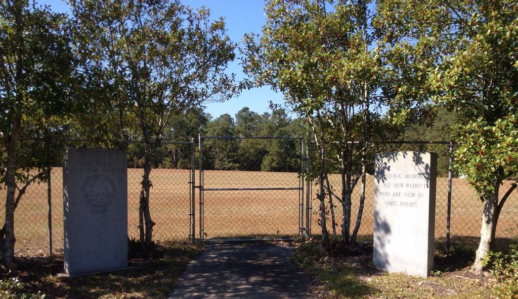
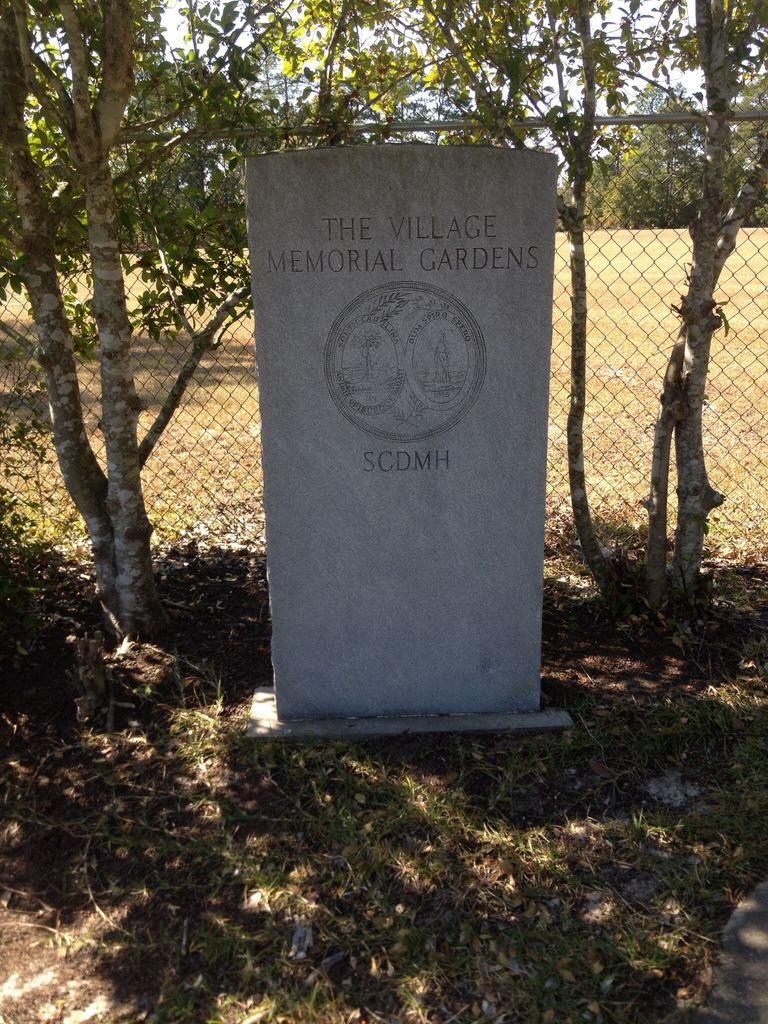
| Description | : | Morris Village Cemetery has been in continuous use since 1922 and until 1966, received only African American patients. It is located directly beside the Farrow Rd. facility. This cemetery was used after the hospital stopped using the cemetery on Slighs Ave in 1922. The grounds are fenced and a memorial stands at it's entrance. Almost all of the gravestones are visible and intact. It is believed there are over 2,000 burials here. It is also known as the "Village Memorial Gardens." This hospital was part of the state hospital in Columbia, but known as Palmettos State Hospital, then later Crafts-Farrow State... Read More |
frequently asked questions (FAQ):
-
Where is Morris Village Cemetery?
Morris Village Cemetery is located at 610 Faison Dr State Park, Richland County ,South Carolina ,USA.
-
Morris Village Cemetery cemetery's updated grave count on graveviews.com?
60 memorials
-
Where are the coordinates of the Morris Village Cemetery?
Latitude: 34.0879240
Longitude: -80.9898380
Nearby Cemetories:
1. Columbia Friends Meeting Cemetery
Columbia, Richland County, USA
Coordinate: 34.0949610, -80.9716150
2. Pisgah Church Road Cemetery
Columbia, Richland County, USA
Coordinate: 34.0958670, -80.9710550
3. Gill Creek Baptist Church Cemetery
Columbia, Richland County, USA
Coordinate: 34.0758910, -81.0120900
4. Saint Patricks Cemetery
Columbia, Richland County, USA
Coordinate: 34.0669000, -81.0092000
5. Bethlehem Bapt. Church Family Life Center Cemetery
Columbia, Richland County, USA
Coordinate: 34.0597440, -81.0124540
6. LeGrand Road Cemetery
Columbia, Richland County, USA
Coordinate: 34.0895000, -80.9479300
7. Rehoboth United Methodist Church
Richland County, USA
Coordinate: 34.0618640, -80.9611580
8. One Faith Ministries Cemetery
Columbia, Richland County, USA
Coordinate: 34.1079520, -81.0256040
9. Fair Lawn United Methodist Church Cemetery
Columbia, Richland County, USA
Coordinate: 34.1233870, -80.9964610
10. Pine Ridge Cemetery
Columbia, Richland County, USA
Coordinate: 34.0539017, -81.0124969
11. Cook Cemetery
Columbia, Richland County, USA
Coordinate: 34.0497220, -80.9809250
12. Antioch Baptist Church Cemetery
Columbia, Richland County, USA
Coordinate: 34.0525790, -81.0114780
13. Serenity Memorial Gardens
Columbia, Richland County, USA
Coordinate: 34.0642014, -81.0286026
14. Memorial Gardens of Columbia
Columbia, Richland County, USA
Coordinate: 34.1278400, -80.9934800
15. Jackson Creek Baptist Church Cemetery
Dentsville, Richland County, USA
Coordinate: 34.0807710, -80.9405490
16. Free Hope Free Will Cemetery
Columbia, Richland County, USA
Coordinate: 34.1130170, -80.9479630
17. Dent Cemetery
Columbia, Richland County, USA
Coordinate: 34.0560620, -81.0276490
18. Promised Land Cemetery
Columbia, Richland County, USA
Coordinate: 34.0423830, -80.9960170
19. Beth Shalom Arcadia Lakes Cemetery
Columbia, Richland County, USA
Coordinate: 34.0487840, -80.9583910
20. Mount Pilgrim Baptist Church Cemetery
Killian, Richland County, USA
Coordinate: 34.1191680, -80.9468150
21. Mount Olive AME Church Cemetery
Columbia, Richland County, USA
Coordinate: 34.0885990, -81.0476660
22. Palmetto Cemetery
Columbia, Richland County, USA
Coordinate: 34.0521785, -81.0290293
23. Forest Lake Presbyterian Church Memorial Garden
Columbia, Richland County, USA
Coordinate: 34.0457610, -80.9604940
24. Rials Family Cemetery
Forest Acres, Richland County, USA
Coordinate: 34.0401070, -80.9737340