
| Memorials | : | 31 |
| Location | : | Marietta, Washington County, USA |
| Coordinate | : | 39.4199829, -81.4518661 |
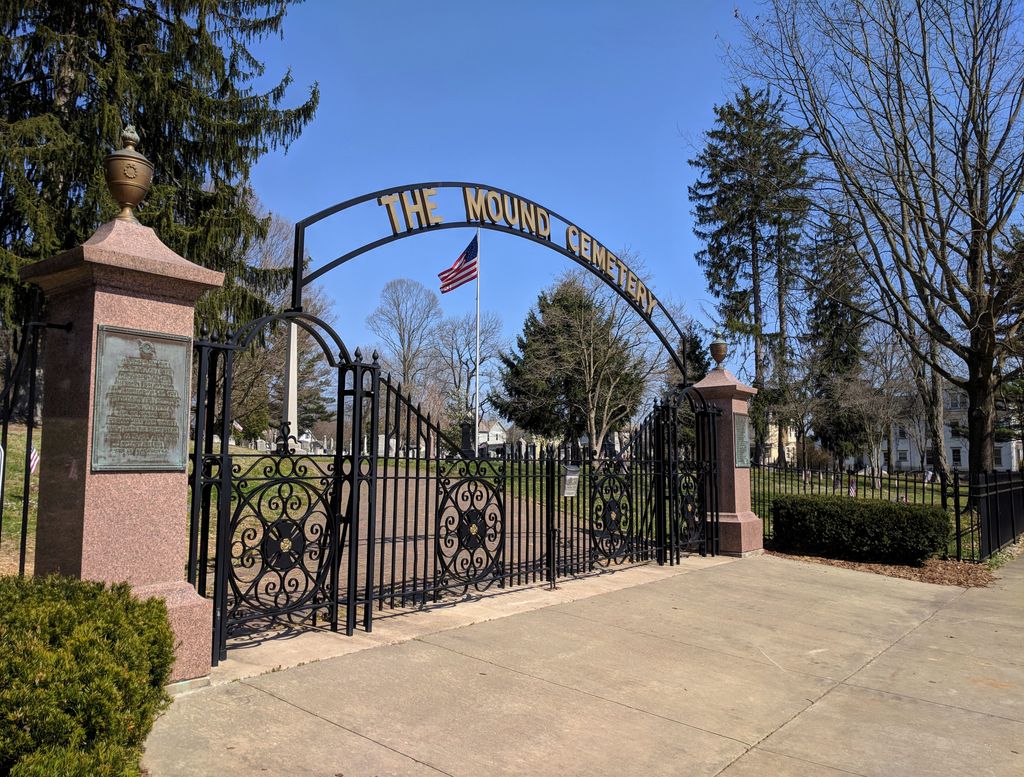
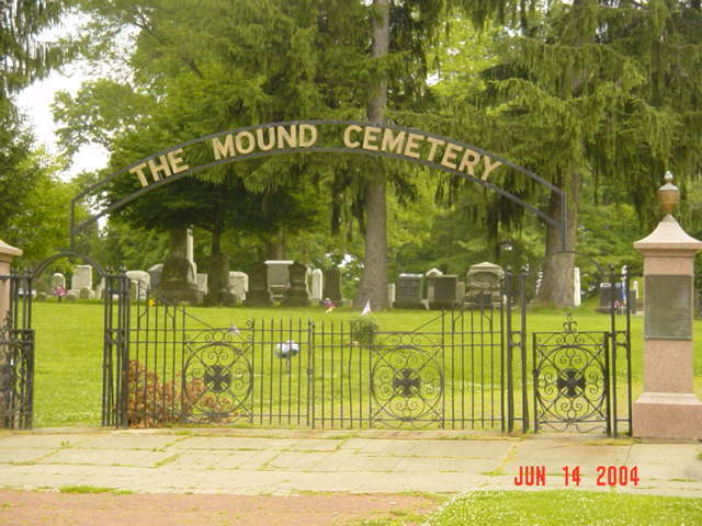
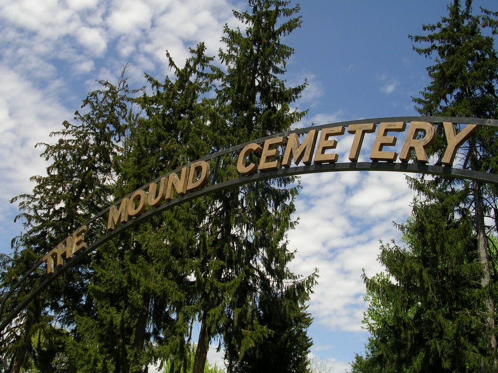
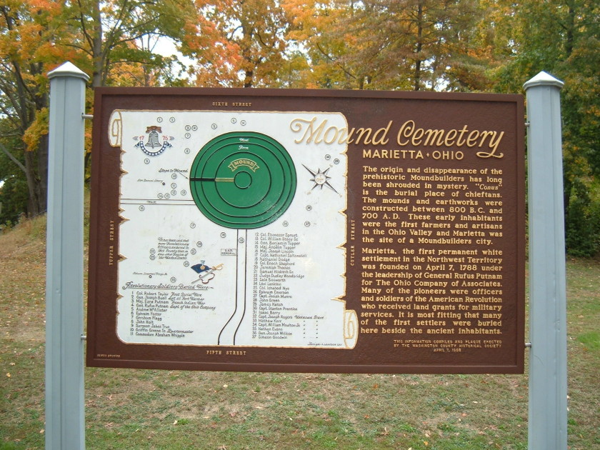
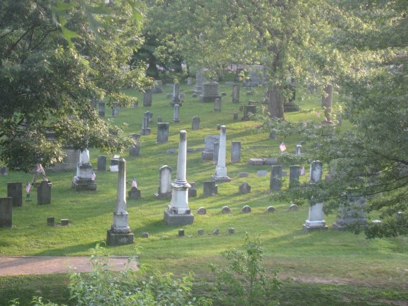
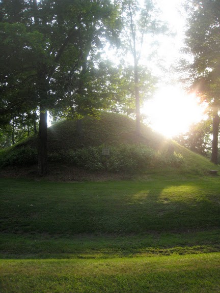
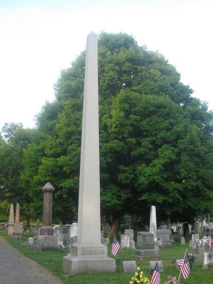
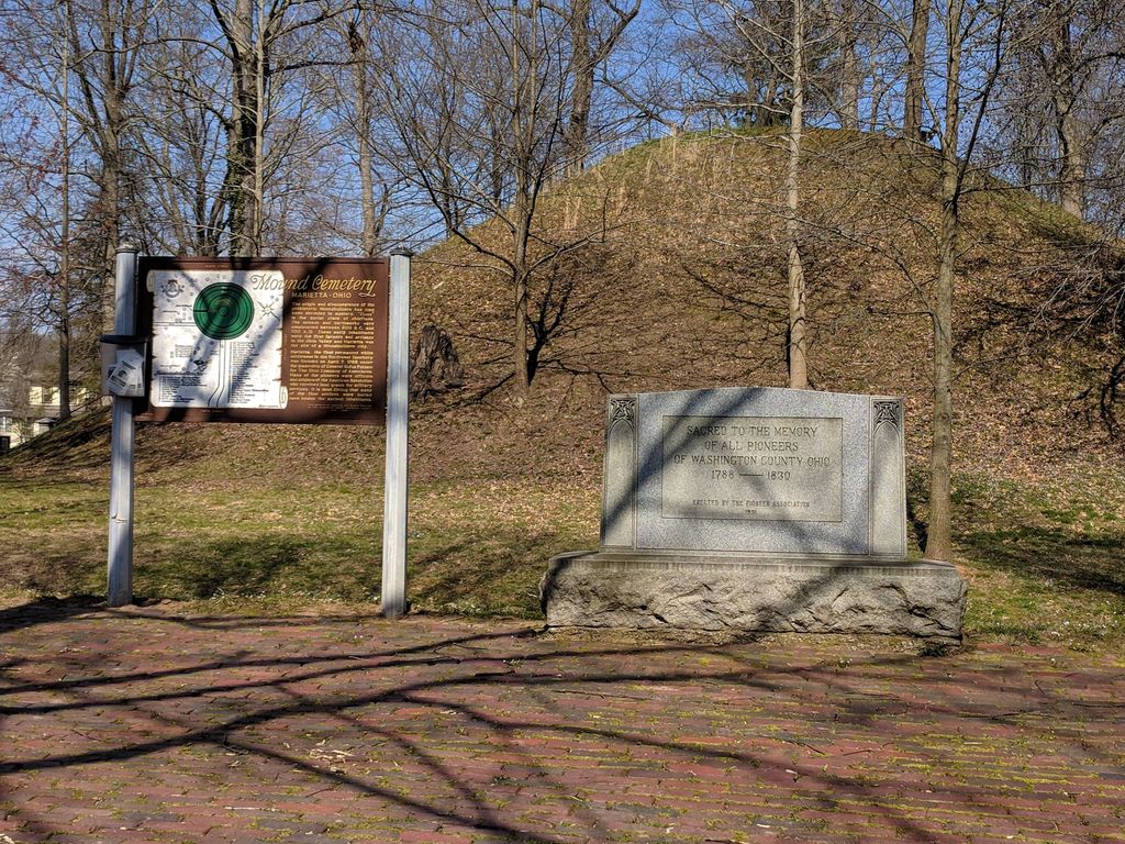
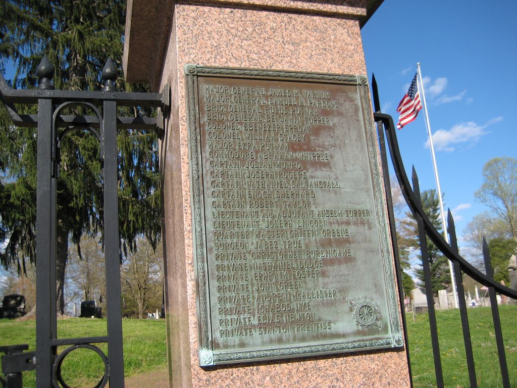
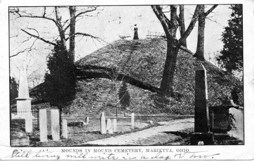
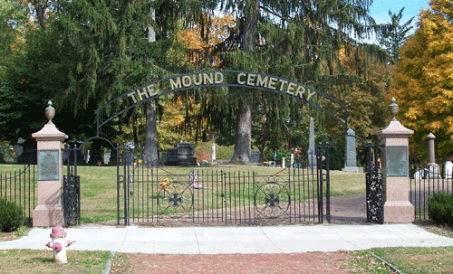
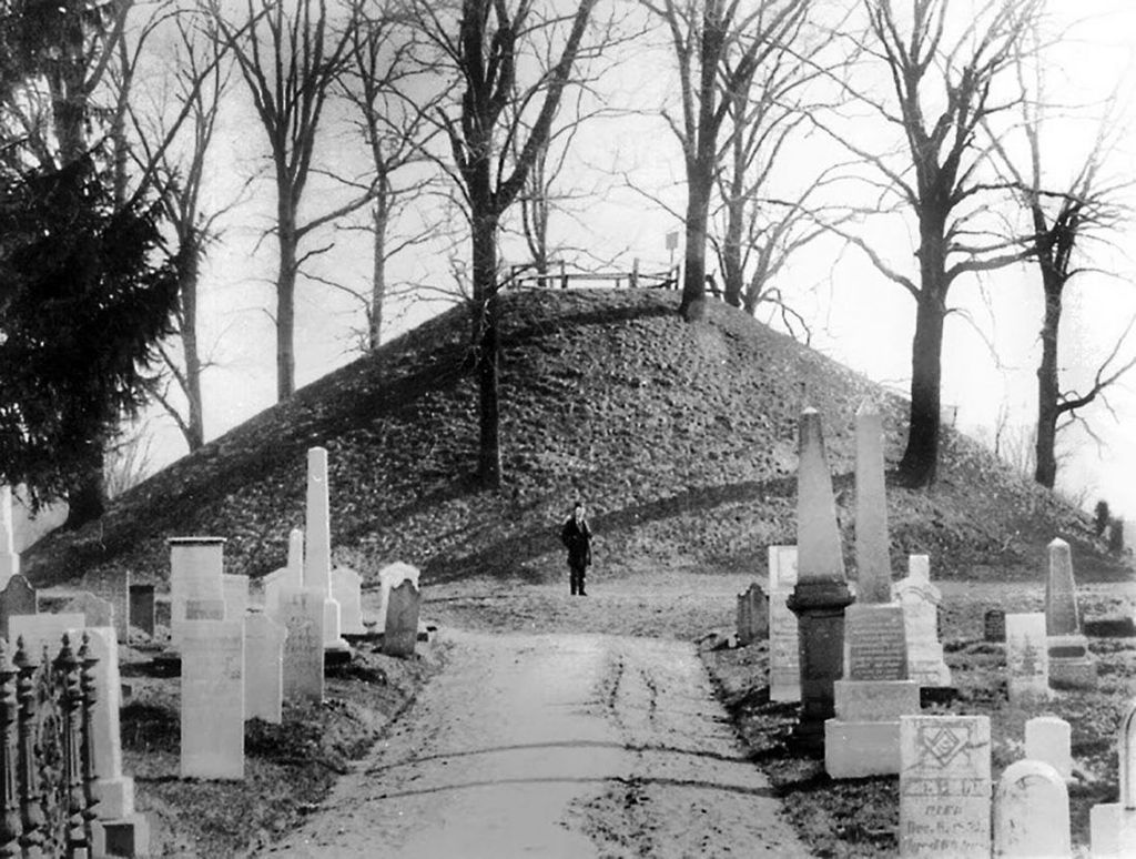
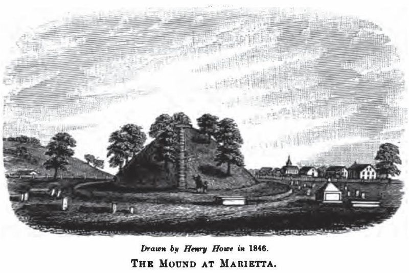
| Description | : | The Mound Cemetery was established in 1801 by the citizens of Marietta, Ohio, to preserve an Ohio Hopewell burial mound dating from 100 BC to 500 AD, and provide for settler burials. After the Revolutionary War, the area along the Ohio River and Marietta attracted many veterans rewarded with land grants. General Rufus Putnam donated land for the cemetery. The cemetery is thought to have the largest number of Revolutionary War Officer burials, among other important Ohio River pioneer settlers and Northwest Territory politicians. Burials continue to today despite the limited space. The cemetery is open to the public, but parking is on... Read More |
frequently asked questions (FAQ):
-
Where is Mound Cemetery?
Mound Cemetery is located at 5th and Scammel Streets Marietta, Washington County ,Ohio , 45750USA.
-
Mound Cemetery cemetery's updated grave count on graveviews.com?
29 memorials
-
Where are the coordinates of the Mound Cemetery?
Latitude: 39.4199829
Longitude: -81.4518661
Nearby Cemetories:
1. Saint Lukes Episcopal Church Memorial Garden
Marietta, Washington County, USA
Coordinate: 39.4172964, -81.4556770
2. Oak Grove Cemetery
Marietta, Washington County, USA
Coordinate: 39.4255981, -81.4507980
3. Harmar Cemetery
Marietta, Washington County, USA
Coordinate: 39.4166985, -81.4638977
4. Saint Marys Old Cemetery
Marietta, Washington County, USA
Coordinate: 39.4282112, -81.4629593
5. Saint Mary Cemetery
Marietta, Washington County, USA
Coordinate: 39.4331474, -81.4562149
6. Ginsburg Cemetery
Marietta, Washington County, USA
Coordinate: 39.4351158, -81.4501495
7. Unidentified Cemetery #1
Marietta Township, Washington County, USA
Coordinate: 39.4350610, -81.4482920
8. Childrens Home Cemetery
Marietta, Washington County, USA
Coordinate: 39.4420760, -81.4555450
9. Kinnaird Cemetery
Wood County, USA
Coordinate: 39.3976430, -81.4280890
10. Washington County Home Cemetery
Marietta, Washington County, USA
Coordinate: 39.4103050, -81.4022446
11. Brabham Cemetery
Fleming, Washington County, USA
Coordinate: 39.4343987, -81.5017014
12. Goldsmith Cemetery
Caywood, Washington County, USA
Coordinate: 39.4573364, -81.4159012
13. Lynch Church Cemetery
Caywood, Washington County, USA
Coordinate: 39.4497986, -81.4026031
14. Henderson Cemetery
Boaz, Wood County, USA
Coordinate: 39.3744011, -81.4792023
15. Pugh Cemetery
Wood County, USA
Coordinate: 39.3711014, -81.4841995
16. Minor Cemetery
Caywood, Washington County, USA
Coordinate: 39.4397049, -81.3842697
17. Hadley Cemetery
Cornerville, Washington County, USA
Coordinate: 39.3923950, -81.3886032
18. Saint Jacobs Cemetery
Washington County, USA
Coordinate: 39.4744810, -81.4277490
19. Whitney Cemetery
Marietta, Washington County, USA
Coordinate: 39.4332200, -81.3792600
20. Bethel Cemetery
Washington County, USA
Coordinate: 39.4319000, -81.5257034
21. Uhl Cemetery
Wood County, USA
Coordinate: 39.3694000, -81.4922028
22. Putnam Cemetery
Devola, Washington County, USA
Coordinate: 39.4756012, -81.4858017
23. Stanleyville Cemetery
Washington County, USA
Coordinate: 39.4717979, -81.4082870
24. Johnson Cemetery
Wood County, USA
Coordinate: 39.3656006, -81.4966965