
| Memorials | : | 0 |
| Location | : | Upper Oxford Township, Chester County, USA |
| Coordinate | : | 39.7863998, -76.0089035 |
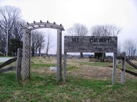
| Description | : | Mt. Calvary A.M.E. Church was erected in 1852. Reverend Henry Jones, being a leader in the work of the Church for several years, donated the land on which the meeting house was erected. Mount Calvary later relocated from Lower Oxford Township to East Market Street where the cornerstone was laid on August 8, 1884. The church was renamed to Allen A.M.E and was dedicated on May 5, 1886 in honor of Richard Allen, founder of the A.M.E. Church. The only evidence of the old Mount Calvary today is this cemetery. |
frequently asked questions (FAQ):
-
Where is Mount Calvary African Methodist Episcopal Cemetery?
Mount Calvary African Methodist Episcopal Cemetery is located at 164 Bethel Road Upper Oxford Township, Chester County ,Pennsylvania , 19363USA.
-
Mount Calvary African Methodist Episcopal Cemetery cemetery's updated grave count on graveviews.com?
0 memorials
-
Where are the coordinates of the Mount Calvary African Methodist Episcopal Cemetery?
Latitude: 39.7863998
Longitude: -76.0089035
Nearby Cemetories:
1. Oxford Cemetery
Oxford, Chester County, USA
Coordinate: 39.7914734, -75.9781189
2. Nottingham Missionary Baptist Church Cemetery
Nottingham, Chester County, USA
Coordinate: 39.7581000, -76.0404000
3. Nottingham Cemetery
Nottingham, Chester County, USA
Coordinate: 39.7522011, -76.0344009
4. Oxford Amish Cemetery
Oxford, Chester County, USA
Coordinate: 39.7694720, -75.9620800
5. Bible Evangelical Church Cemetery
Oxford, Chester County, USA
Coordinate: 39.7494570, -75.9570070
6. Union Cemetery
Nottingham, Chester County, USA
Coordinate: 39.7419000, -76.0651000
7. Mount Olivet Methodist Protestant Church Cemetery
East Nottingham Township, Chester County, USA
Coordinate: 39.7311500, -75.9665200
8. Union Cemetery
Kirkwood, Lancaster County, USA
Coordinate: 39.8408980, -76.0600590
9. Hosanna African Union Methodist Protestant Cemetery
Lincoln University, Chester County, USA
Coordinate: 39.8111725, -75.9252701
10. State Line Baptist Church Cemetery
Rising Sun, Cecil County, USA
Coordinate: 39.7205567, -75.9780979
11. Elk Ridge Methodist Cemetery
East Nottingham Township, Chester County, USA
Coordinate: 39.7832985, -75.9171982
12. Little Elk Friends Meeting Cemetery
Hickory Hill, Chester County, USA
Coordinate: 39.7482986, -75.9310989
13. Somerset Union American Methodist Episcopal Cemetery
Upper Oxford Township, Chester County, USA
Coordinate: 39.8537025, -75.9673882
14. Beulah Baptist Church Cemetery
Russellville, Chester County, USA
Coordinate: 39.8423996, -75.9449005
15. Homeville Friends Burying Ground
Homeville, Chester County, USA
Coordinate: 39.8605000, -75.9876000
16. Penns Grove Friends Cemetery
Lincoln University, Chester County, USA
Coordinate: 39.8230670, -75.9200790
17. Homeville Amish Cemetery
Homeville, Chester County, USA
Coordinate: 39.8628505, -75.9809139
18. Beyer Family Cemetery
Christiana, Lancaster County, USA
Coordinate: 39.8676870, -76.0319890
19. Mount Rocky Methodist Episcopal Cemetery
Elk Township, Chester County, USA
Coordinate: 39.7256550, -75.9336410
20. Calvary Missionary Baptist Church Cemetery
Rising Sun, Cecil County, USA
Coordinate: 39.7028200, -76.0263000
21. Brick Meeting House Cemetery
Calvert, Cecil County, USA
Coordinate: 39.7011700, -75.9819800
22. Rosebank Cemetery
Calvert, Cecil County, USA
Coordinate: 39.7010994, -75.9805984
23. Andrews Bridge Mennonite Cemetery
Christiana, Lancaster County, USA
Coordinate: 39.8747000, -76.0087000
24. Thunder Hill Cemetery
New London, Chester County, USA
Coordinate: 39.7719600, -75.8924700