
| Memorials | : | 0 |
| Location | : | Franklin Township, Adams County, USA |
| Coordinate | : | 39.9005000, -77.3529000 |
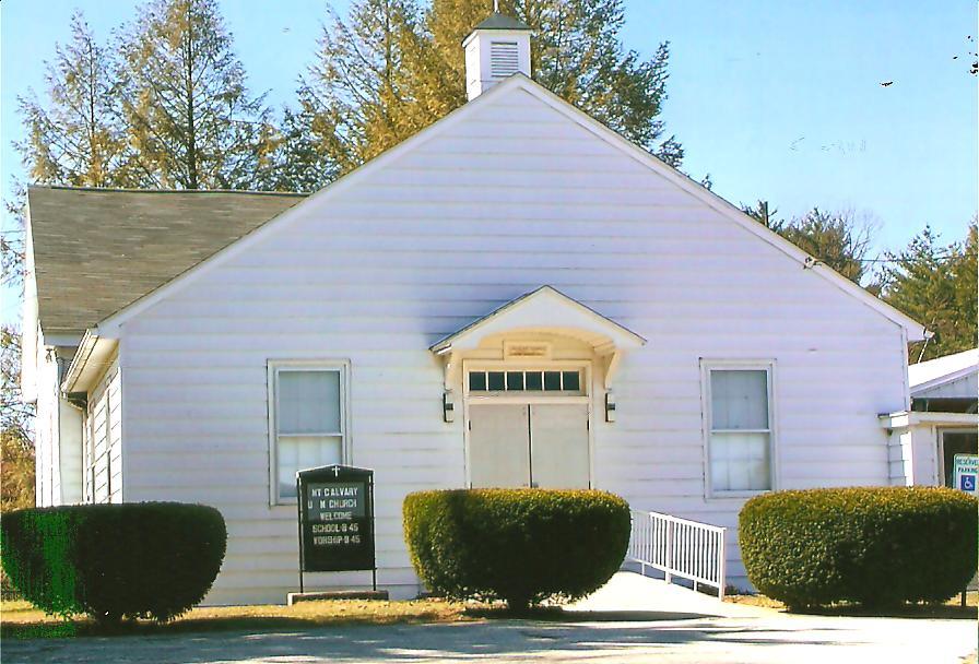
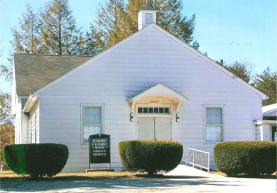
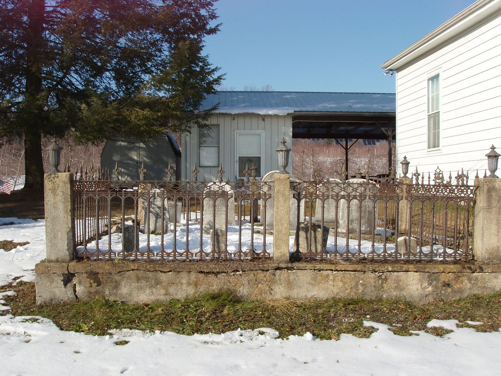
| Description | : | From Cashtown, from the intersection of Highway 30 and Cashtown Road, go north on Cashtown Road for about 1 mile. The cemetery is on the west side of the road up on a hill next to the church. This is the cemetery for a Methodist Church that was formed in 1861. The first burials took place in 1860. The last burial took place in 1917. |
frequently asked questions (FAQ):
-
Where is Mount Calvary Methodist Cemetery?
Mount Calvary Methodist Cemetery is located at 228 Cashtown Rd Franklin Township, Adams County ,Pennsylvania , 17307USA.
-
Mount Calvary Methodist Cemetery cemetery's updated grave count on graveviews.com?
0 memorials
-
Where are the coordinates of the Mount Calvary Methodist Cemetery?
Latitude: 39.9005000
Longitude: -77.3529000

Nearby Cemetories:
1. German Society Lutheran Calvinist Cemetery
Franklin Township, Adams County, USA
Coordinate: 39.8762000, -77.3391000
2. Flohrs Lutheran Church Cemetery
Franklin Township, Adams County, USA
Coordinate: 39.8748920, -77.3388890
3. Saint Ignatius Loyola Catholic Church Cemetery
Orrtanna, Adams County, USA
Coordinate: 39.9170000, -77.3947000
4. McKnightstown Cemetery
McKnightstown, Adams County, USA
Coordinate: 39.8683000, -77.3230000
5. Fairview Cemetery
Arendtsville, Adams County, USA
Coordinate: 39.9180489, -77.3014832
6. Greenmount Cemetery
Arendtsville, Adams County, USA
Coordinate: 39.9202000, -77.3020000
7. Arendtsville Lutheran Reformed Cemetery
Arendtsville, Adams County, USA
Coordinate: 39.9227520, -77.2980350
8. Mummasburg Mennonite Cemetery
Franklin Township, Adams County, USA
Coordinate: 39.8863000, -77.2855000
9. Chamberlin Hill Cemetery
Orrtanna, Adams County, USA
Coordinate: 39.8499550, -77.3831380
10. Mount Carmel United Methodist Church Cemetery
Orrtanna, Adams County, USA
Coordinate: 39.8493000, -77.3993000
11. Black's Graveyard
Cumberland Township, Adams County, USA
Coordinate: 39.8622017, -77.2722015
12. Oak Lawn Memorial Gardens
Gettysburg, Adams County, USA
Coordinate: 39.8485718, -77.2779312
13. Pfoutz Meeting House Cemetery
Highland Township, Adams County, USA
Coordinate: 39.8369000, -77.2939000
14. Lower Marsh Creek Presbyterian Cemetery
Gettysburg, Adams County, USA
Coordinate: 39.8325005, -77.2985992
15. Biglerville Cemetery
Biglerville, Adams County, USA
Coordinate: 39.9331500, -77.2515000
16. Trinity Memorial Garden
Biglerville, Adams County, USA
Coordinate: 39.9331110, -77.2399720
17. Wenksville Cemetery
Menallen Township, Adams County, USA
Coordinate: 39.9895000, -77.3075700
18. McClelland Cemetery
Gettysburg, Adams County, USA
Coordinate: 39.8205986, -77.2844009
19. Cold Springs Lutheran Cemetery
Orrtanna, Adams County, USA
Coordinate: 39.8436694, -77.4597625
20. Baker Cemetery
Hamiltonban Township, Adams County, USA
Coordinate: 39.8346021, -77.4538692
21. Strang Cemetery
South Mountain, Franklin County, USA
Coordinate: 39.8577995, -77.4749985
22. Menallen Friends Cemetery
Menallen Township, Adams County, USA
Coordinate: 39.9640540, -77.2463220
23. Lutheran Theological Seminary Memorial Garden
Gettysburg, Adams County, USA
Coordinate: 39.8317310, -77.2437440
24. Benders Lutheran Church Cemetery
Butler Township, Adams County, USA
Coordinate: 39.9297900, -77.2145400