
| Memorials | : | 65 |
| Location | : | Shepherdsville, Bullitt County, USA |
| Coordinate | : | 38.0103940, -85.8091610 |
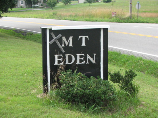
| Description | : | The Mt. Eden Church was organized in 1820 and was the oldest place of worship in Bullitt County. In 1957 the U.S. Army acquired 5,500 acres in Bullitt County at the north edge of of Fort Knox, which included the original church and cemetery. The Mt. Eden Cemetery and thirteen (13) family cemeteries in the acquisition, which contained 341 bodies, were moved and reburied in the present Mt. Eden Cemetery that the U.S. Government bought and dedicated on May 25, 1958. Mt. Eden Cemetery is located on the south side of Highway 44, six miles west... Read More |
frequently asked questions (FAQ):
-
Where is Mount Eden Cemetery?
Mount Eden Cemetery is located at 6165 Kentucky 44 Shepherdsville, Bullitt County ,Kentucky ,USA.
-
Mount Eden Cemetery cemetery's updated grave count on graveviews.com?
64 memorials
-
Where are the coordinates of the Mount Eden Cemetery?
Latitude: 38.0103940
Longitude: -85.8091610

Nearby Cemetories:
1. Harshfield Cemetery
Shepherdsville, Bullitt County, USA
Coordinate: 38.0098320, -85.8066630
2. Achers Cemetery
Bullitt County, USA
Coordinate: 38.0163994, -85.8171997
3. Pet Haven Cemetery
Shepherdsville, Bullitt County, USA
Coordinate: 38.0061390, -85.7913390
4. Martin Hill Cemetery
Shepherdsville, Bullitt County, USA
Coordinate: 38.0060200, -85.7913830
5. Campground Memorial Cemetery
Shepherdsville, Bullitt County, USA
Coordinate: 38.0093994, -85.7900009
6. Funk Cemetery #1
Shepherdsville, Bullitt County, USA
Coordinate: 38.0172370, -85.8338030
7. Miller Cemetery
Bullitt County, USA
Coordinate: 38.0320100, -85.8113900
8. Smith Cemetery
Bullitt County, USA
Coordinate: 38.0313988, -85.8206024
9. Shepherd-Keith Cemetery
Shepherdsville, Bullitt County, USA
Coordinate: 37.9935340, -85.7883510
10. Redden Family Cemetery
Bullitt County, USA
Coordinate: 38.0305420, -85.8260870
11. Weird Cemetery
Bullitt County, USA
Coordinate: 38.0306015, -85.8261032
12. Shepherd Cemetery
Bullitt County, USA
Coordinate: 37.9933014, -85.7872009
13. Losch Hodge Family Cemetery
Shepherdsville, Bullitt County, USA
Coordinate: 37.9930770, -85.7853170
14. Green Key Cemetery (Defunct)
Shepherdsville, Bullitt County, USA
Coordinate: 37.9908310, -85.8311090
15. Myers Cemetery
Shepherdsville, Bullitt County, USA
Coordinate: 37.9831009, -85.8227997
16. Funk Cemetery #2
Shepherdsville, Bullitt County, USA
Coordinate: 38.0097610, -85.8470810
17. Christian Barrall Family Cemetery
Brooks, Bullitt County, USA
Coordinate: 38.0405810, -85.7998580
18. Vaughn Cemetery
Shepherdsville, Bullitt County, USA
Coordinate: 38.0133180, -85.8507370
19. Moore Family Cemetery
Pitts Point, Bullitt County, USA
Coordinate: 38.0079530, -85.7647440
20. Bullitt Lick Cemetery
Shepherdsville, Bullitt County, USA
Coordinate: 38.0008888, -85.7647018
21. Hurst Family Cemetery
Brooks, Bullitt County, USA
Coordinate: 38.0456150, -85.7972380
22. Ann Clark Cemetery (Defunct)
Shepherdsville, Bullitt County, USA
Coordinate: 37.9983250, -85.8538560
23. Christian Harshfield Cemetery
Brooks, Bullitt County, USA
Coordinate: 38.0492400, -85.8096080
24. Monroe Family Cemetery
Brooks, Bullitt County, USA
Coordinate: 38.0426512, -85.7816779