
| Memorials | : | 0 |
| Location | : | East Harlsey, Hambleton District, England |
| Coordinate | : | 54.3799590, -1.3109160 |
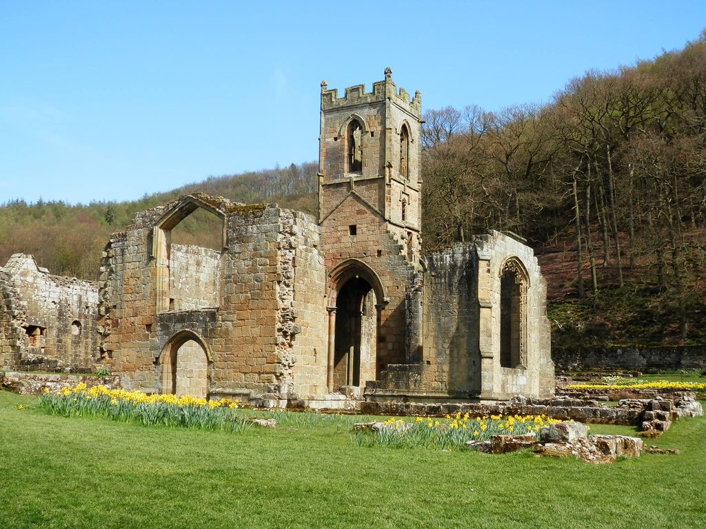
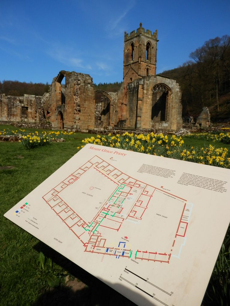
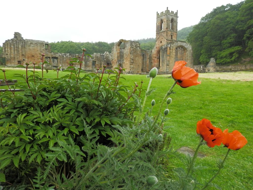
| Description | : | Carthusian Priory of Mount Grace, in the parish of East Harlsey, was founded about the year 1398, by Thomas Holand, Duke of Surrey. The royal licence having been granted to him by Richard II, Thomas Holand commanded the monks to pray for the king and queen and several members of the royal family, as well as for himself and his heirs, and for John Ingelby and Eleanor his wife, and many others. With the assent of the prior of the Grande Chartreuse he nominated the first prior and dedicated the priory to the honour of the Blessed Virgin and St.... Read More |
frequently asked questions (FAQ):
-
Where is Mount Grace Priory?
Mount Grace Priory is located at East Harlsey, Hambleton District ,North Yorkshire ,England.
-
Mount Grace Priory cemetery's updated grave count on graveviews.com?
0 memorials
-
Where are the coordinates of the Mount Grace Priory?
Latitude: 54.3799590
Longitude: -1.3109160
Nearby Cemetories:
1. Osmotherley Cemetery
Osmotherley, Hambleton District, England
Coordinate: 54.3684200, -1.3046700
2. St Peter Churchyard
Osmotherley, Hambleton District, England
Coordinate: 54.3681190, -1.3001490
3. All Saints Churchyard
Ingleby Arncliffe, Hambleton District, England
Coordinate: 54.3959000, -1.3042000
4. St. Oswald Churchyard
East Harlsey, Hambleton District, England
Coordinate: 54.3914290, -1.3451990
5. St Lawrence Churchyard
Kirby Sigston, Hambleton District, England
Coordinate: 54.3458700, -1.3609600
6. Holy Cross Old Churchyard
Swainby, Hambleton District, England
Coordinate: 54.4152440, -1.2567640
7. St. Mary's Churchyard
Over Silton, Hambleton District, England
Coordinate: 54.3319180, -1.3002410
8. St. Lawrence Churchyard
East Rounton, Hambleton District, England
Coordinate: 54.4241000, -1.3510700
9. St Oswald Churchyard
West Rounton, Hambleton District, England
Coordinate: 54.4243670, -1.3638680
10. St Leonard Churchyard
Welbury, Hambleton District, England
Coordinate: 54.4138000, -1.3855600
11. All Saints Churchyard
Nether Silton, Hambleton District, England
Coordinate: 54.3244920, -1.3001000
12. St Mary Magdalene Churchyard
Faceby, Hambleton District, England
Coordinate: 54.4204090, -1.2377320
13. Brompton Cemetery
Northallerton, Hambleton District, England
Coordinate: 54.3614100, -1.4140900
14. All Saints Churchyard
Deighton, Hambleton District, England
Coordinate: 54.4099130, -1.4141500
15. St. Thomas Churchyard
Brompton, Hambleton District, England
Coordinate: 54.3613700, -1.4263900
16. St Mary the Virgin Churchyard
Leake, Hambleton District, England
Coordinate: 54.3094180, -1.3357310
17. St Botolph Churchyard
Carlton-in-Cleveland, Hambleton District, England
Coordinate: 54.4338200, -1.2199490
18. All Saints Churchyard
Hutton Rudby, Hambleton District, England
Coordinate: 54.4532040, -1.2737220
19. St Mary Churchyard
Appleton Wiske, Hambleton District, England
Coordinate: 54.4360250, -1.4003270
20. St. Michael's and All Angels Churchyard
Cowesby, Hambleton District, England
Coordinate: 54.3029750, -1.2875840
21. All Saints Churchyard
Crathorne, Hambleton District, England
Coordinate: 54.4615000, -1.3176000
22. All Saints Churchyard
Northallerton, Hambleton District, England
Coordinate: 54.3420430, -1.4366340
23. Northallerton Cemetery
Northallerton, Hambleton District, England
Coordinate: 54.3410870, -1.4380120
24. Thornton-le-Beans Chapelyard
Thornton-le-Beans, Hambleton District, England
Coordinate: 54.3074250, -1.3934900