
| Memorials | : | 20 |
| Location | : | Crooksville, Perry County, USA |
| Coordinate | : | 39.7858009, -82.1350021 |
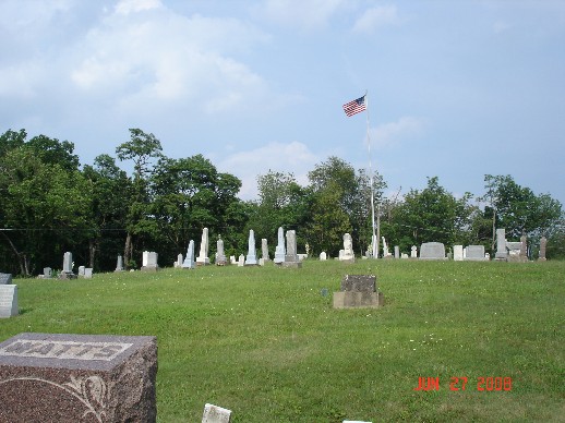
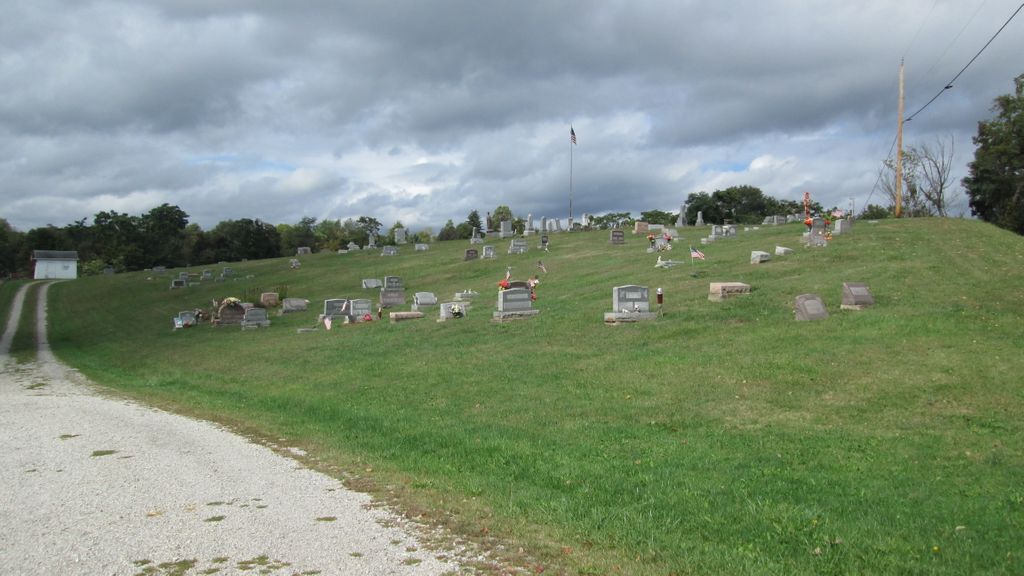
| Description | : | The cemetery is located on the south side of Ohio State Route 669 about 1.1 miles east of its intersection with Ohio State Route 345. The cemetery is located in Harrison Township, Perry County, Ohio, and is # 9312 (Mount Horeb Cemetery) in “Ohio Cemeteries 1803-2003”, compiled by the Ohio Genealogical Society. The cemetery is registered with the Ohio Division of Real Estate and Professional Licensing (ODRE) as Mt. Horeb Cemetery with registration license number CGR.0000980982. The U.S. Geological Survey (USGS) Geographic Names Information System (GNIS) feature ID for the cemetery is 1043527 (Mount Horeb Cemetery). |
frequently asked questions (FAQ):
-
Where is Mount Horeb Cemetery?
Mount Horeb Cemetery is located at Ohio State Route 669 Crooksville, Perry County ,Ohio , 43777USA.
-
Mount Horeb Cemetery cemetery's updated grave count on graveviews.com?
19 memorials
-
Where are the coordinates of the Mount Horeb Cemetery?
Latitude: 39.7858009
Longitude: -82.1350021
Nearby Cemetories:
1. Amrine Cemetery
Saltillo, Perry County, USA
Coordinate: 39.7996590, -82.1611190
2. Crooksville Cemetery
Crooksville, Perry County, USA
Coordinate: 39.7715797, -82.1031113
3. Saint Dominics McCluney Catholic Cemetery
Perry County, USA
Coordinate: 39.7575200, -82.1549500
4. Owens Cemetery
Roseville, Perry County, USA
Coordinate: 39.8142349, -82.1143092
5. McLuney Cemetery
Perry County, USA
Coordinate: 39.7569008, -82.1549988
6. Moore-Horn Cemetery
East Fultonham, Muskingum County, USA
Coordinate: 39.8257500, -82.1363000
7. Roseville Cemetery
Roseville, Muskingum County, USA
Coordinate: 39.8088150, -82.0751266
8. Iliff Cemetery
McLuney, Perry County, USA
Coordinate: 39.7424316, -82.0979004
9. Saint Joseph Atonement Catholic Cemetery
Crooksville, Perry County, USA
Coordinate: 39.7493920, -82.0848870
10. Bethel Methodist Episcopal Church Cemetery
Somerset, Perry County, USA
Coordinate: 39.8277800, -82.1788300
11. Rider Cemetery
Roseville, Muskingum County, USA
Coordinate: 39.7942000, -82.0645000
12. Stokely Cemetery
Muskingum County, USA
Coordinate: 39.8216800, -82.0713000
13. Ebenezer Cemetery
Roseville, Muskingum County, USA
Coordinate: 39.7827988, -82.0552979
14. Shreve Family Cemetery
Perry County, USA
Coordinate: 39.7569000, -82.2077300
15. Wesley Chapel Cemetery
Somerset, Perry County, USA
Coordinate: 39.8010368, -82.2161407
16. Rehoboth Methodist Episcopal Church Cemetery
New Lexington, Perry County, USA
Coordinate: 39.7395100, -82.1943100
17. Rees Cemetery
Roseville, Muskingum County, USA
Coordinate: 39.8292000, -82.0711000
18. Teal Cemetery
Perry County, USA
Coordinate: 39.7192001, -82.1164017
19. Fultonham Baptist Church Cemetery
Fultonham, Muskingum County, USA
Coordinate: 39.8542470, -82.1408520
20. Shick Cemetery
Perry County, USA
Coordinate: 39.7247009, -82.0942001
21. Rose Hill Cemetery
Roseville, Muskingum County, USA
Coordinate: 39.8356018, -82.0686035
22. Uniontown Cemetery
Fultonham, Muskingum County, USA
Coordinate: 39.8568993, -82.1489029
23. Fultonham Cemetery
Fultonham, Muskingum County, USA
Coordinate: 39.8577995, -82.1386032
24. Unity Presbyterian Cemetery
Somerset, Perry County, USA
Coordinate: 39.7921982, -82.2347031