
| Memorials | : | 12 |
| Location | : | Council, Bladen County, USA |
| Coordinate | : | 34.5161110, -78.4505560 |
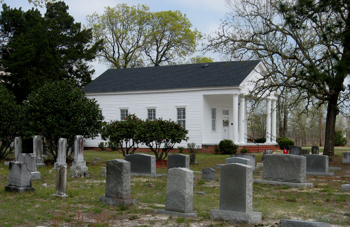
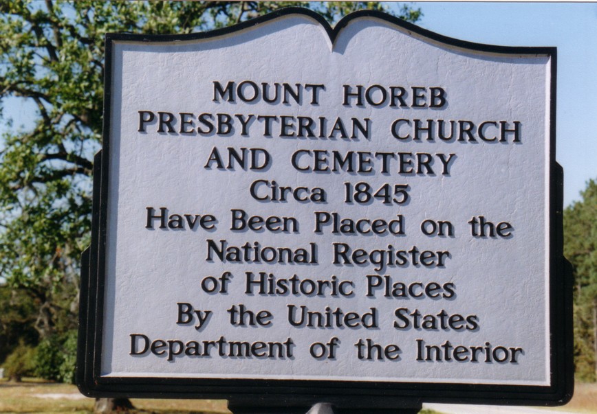
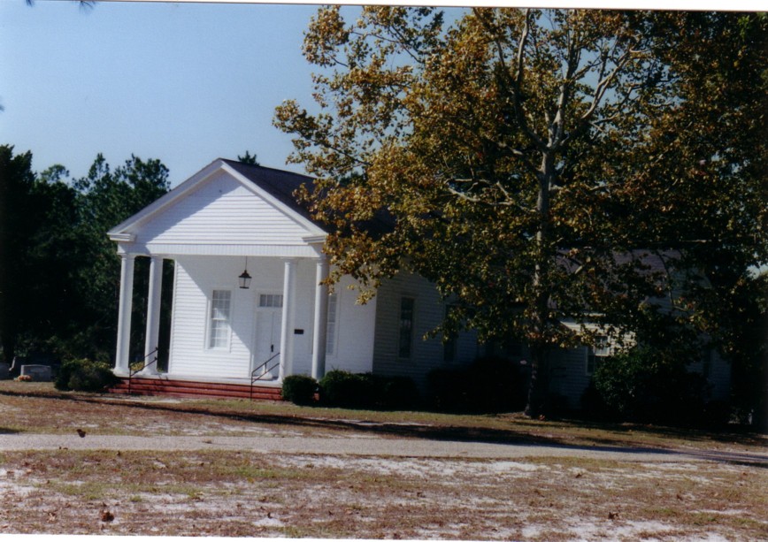
| Description | : | Mt. Horeb Presbyterian Church is listed in the National Register of Historical Places. It originated in 1843, and the original building, built in 1845, is in use today. It has handmade pews and pulpit, original siding, and a cemetery. It is located 15 miles east of Elizabethtown on Hwy 87. |
frequently asked questions (FAQ):
-
Where is Mount Horeb Presbyterian Church Cemetery?
Mount Horeb Presbyterian Church Cemetery is located at Council, Bladen County ,North Carolina ,USA.
-
Mount Horeb Presbyterian Church Cemetery cemetery's updated grave count on graveviews.com?
8 memorials
-
Where are the coordinates of the Mount Horeb Presbyterian Church Cemetery?
Latitude: 34.5161110
Longitude: -78.4505560
Nearby Cemetories:
1. Dowey Family Cemetery
Bladen County, USA
Coordinate: 34.5147300, -78.4415000
2. Cromartie Family Cemetery
Bladen County, USA
Coordinate: 34.5062800, -78.4381900
3. Beatty Cemetery
Bladen County, USA
Coordinate: 34.5430984, -78.4135971
4. Dickson Cemetery
Carvers, Bladen County, USA
Coordinate: 34.4734100, -78.4057700
5. Carvers Creek AME Zion Church Cemetery
Council, Bladen County, USA
Coordinate: 34.4606247, -78.4074097
6. Carvers Creek United Methodist Church Cemetery
Council, Bladen County, USA
Coordinate: 34.4577026, -78.4099731
7. Daniel Clark Cemetery
Bladen County, USA
Coordinate: 34.4777200, -78.5219500
8. Hector Clark Cemetery
Bladen County, USA
Coordinate: 34.4843270, -78.5362820
9. Atkinson Cemetery
Bladen County, USA
Coordinate: 34.5900002, -78.4847031
10. White Plains Presbyterian Church Cemetery
Council, Bladen County, USA
Coordinate: 34.4699821, -78.5408325
11. Council Family Cemetery
Bladen County, USA
Coordinate: 34.4209000, -78.4749000
12. McCall Cemetery
Clarkton, Bladen County, USA
Coordinate: 34.5060997, -78.5856018
13. Blank Cemetery
Bladen County, USA
Coordinate: 34.4136009, -78.5128021
14. Philadelphia Seventh Day Adventist Church Cemetery
Clarkton, Bladen County, USA
Coordinate: 34.4081840, -78.5089870
15. McKeithan Hales Cemetery
Clarkton, Bladen County, USA
Coordinate: 34.5647500, -78.5821200
16. Buie Cemetery
Columbus County, USA
Coordinate: 34.4056015, -78.5119019
17. McCall Cemetery #2
Clarkton, Bladen County, USA
Coordinate: 34.5144870, -78.5993780
18. Burney Cemetery
Elkton, Bladen County, USA
Coordinate: 34.4723800, -78.5925100
19. Bluefield United Methodist Church Cemetery
Clarkton, Bladen County, USA
Coordinate: 34.5252266, -78.6051178
20. Pilgrim Hill Baptist Church Cemetery
Bluefield, Bladen County, USA
Coordinate: 34.5421150, -78.6044560
21. Blue Cemetery
Bladen County, USA
Coordinate: 34.5279600, -78.6097800
22. Mears Cemetery
Elizabethtown, Bladen County, USA
Coordinate: 34.5969009, -78.5768967
23. Freewill Pentecostal Church Cemetery
Lake Waccamaw, Columbus County, USA
Coordinate: 34.3954400, -78.5156200
24. Mount Olive AME Zion Church Cemetery
Elizabethtown, Bladen County, USA
Coordinate: 34.5876790, -78.5861490