
| Memorials | : | 0 |
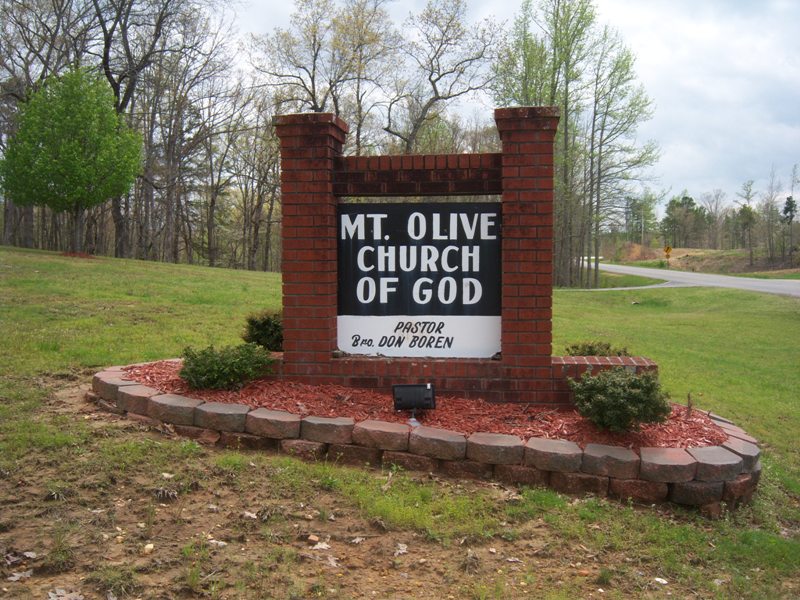
| Location | : | Altitude, Prentiss County, USA |
| Coordinate | : | 34.7168999, -88.4496994 |
| Description | : | From Highway 4 E & Highway 30 E intersection, take Highway 30 East about 2 miles to Highway 364 East. Turn Left; go about 3.5 miles to CR 2371 and turn left, go about 3.5 miles. Church and cemetery are on the right. |
frequently asked questions (FAQ):
-
Where is Mount Olive Church of God Cemetery?
Mount Olive Church of God Cemetery is located at Altitude, Prentiss County ,Mississippi ,USA.
-
Mount Olive Church of God Cemetery cemetery's updated grave count on graveviews.com?
0 memorials
-
Where are the coordinates of the Mount Olive Church of God Cemetery?
Latitude: 34.7168999
Longitude: -88.4496994
Nearby Cemetories:
1. Jones Chapel Cemetery
Prentiss County, USA
Coordinate: 34.7233009, -88.4480972
2. Willis-McAnally Family Cemetery
Altitude, Prentiss County, USA
Coordinate: 34.7237050, -88.4334260
3. Williams Cemetery
Prentiss County, USA
Coordinate: 34.7214012, -88.4811020
4. Jones Graveyard
Booneville, Prentiss County, USA
Coordinate: 34.6903000, -88.4655991
5. Harden Cemetery
Altitude, Prentiss County, USA
Coordinate: 34.6869011, -88.4657974
6. New Candler Cemetery
Prentiss County, USA
Coordinate: 34.7346992, -88.4875031
7. Piney Grove Baptist Church Cemetery
Prentiss County, USA
Coordinate: 34.7355995, -88.4871674
8. Old Mormon Cemetery
Prentiss County, USA
Coordinate: 34.6954100, -88.4872900
9. Jacinto Cemetery
Alcorn County, USA
Coordinate: 34.7574997, -88.4319000
10. Rhodes Cemetery
Prentiss County, USA
Coordinate: 34.7261009, -88.3983002
11. Carters Chapel Cemetery
Prentiss County, USA
Coordinate: 34.6822014, -88.4141998
12. Gray Cemetery
Alcorn County, USA
Coordinate: 34.7627983, -88.4580994
13. Smith Chapel Cemetery
Booneville, Prentiss County, USA
Coordinate: 34.6992000, -88.5036010
14. Smith Family Cemetery #2
Prentiss County, USA
Coordinate: 34.6992493, -88.5047836
15. Fondren Cemetery
Altitude, Prentiss County, USA
Coordinate: 34.6716995, -88.4717026
16. Freewill Cemetery
Prentiss County, USA
Coordinate: 34.6707993, -88.4719009
17. Jacinto Church of Christ Cemetery
Jacinto, Alcorn County, USA
Coordinate: 34.7619000, -88.4217000
18. Faith Temple Cemetery
Jacinto, Alcorn County, USA
Coordinate: 34.7618400, -88.4146000
19. Hill Top Church of God Cemetery
Cairo, Prentiss County, USA
Coordinate: 34.7514860, -88.3972510
20. Snowdown Church of Christ Cemetery
Prentiss County, USA
Coordinate: 34.7269000, -88.3833000
21. Mount Pleasant Cemetery
Prentiss County, USA
Coordinate: 34.6605988, -88.4436035
22. Armstrong Cemetery
Cairo, Prentiss County, USA
Coordinate: 34.6939011, -88.3867035
23. Hare Memorial Garden
Altitude, Prentiss County, USA
Coordinate: 34.6599270, -88.4434270
24. Jones Family Cemetery
Jacinto, Alcorn County, USA
Coordinate: 34.7656290, -88.4089460