
| Memorials | : | 4 |
| Location | : | Kincaid, Anderson County, USA |
| Coordinate | : | 38.1046982, -95.1864014 |
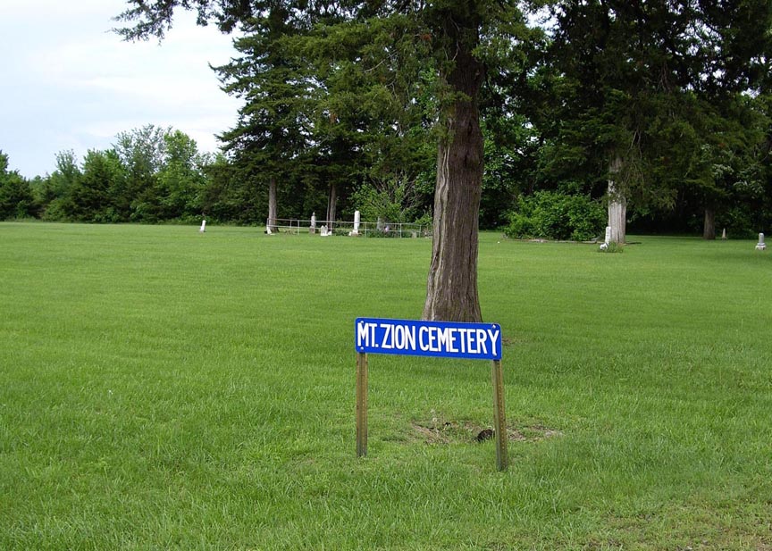
| Description | : | A cemetery book lists this cemetery as abandoned and is located 2 miles west and 1 1/2 miles north of Kincaid, Kansas. Mount Zion Cemetery was originally called Deer Creek Cemetery. It was quite popular from the 1880s through the very early 1900s. For some reason, after about 1910, it fell into disuse and only a small handful of burials occurred after that. A burial from a news clipping in 1929 still lists it as Deer Creek, so the name was not changed to Mount Zion until sometime after 1929. |
frequently asked questions (FAQ):
-
Where is Mount Zion Cemetery?
Mount Zion Cemetery is located at Kincaid, Anderson County ,Kansas ,USA.
-
Mount Zion Cemetery cemetery's updated grave count on graveviews.com?
4 memorials
-
Where are the coordinates of the Mount Zion Cemetery?
Latitude: 38.1046982
Longitude: -95.1864014
Nearby Cemetories:
1. Kincaid Cemetery
Kincaid, Anderson County, USA
Coordinate: 38.0917015, -95.1513977
2. Lone Elm Cemetery
Lone Elm, Anderson County, USA
Coordinate: 38.0882988, -95.2422028
3. Fairview Cemetery
Mildred, Allen County, USA
Coordinate: 38.0238020, -95.1401740
4. Osage Valley Cemetery
Mildred, Allen County, USA
Coordinate: 38.0313988, -95.0969009
5. Horn Cemetery
Anderson County, USA
Coordinate: 38.2010994, -95.2313995
6. Sugar Valley Cemetery
Anderson County, USA
Coordinate: 38.1903300, -95.1130200
7. Ozark Cemetery #1
Anderson County, USA
Coordinate: 38.0424200, -95.2992300
8. Welda Cemetery
Welda, Anderson County, USA
Coordinate: 38.1808014, -95.2966995
9. Springfield Cemetery
Garnett, Anderson County, USA
Coordinate: 38.2196999, -95.2219009
10. Oakwood Cemetery
Centerville, Linn County, USA
Coordinate: 38.1605988, -95.0391998
11. Stanley Cemetery
Bayard, Allen County, USA
Coordinate: 37.9944200, -95.0970400
12. Pleasant View Cemetery
Blue Mound, Linn County, USA
Coordinate: 38.0952988, -95.0175018
13. Old Blue Mound Cemetery
Blue Mound, Linn County, USA
Coordinate: 38.0636600, -95.0249000
14. Sunny Slope Cemetery
Blue Mound, Linn County, USA
Coordinate: 38.0952988, -95.0149994
15. Morris Family Cemetery
Garnett, Anderson County, USA
Coordinate: 38.2434600, -95.1842400
16. Gillham Cemetery
Allen County, USA
Coordinate: 37.9795100, -95.1103500
17. Colony Cemetery
Colony, Anderson County, USA
Coordinate: 38.0652700, -95.3634000
18. Wardell Cemetery
Anderson County, USA
Coordinate: 38.1697006, -95.3533020
19. Boulware Cemetery
Mapleton, Bourbon County, USA
Coordinate: 38.0264600, -95.0245400
20. Pleasant Valley Cemetery
Allen County, USA
Coordinate: 38.0093994, -95.3328018
21. Hyatt Cemetery
Anderson County, USA
Coordinate: 38.2275009, -95.2968979
22. Ashburn Family Cemetery
Garnett, Anderson County, USA
Coordinate: 38.2629600, -95.1872900
23. Mont Ida Cemetery
Mont Ida, Anderson County, USA
Coordinate: 38.2064018, -95.3692017
24. South Sugar Valley Cemetery
Garnett, Anderson County, USA
Coordinate: 38.2697890, -95.1021450