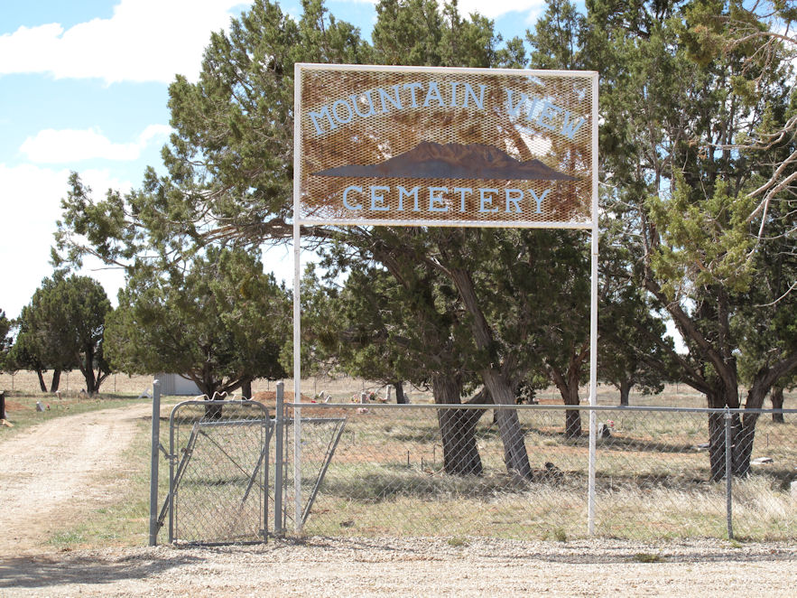
| Memorials | : | 0 |
| Location | : | Eastland, San Juan County, USA |
| Coordinate | : | 37.7999992, -109.1081009 |
| Description | : | Directions: East on Highway 666 to Eastland turn, then east of Eastland on E. Lockerby Rd 1.5 miles. The U.S. Geological Survey (USGS) Geographic Names Information System (GNIS) feature ID for the cemetery is 1433868 (Valley View Cemetery). |
frequently asked questions (FAQ):
-
Where is Mountain View Cemetery?
Mountain View Cemetery is located at East Lockerby Road Eastland, San Juan County ,Utah , 84535USA.
-
Mountain View Cemetery cemetery's updated grave count on graveviews.com?
0 memorials
-
Where are the coordinates of the Mountain View Cemetery?
Latitude: 37.7999992
Longitude: -109.1081009
Nearby Cemetories:
1. Cedar Point Cemetery
San Juan County, USA
Coordinate: 37.7057000, -109.0819000
2. Burns Cemetery
Egnar, San Miguel County, USA
Coordinate: 37.9098740, -109.0136871
3. Peel Cemetery
Dove Creek, Dolores County, USA
Coordinate: 37.8656006, -108.9483032
4. Dove Creek Cemetery
Dove Creek, Dolores County, USA
Coordinate: 37.7649700, -108.9123600
5. Urado Cemetery
San Juan County, USA
Coordinate: 37.6459000, -109.0590000
6. Monticello City Cemetery
Monticello, San Juan County, USA
Coordinate: 37.8683014, -109.3300018
7. Verdure Cemetery
Verdure, San Juan County, USA
Coordinate: 37.7837000, -109.3461000
8. Harry Hopkins Gravesite
San Juan County, USA
Coordinate: 37.7830010, -109.4367980
9. Cahone Cemetery
Cahone, Dolores County, USA
Coordinate: 37.6774000, -108.7886000
10. Sylvan Cemetery
Pleasant View, Montezuma County, USA
Coordinate: 37.5797005, -108.8850021
11. Poverty Flat Cemetery
Egnar, San Miguel County, USA
Coordinate: 38.0430400, -108.9150400
12. Blanding City Cemetery
Blanding, San Juan County, USA
Coordinate: 37.6307983, -109.4682999
13. Home of Truth Cemetery
Dry Valley, San Juan County, USA
Coordinate: 38.0598500, -109.4044900
14. Westcott Cemetery
San Miguel County, USA
Coordinate: 37.9209900, -108.6799900
15. Hardman Family Cemetery
San Miguel County, USA
Coordinate: 37.9944200, -108.7210200
16. Fairview Cemetery
Yellow Jacket, Montezuma County, USA
Coordinate: 37.5438995, -108.7397003
17. Allen Canyon Ute Cemetery
Blanding, San Juan County, USA
Coordinate: 37.6595900, -109.6340300
18. Sunnyside Cemetery
Lewis, Montezuma County, USA
Coordinate: 37.5014000, -108.6594009
19. Goodman Point Cemetery
Montezuma County, USA
Coordinate: 37.4127998, -108.7121964
20. McElmo Cemetery
Montezuma County, USA
Coordinate: 37.3374405, -108.8397980
21. Battlerock Cemetery
Montezuma County, USA
Coordinate: 37.3375000, -108.8395000
22. Rockland Ranch Cemetery
La Sal Junction, San Juan County, USA
Coordinate: 38.2278500, -109.4598350
23. Eaton Cemetery
Cortez, Montezuma County, USA
Coordinate: 37.4132000, -108.6824000
24. Lamb Cemetery
Montezuma County, USA
Coordinate: 37.3418999, -108.8099976

