
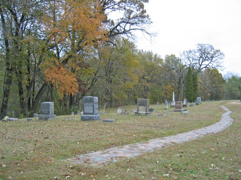
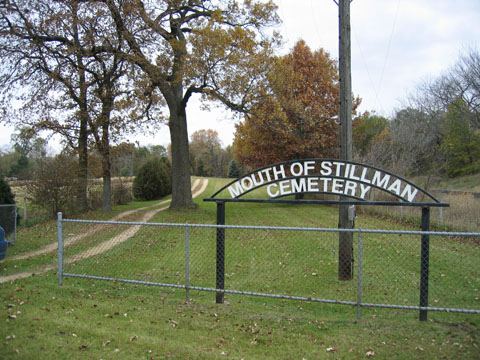
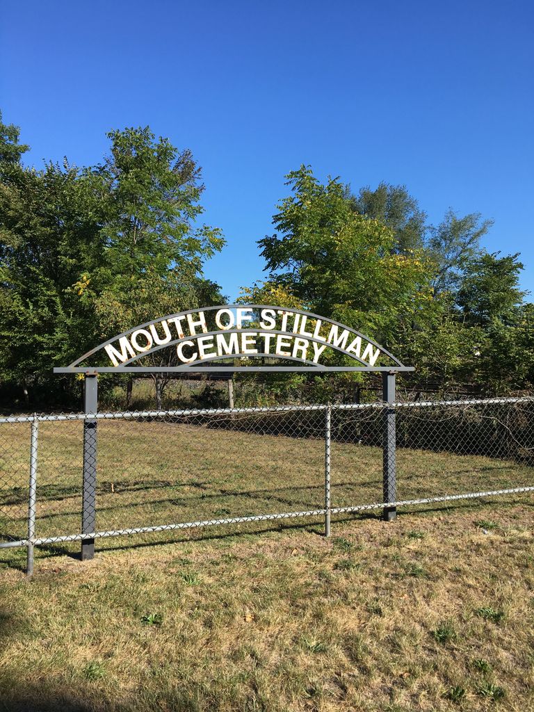
| Memorials | : | 1 |
| Location | : | Byron, Ogle County, USA |
| Coordinate | : | 42.1265182, -89.2269516 |
frequently asked questions (FAQ):
-
Where is Mouth of Stillman Cemetery?
Mouth of Stillman Cemetery is located at Byron, Ogle County ,Illinois ,USA.
-
Mouth of Stillman Cemetery cemetery's updated grave count on graveviews.com?
1 memorials
-
Where are the coordinates of the Mouth of Stillman Cemetery?
Latitude: 42.1265182
Longitude: -89.2269516
Nearby Cemetories:
1. Byron Cemetery
Byron, Ogle County, USA
Coordinate: 42.1307716, -89.2521133
2. Saint Mary's Cemetery
Byron, Ogle County, USA
Coordinate: 42.1253014, -89.2742004
3. Stillman Valley Cemetery
Stillman Valley, Ogle County, USA
Coordinate: 42.1127892, -89.1784134
4. Stillmans Run Battlefield Memorial
Stillman Valley, Ogle County, USA
Coordinate: 42.1066399, -89.1760025
5. Linn Farm Cemetery
Byron, Ogle County, USA
Coordinate: 42.1745834, -89.2744522
6. Ebenezer Cemetery
Oregon, Ogle County, USA
Coordinate: 42.0572319, -89.2780380
7. Beach Cemetery
Stillman Valley, Ogle County, USA
Coordinate: 42.0786018, -89.1299973
8. Chaney Cemetery
Stillman Valley, Ogle County, USA
Coordinate: 42.0525017, -89.1631012
9. Brooklyn Cemetery
Oregon, Ogle County, USA
Coordinate: 42.0668907, -89.3221283
10. Big Mound Cemetery
Davis Junction, Ogle County, USA
Coordinate: 42.0793991, -89.1093979
11. Emmanuel Lutheran Cemetery
Paynes Point, Ogle County, USA
Coordinate: 42.0264091, -89.2071533
12. Mount Pleasant Cemetery
Paynes Point, Ogle County, USA
Coordinate: 42.0258713, -89.2063065
13. Stinsonian Cemetery
Paynes Point, Ogle County, USA
Coordinate: 42.0236015, -89.2174988
14. Lucas Cemetery
Lindenwood, Ogle County, USA
Coordinate: 42.0402908, -89.1215210
15. Better Place Forest
Ogle County, USA
Coordinate: 42.0411546, -89.3341425
16. Camling Cemetery
Leaf River, Ogle County, USA
Coordinate: 42.0882988, -89.3758011
17. Riverview Cemetery
Oregon, Ogle County, USA
Coordinate: 42.0275002, -89.3399963
18. Riverside Cemetery
Oregon, Ogle County, USA
Coordinate: 42.0177994, -89.3308029
19. White Rock Cemetery
White Rock, Ogle County, USA
Coordinate: 42.0210495, -89.1152267
20. Lightsville Cemetery
Leaf River, Ogle County, USA
Coordinate: 42.1443100, -89.4085007
21. Kilbuck Cemetery
Monroe Center, Ogle County, USA
Coordinate: 42.1227989, -89.0425034
22. Saint Brides Episcopal Cemetery
Oregon, Ogle County, USA
Coordinate: 42.0270271, -89.3536911
23. Silver Creek Cemetery
Leaf River, Ogle County, USA
Coordinate: 42.0928001, -89.4083023
24. Egan Cemetery
Leaf River, Ogle County, USA
Coordinate: 42.1805992, -89.4056015