
| Memorials | : | 0 |
| Location | : | West Point, Tippecanoe County, USA |
| Coordinate | : | 40.3134000, -87.0232000 |
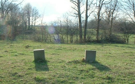
| Description | : | The cemetery is located in Wayne Township (SW quadrant of the NE quadrant of the NE quadrant of Section 31 Township 22N Range 5W) on the west side of S County Road 625 W a little less than 0.2 miles south of its intersection with W County Road 700 S. Indiana Cemetery Locations, Volume 3, published by the Indiana Genealogical Society (April 2007), gives the primary cemetery name as Moyer Cemetery. The cemetery is listed in the Cemetery and Burial Grounds Registry of the Indiana Department of Natural Resources (DNR) and in the State Historical Architectural and Archaeological... Read More |
frequently asked questions (FAQ):
-
Where is Moyer Family Graveyard?
Moyer Family Graveyard is located at S County Road 625 W West Point, Tippecanoe County ,Indiana , 47992USA.
-
Moyer Family Graveyard cemetery's updated grave count on graveviews.com?
0 memorials
-
Where are the coordinates of the Moyer Family Graveyard?
Latitude: 40.3134000
Longitude: -87.0232000
Nearby Cemetories:
1. Pinhook Cemetery
Romney, Tippecanoe County, USA
Coordinate: 40.2877998, -87.0262985
2. West Point Cemetery
West Point, Tippecanoe County, USA
Coordinate: 40.3434563, -87.0360565
3. Farmers Institute Cemetery
Shadeland, Tippecanoe County, USA
Coordinate: 40.3236008, -86.9760971
4. Marks Cemetery
Odell, Tippecanoe County, USA
Coordinate: 40.3099470, -87.0782810
5. Shelby Cemetery
Tippecanoe County, USA
Coordinate: 40.2891998, -86.9756012
6. Helms Cemetery
West Point, Tippecanoe County, USA
Coordinate: 40.3414345, -87.0738144
7. Durkee Cemetery
Shadeland, Tippecanoe County, USA
Coordinate: 40.3549995, -86.9664001
8. Sherry Cemetery
Tippecanoe County, USA
Coordinate: 40.3725014, -87.0639038
9. Gay Farm Burial Site
Wayne Township, Tippecanoe County, USA
Coordinate: 40.3778000, -87.0606000
10. Mintonye Cemetery
Romney, Tippecanoe County, USA
Coordinate: 40.3011017, -86.9319000
11. Hickory Grove Cemetery
Taylor, Tippecanoe County, USA
Coordinate: 40.3450012, -86.9330978
12. Salem Cemetery
Attica, Fountain County, USA
Coordinate: 40.2868118, -87.1163712
13. Provolt Cemetery
Taylor, Tippecanoe County, USA
Coordinate: 40.3438988, -86.9233017
14. Kyle Family Cemetery
Wea Township, Tippecanoe County, USA
Coordinate: 40.3201000, -86.9134000
15. Old Mintonye Cemetery
Shadeland, Tippecanoe County, USA
Coordinate: 40.3791000, -86.9520000
16. Cochran Cemetery
South Raub, Tippecanoe County, USA
Coordinate: 40.3021700, -86.9101400
17. Wheelers Grove Cemetery
Lafayette, Tippecanoe County, USA
Coordinate: 40.2336006, -87.0757980
18. Sugar Grove Cemetery
Jackson Township, Tippecanoe County, USA
Coordinate: 40.2238998, -87.0132980
19. Canal Cemetery
Tippecanoe County, USA
Coordinate: 40.4005394, -86.9897232
20. Granville Cemetery
Tippecanoe County, USA
Coordinate: 40.4063988, -87.0258026
21. Baer Cemetery
Shadeland, Tippecanoe County, USA
Coordinate: 40.3900970, -86.9531860
22. Maysville Cemetery
Fountain County, USA
Coordinate: 40.3266983, -87.1505966
23. Grace Lutheran Church Memorial Garden
Lafayette, Tippecanoe County, USA
Coordinate: 40.3542097, -86.9062021
24. Elmwood Cemetery
Romney, Tippecanoe County, USA
Coordinate: 40.2593994, -86.9100037