
| Memorials | : | 55 |
| Location | : | Port Tobacco, Charles County, USA |
| Coordinate | : | 38.4933660, -77.0142920 |
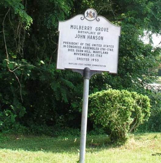
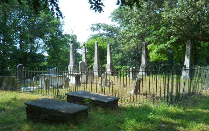
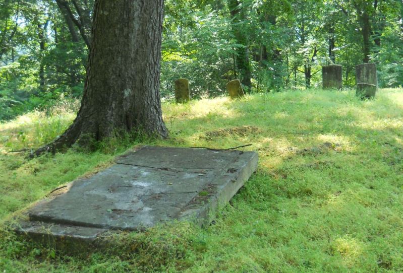
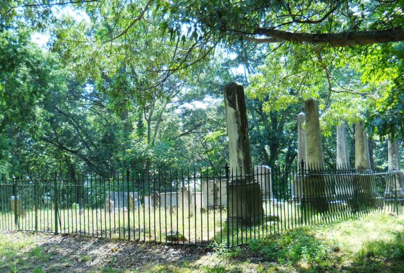
| Description | : | Located on the property which was at one time a plantation called Mulberry Grove, also the birthplace of John Hanson. Hanson served as 'President of the United States in Congress Assembled' from 1781-82. This cemetery is sometimes called the Fergusson family cemetery as well. |
frequently asked questions (FAQ):
-
Where is Mulberry Grove Cemetery?
Mulberry Grove Cemetery is located at 7930 Chapel Point Road Port Tobacco, Charles County ,Maryland ,USA.
-
Mulberry Grove Cemetery cemetery's updated grave count on graveviews.com?
55 memorials
-
Where are the coordinates of the Mulberry Grove Cemetery?
Latitude: 38.4933660
Longitude: -77.0142920
Nearby Cemetories:
1. Chambers Burial Site
Port Tobacco, Charles County, USA
Coordinate: 38.5065350, -77.0056200
2. Brawner Family Cemetery
McConchie, Charles County, USA
Coordinate: 38.4896870, -77.0344110
3. Port Tobacco Baptist Cemetery
Port Tobacco, Charles County, USA
Coordinate: 38.5110100, -77.0203300
4. Ellerslie Estate Cemetery
Port Tobacco, Charles County, USA
Coordinate: 38.5037500, -77.0411600
5. Saint Ignatius Cemetery
Port Tobacco, Charles County, USA
Coordinate: 38.4653015, -77.0246964
6. Stonestreet Family Cemetery
La Plata, Charles County, USA
Coordinate: 38.5219279, -76.9941599
7. Stromatt Family Cemetery
Nanjemoy, Charles County, USA
Coordinate: 38.4981390, -76.9699140
8. Saint Catherine of Alexandria Cemetery
McConchie, Charles County, USA
Coordinate: 38.5024000, -77.0584600
9. Saint Katherines Cemetery
Charles County, USA
Coordinate: 38.5024986, -77.0586014
10. Wills Family Cemetery at Preference
La Plata, Charles County, USA
Coordinate: 38.4843600, -76.9688700
11. Sacred Heart Cemetery
La Plata, Charles County, USA
Coordinate: 38.5214005, -76.9777985
12. Thomas Stone National Historic Site
Port Tobacco, Charles County, USA
Coordinate: 38.5299900, -77.0375300
13. Mount Rest Cemetery
La Plata, Charles County, USA
Coordinate: 38.5321999, -76.9649963
14. Dent Family Cemetery
La Plata, Charles County, USA
Coordinate: 38.5000030, -76.9430870
15. Bowling Family Farm Cemetery
Faulkner, Charles County, USA
Coordinate: 38.4424600, -76.9716300
16. Mount Carmel Cemetery
La Plata, Charles County, USA
Coordinate: 38.5560989, -77.0008011
17. Poynton Manor Farm Cemetery
Welcome, Charles County, USA
Coordinate: 38.4672240, -77.0887561
18. Wood Gravesite
Faulkner, Charles County, USA
Coordinate: 38.4323670, -76.9669290
19. Hawkins Family Cemetery
La Plata, Charles County, USA
Coordinate: 38.5261600, -76.9218500
20. Zion Baptist Church Cemetery
Welcome, Charles County, USA
Coordinate: 38.4897003, -77.1219025
21. Smith Chapel Cemetery
La Plata, Charles County, USA
Coordinate: 38.5327988, -77.1117020
22. Speake Cemetery
Pisgah, Charles County, USA
Coordinate: 38.5166800, -77.1221400
23. New Life Church Cemetery
La Plata, Charles County, USA
Coordinate: 38.5754660, -76.9731100
24. Wesleyan Memorial Gardens
La Plata, Charles County, USA
Coordinate: 38.5754170, -76.9725280