
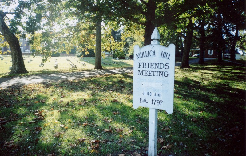
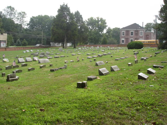
| Memorials | : | 792 |
| Location | : | Mullica Hill, Gloucester County, USA |
| Phone | : | 856-478-2908 |
| Coordinate | : | 39.7315712, -75.2244415 |
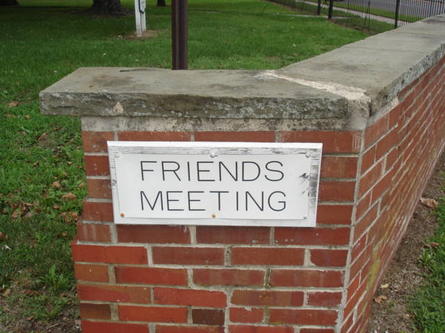
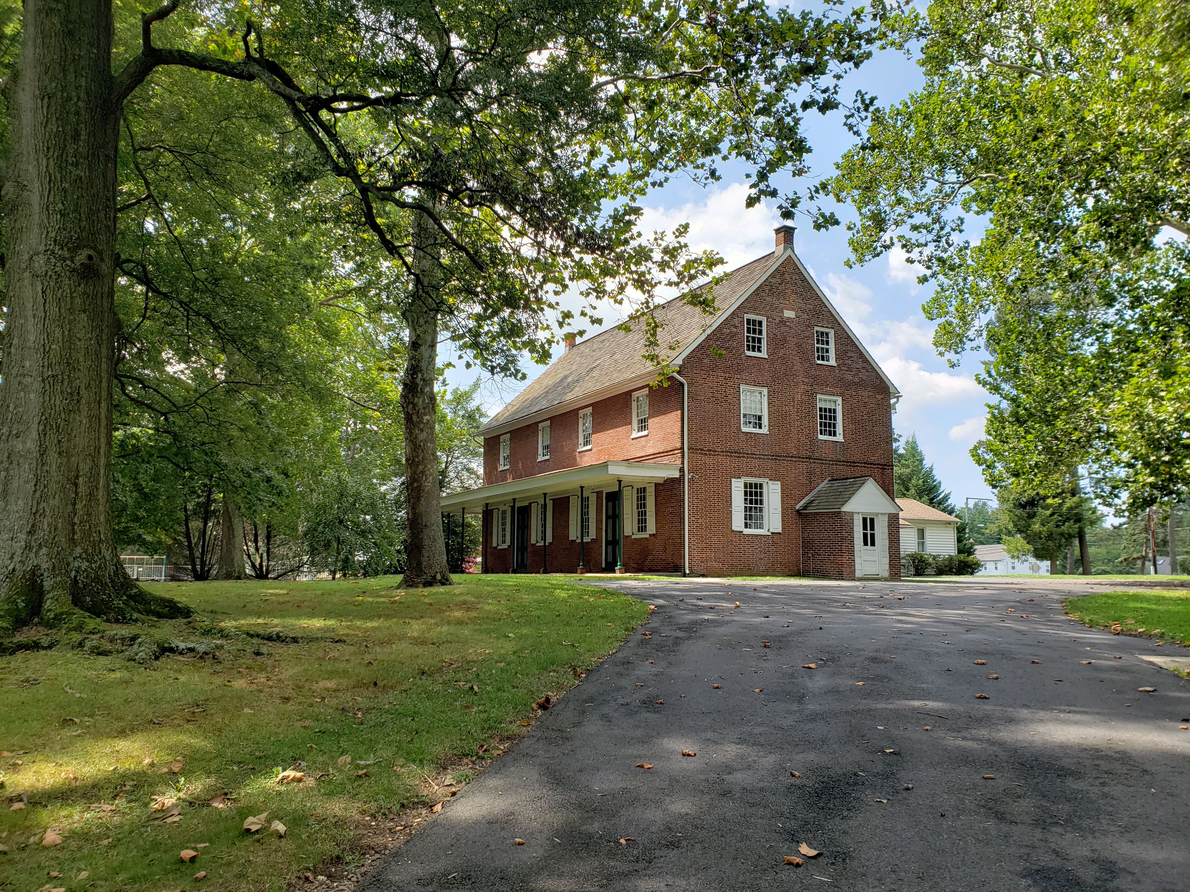
| Description | : | The cemetery is in front of the Meeting House. Parking is next to the Meeting House. The Meeting has a map and roster of the cemetery and will look up grave locations on request. |
frequently asked questions (FAQ):
-
Where is Mullica Hill Friends Cemetery?
Mullica Hill Friends Cemetery is located at 2 Woodstown Rd (Route 45) Mullica Hill, Gloucester County ,New Jersey ,USA.
-
Mullica Hill Friends Cemetery cemetery's updated grave count on graveviews.com?
792 memorials
-
Where are the coordinates of the Mullica Hill Friends Cemetery?
Latitude: 39.7315712
Longitude: -75.2244415
Nearby Cemetories:
1. Trinity United Methodist Church Cemetery
Mullica Hill, Gloucester County, USA
Coordinate: 39.7320251, -75.2273941
2. Mullica Hill Baptist Cemetery
Mullica Hill, Gloucester County, USA
Coordinate: 39.7337837, -75.2258377
3. Saint Stephen's Episcopal Church Cemetery
Mullica Hill, Gloucester County, USA
Coordinate: 39.7388300, -75.2244400
4. Holy Name of Jesus Catholic Church Cemetery
Mullica Hill, Gloucester County, USA
Coordinate: 39.7411842, -75.2212982
5. Mount Calvary Baptist Church Cemetery
Mullica Hill, Gloucester County, USA
Coordinate: 39.7331009, -75.2371979
6. Richwood United Methodist Church Cemetery
Richwood, Gloucester County, USA
Coordinate: 39.7211100, -75.1667700
7. Mount Zion Methodist Church Cemetery
Barnsboro, Gloucester County, USA
Coordinate: 39.7547540, -75.1629530
8. Ferrell United Methodist Church Cemetery
Harrisonville, Gloucester County, USA
Coordinate: 39.6847725, -75.2669296
9. Saint Johns United Methodist Church Cemetery
Harrisonville, Gloucester County, USA
Coordinate: 39.6842500, -75.2666000
10. Mickleton Meeting House Graveyard
Mickleton, Gloucester County, USA
Coordinate: 39.7910800, -75.2378900
11. Solomons Graveyard
Wolfert, Gloucester County, USA
Coordinate: 39.7846985, -75.2636032
12. Driver Cemetery
Barnsboro, Gloucester County, USA
Coordinate: 39.7631000, -75.1554900
13. Lake Park Cemetery
Swedesboro, Gloucester County, USA
Coordinate: 39.7424393, -75.3076324
14. Eglington Cemetery
Clarksboro, Gloucester County, USA
Coordinate: 39.7980690, -75.2257462
15. Trinity Episcopal Churchyard
Swedesboro, Gloucester County, USA
Coordinate: 39.7511597, -75.3074951
16. Gates of Heaven Cemetery
Mount Royal, Gloucester County, USA
Coordinate: 39.7961006, -75.1967010
17. Trinity Episcopal Church New Cemetery
Swedesboro, Gloucester County, USA
Coordinate: 39.7522392, -75.3088837
18. Old Saint Josephs Cemetery
Swedesboro, Gloucester County, USA
Coordinate: 39.7521477, -75.3098068
19. Methodist Cemetery
Swedesboro, Gloucester County, USA
Coordinate: 39.7483990, -75.3114040
20. Cost Family Cemetery
Pitman, Gloucester County, USA
Coordinate: 39.7307100, -75.1332310
21. Jesse Chew Cemetery
Gloucester County, USA
Coordinate: 39.7736800, -75.1498250
22. Zion United Methodist Church Cemetery
Clarksboro, Gloucester County, USA
Coordinate: 39.8030891, -75.2191696
23. Mantua Union Graveyard
Mantua, Gloucester County, USA
Coordinate: 39.7902460, -75.1707610
24. Alms House Cemetery
Gloucester County, USA
Coordinate: 39.8029980, -75.2142200