
| Memorials | : | 1082 |
| Location | : | Mulvane, Sumner County, USA |
| Coordinate | : | 37.4724998, -97.2067032 |
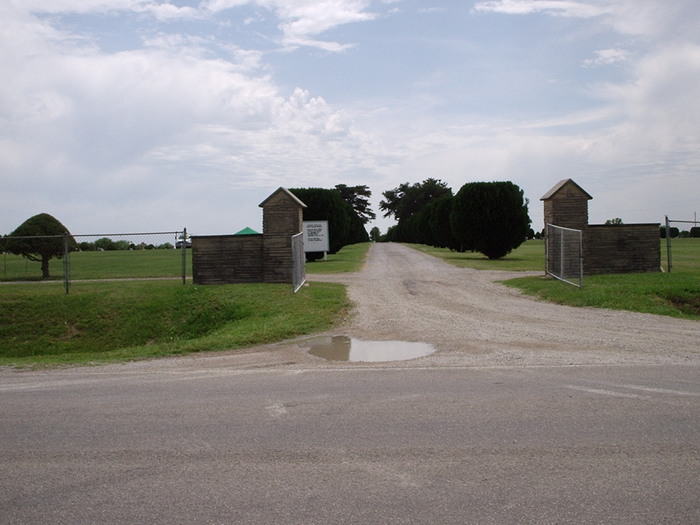
| Description | : | Gore Twp. Location from Mulvane: 1 ½ E. The original cemetery measured 664' x 742'. The Plat was filed Dec. 8, 1886. The oldest legible marker is dated 1879. The first cemetery association was composed of Adam Huffbauer, Erasmus Shull, M D Canady, 11 acres were purchased from Oscar Potter. Early in 1957, the Mulvane Cemetery and the Littleton Cemetery were made into a district to be funded by a Township Mill Levy. This district became known as the Mulvane-Littleton Cemetery Association. Feb. 16, 1957, five directors were elected: G C Hooten, Pres; Geo Bradfield, Vice-pres; Jessie Long, Sec; and Margaret Conklin. At... Read More |
frequently asked questions (FAQ):
-
Where is Mulvane Cemetery?
Mulvane Cemetery is located at Mulvane, Sumner County ,Kansas ,USA.
-
Mulvane Cemetery cemetery's updated grave count on graveviews.com?
1078 memorials
-
Where are the coordinates of the Mulvane Cemetery?
Latitude: 37.4724998
Longitude: -97.2067032

Nearby Cemetories:
1. Littleton Cemetery
Gore Township, Sumner County, USA
Coordinate: 37.4498400, -97.2075500
2. Hillcrest Cemetery
Derby, Sedgwick County, USA
Coordinate: 37.5194435, -97.2202759
3. Union Cemetery
Derby, Sedgwick County, USA
Coordinate: 37.5271988, -97.1532974
4. Prairie Home Scattering Garden
Derby, Sedgwick County, USA
Coordinate: 37.5482715, -97.1903412
5. El Paso Cemetery
Derby, Sedgwick County, USA
Coordinate: 37.5418015, -97.2624969
6. Prairie Garden Cemetery
Peck, Sumner County, USA
Coordinate: 37.4653015, -97.3146973
7. Red Bud Community Cemetery
Cowley County, USA
Coordinate: 37.4411011, -97.0963974
8. Paradise Valley Cemetery
Belle Plaine, Sumner County, USA
Coordinate: 37.3844150, -97.2761580
9. Belle Plaine Cemetery
Belle Plaine, Sumner County, USA
Coordinate: 37.3852310, -97.2841797
10. Richland Cemetery
Douglass, Butler County, USA
Coordinate: 37.5119019, -97.0808029
11. Udall Cemetery
Udall, Cowley County, USA
Coordinate: 37.3843994, -97.1268997
12. Red Bud Catholic Cemetery
Cowley County, USA
Coordinate: 37.4336600, -97.0787100
13. Rose Hill Cemetery
Rose Hill, Butler County, USA
Coordinate: 37.5633011, -97.1177979
14. Council Hill Cemetery
Peck, Sumner County, USA
Coordinate: 37.4466600, -97.3497600
15. Waco Cemetery
Waco, Sedgwick County, USA
Coordinate: 37.5242004, -97.3419037
16. Friends Cemetery
Rose Hill, Butler County, USA
Coordinate: 37.5625000, -97.0896988
17. Lawless Cemetery
Belle Plaine, Sumner County, USA
Coordinate: 37.3648100, -97.3008000
18. Brookshire Cemetery
Cowley County, USA
Coordinate: 37.4524994, -97.0425034
19. Branson Cemetery
Derby, Sedgwick County, USA
Coordinate: 37.6074982, -97.2067032
20. Roll Cemetery
Sedgwick County, USA
Coordinate: 37.5206030, -97.3739950
21. Star Valley Cemetery
Udall, Cowley County, USA
Coordinate: 37.4124985, -97.0421982
22. Ninnescah Cemetery
Udall, Cowley County, USA
Coordinate: 37.3362200, -97.1424800
23. Dunlap Cemetery
Rose Hill, Butler County, USA
Coordinate: 37.5993996, -97.0975037
24. Reflection Pointe Cemetery
Wichita, Sedgwick County, USA
Coordinate: 37.6344800, -97.2264100