
| Memorials | : | 35 |
| Location | : | Napa, Napa County, USA |
| Coordinate | : | 38.2767540, -122.2722070 |
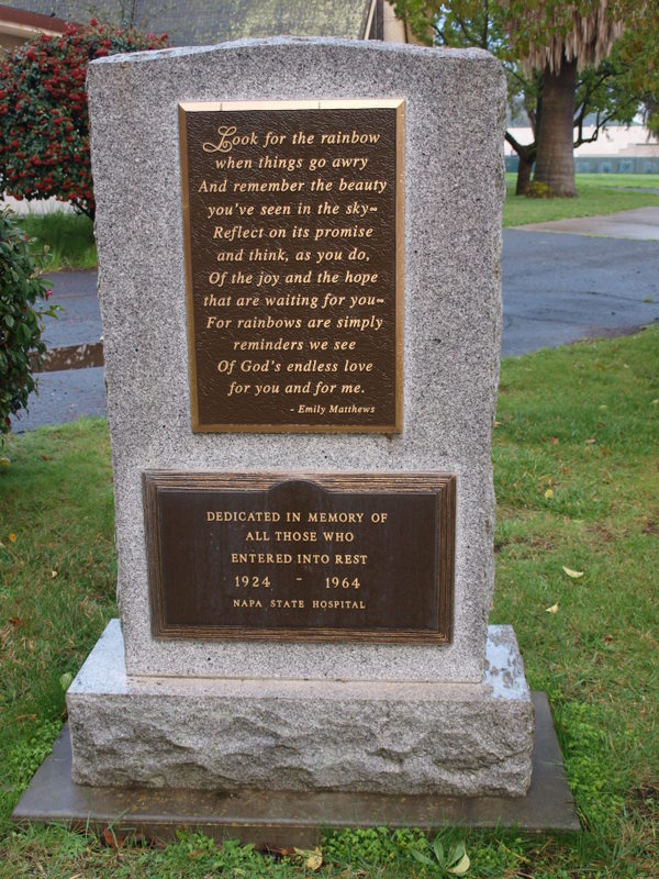
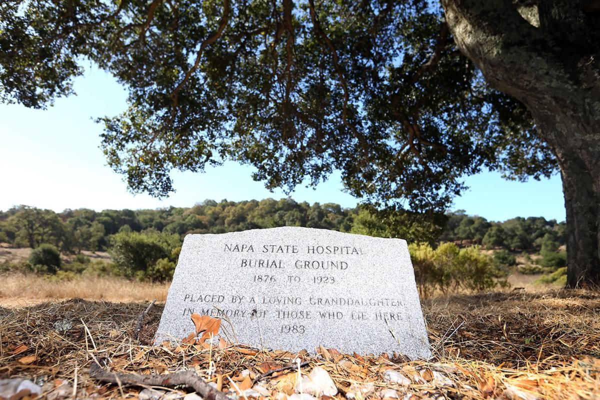
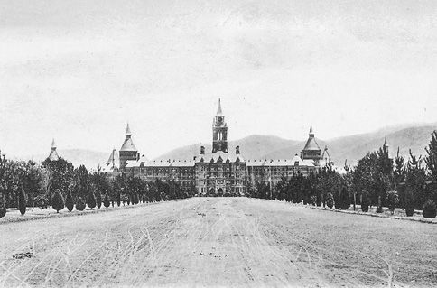
| Description | : | Opening on November 15, 1876, the Napa State Hospital is California's second-oldest mental hospital. For years, the 500-bed hospital was the largest state mental hospital, hence had the problem of dealing with more deceased patients over any other similar facility. Starting with 192 acres, the campus is now 2,000 acres. A two-acre piece of land on the eastern portion of the campus behind the administration building was designated as a cemetery for indigent patients from about 1875 through 1923 and became the final resting place for 4,368 patients' remains. The families of these patients did not claim, for a host... Read More |
frequently asked questions (FAQ):
-
Where is Napa State Hospital Cemetery?
Napa State Hospital Cemetery is located at Napa, Napa County ,California ,USA.
-
Napa State Hospital Cemetery cemetery's updated grave count on graveviews.com?
35 memorials
-
Where are the coordinates of the Napa State Hospital Cemetery?
Latitude: 38.2767540
Longitude: -122.2722070
Nearby Cemetories:
1. Napa Valley Memorial Park and Mortuary
Napa, Napa County, USA
Coordinate: 38.2617700, -122.2717600
2. Tulocay Cemetery
Napa, Napa County, USA
Coordinate: 38.2991982, -122.2688980
3. Saint Mary's Episcopal Church Columbarium
Napa, Napa County, USA
Coordinate: 38.2956500, -122.2952700
4. Dry Creek Cemetery
Napa, Napa County, USA
Coordinate: 38.3394320, -122.3517170
5. Bubbling Well Pet Memorial Park
Napa, Napa County, USA
Coordinate: 38.3686590, -122.2534730
6. Brothers of the Christian Schools Cemetery
Napa, Napa County, USA
Coordinate: 38.3352490, -122.3913450
7. Partrick Cemetery
Napa, Napa County, USA
Coordinate: 38.3347200, -122.4027800
8. Rockville Cemetery
Fairfield, Solano County, USA
Coordinate: 38.2482834, -122.1207504
9. Solano Community College
Fairfield, Solano County, USA
Coordinate: 38.2355700, -122.1254500
10. Wooden Valley Cemetery
Napa, Napa County, USA
Coordinate: 38.3791500, -122.1823200
11. Saint Francis Solano Cemetery
Sonoma, Sonoma County, USA
Coordinate: 38.2915993, -122.4459991
12. Veterans Memorial Grove Cemetery
Yountville, Napa County, USA
Coordinate: 38.3913340, -122.3711930
13. Valley Cemetery
Sonoma, Sonoma County, USA
Coordinate: 38.2832985, -122.4496994
14. Napa Redwoods Cemetery
Napa County, USA
Coordinate: 38.3689003, -122.4094009
15. Trinity Episcopal Church Columbarium
Sonoma, Sonoma County, USA
Coordinate: 38.2930390, -122.4521650
16. Mountain Cemetery
Sonoma, Sonoma County, USA
Coordinate: 38.3008003, -122.4535980
17. Mission San Francisco Solano Cemetery
Sonoma, Sonoma County, USA
Coordinate: 38.2937164, -122.4561844
18. Sonoma Veterans Cemetery
Sonoma, Sonoma County, USA
Coordinate: 38.2992790, -122.4566390
19. George C. Yount Pioneer Cemetery
Yountville, Napa County, USA
Coordinate: 38.4084430, -122.3689470
20. Sunrise Memorial Cemetery
Vallejo, Solano County, USA
Coordinate: 38.1194000, -122.2605972
21. Hillside Cemetery
Vallejo, Solano County, USA
Coordinate: 38.1185989, -122.2647018
22. Good Templar Orphanage Cemetery
Vallejo, Solano County, USA
Coordinate: 38.1177930, -122.2411880
23. Faith Lutheran Church Memorial Garden
Sonoma, Sonoma County, USA
Coordinate: 38.2932380, -122.4880690
24. Fairmont Memorial Park
Fairfield, Solano County, USA
Coordinate: 38.2648040, -122.0411970