| Memorials | : | 0 |
| Location | : | Bona, Dade County, USA |
| Coordinate | : | 37.5617280, -93.6382900 |
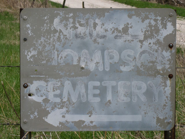
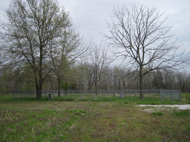
| Description | : | Neil - Thompson Cemetery is located on the south side of the east branch of Stockton lake in the northeast corner of Dade County, Missouri. From Bona, go north about 2 miles on Route 245, turn east on CR14 and then north on CR239. The cemetery is off to the east side of CR239, surrounded by a chain link fence. |
frequently asked questions (FAQ):
-
Where is Neil - Thompson Cemetery?
Neil - Thompson Cemetery is located at Bona, Dade County ,Missouri ,USA.
-
Neil - Thompson Cemetery cemetery's updated grave count on graveviews.com?
0 memorials
-
Where are the coordinates of the Neil - Thompson Cemetery?
Latitude: 37.5617280
Longitude: -93.6382900
Nearby Cemetories:
1. Morgan Cemetery
Masters, Cedar County, USA
Coordinate: 37.5767708, -93.6394577
2. Cheek Cemetery
Bona, Dade County, USA
Coordinate: 37.5611650, -93.6688510
3. Lindley Family Cemetery
Bona, Dade County, USA
Coordinate: 37.5670620, -93.6703890
4. Davis-Blair Cemetery
Aldrich, Polk County, USA
Coordinate: 37.5559660, -93.6061410
5. Asbell Cemetery
Dade County, USA
Coordinate: 37.5353012, -93.6577988
6. Perkins Homestead Cemetery
Cedar County, USA
Coordinate: 37.5743904, -93.6745605
7. Bona Cemetery
Bona, Dade County, USA
Coordinate: 37.5427895, -93.6718292
8. Morris Cemetery
Bona, Dade County, USA
Coordinate: 37.5289001, -93.6406021
9. Shady Grove Cemetery
Aldrich, Polk County, USA
Coordinate: 37.5736008, -93.5943985
10. Routh Cemetery
Bona, Dade County, USA
Coordinate: 37.5256200, -93.6265400
11. White Family Cemetery
Bona, Dade County, USA
Coordinate: 37.5389000, -93.6772000
12. Long Cemetery
Bona, Dade County, USA
Coordinate: 37.5502586, -93.6891785
13. Bethel Cemetery
Masters, Cedar County, USA
Coordinate: 37.6036682, -93.6331863
14. McDaniel Cemetery
Polk County, USA
Coordinate: 37.5257988, -93.6100006
15. Trimble Cemetery
Fair Play, Polk County, USA
Coordinate: 37.5918999, -93.5982971
16. Hartley Cemetery
Masters, Cedar County, USA
Coordinate: 37.5993970, -93.6678040
17. Sutherland Cemetery
Aldrich, Polk County, USA
Coordinate: 37.5801000, -93.5773000
18. Davis Cemetery
Polk County, USA
Coordinate: 37.5668000, -93.5723000
19. Crain Cemetery (Re-Located)
Aldrich, Polk County, USA
Coordinate: 37.5615290, -93.5578890
20. Hubbard Cemetery
Aldrich, Polk County, USA
Coordinate: 37.5416985, -93.5618973
21. Mt. Zion Cemetery (Re-Located)
Aldrich, Polk County, USA
Coordinate: 37.5618840, -93.5566120
22. Pleasant Ridge Cemetery
Aldrich, Polk County, USA
Coordinate: 37.5160713, -93.5773468
23. Flint Hill Cemetery
Bona, Dade County, USA
Coordinate: 37.5695200, -93.7272300
24. Dale Cemetery
Cane Hill, Cedar County, USA
Coordinate: 37.5881740, -93.7293770


