
| Memorials | : | 127 |
| Location | : | Cordova, Talbot County, USA |
| Coordinate | : | 38.9020538, -76.0510101 |
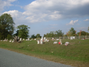
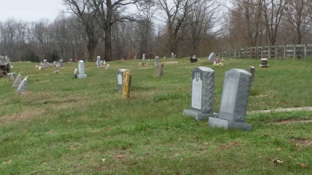
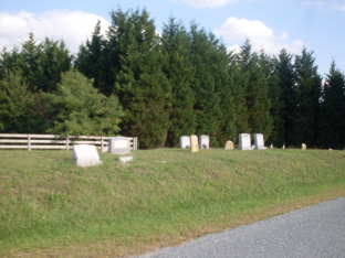
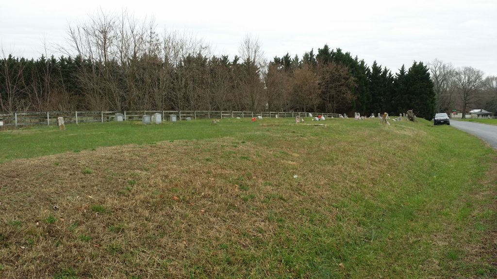
| Description | : | Most of the graves in this small cemetery are in concrete vaults due to the high water table. One vault had disintegrated with visible holes in the top of the ground level covering to reveal the water level to be about 8 inches from the top of the ground. Many graves are unmarked. This cemetery sits on a small hillside, just off Skipton Jack Rd in Cordova. |
frequently asked questions (FAQ):
-
Where is Newton Road Cemetery?
Newton Road Cemetery is located at Cordova, Talbot County ,Maryland ,USA.
-
Newton Road Cemetery cemetery's updated grave count on graveviews.com?
127 memorials
-
Where are the coordinates of the Newton Road Cemetery?
Latitude: 38.9020538
Longitude: -76.0510101
Nearby Cemetories:
1. Hopkins-Stafford Family Cemetery
Skipton, Talbot County, USA
Coordinate: 38.8896488, -76.0609487
2. Saint Joseph's Cemetery
Cordova, Talbot County, USA
Coordinate: 38.9099998, -76.0132980
3. Saint Pauls Cemetery
Cordova, Talbot County, USA
Coordinate: 38.8802986, -76.0149994
4. Old Wye Episcopal Church Cemetery
Wye Mills, Talbot County, USA
Coordinate: 38.9366989, -76.0800018
5. Woodlawn Memorial Park
Easton, Talbot County, USA
Coordinate: 38.8610992, -76.0597000
6. Clayton Cemetery
Wye Mills, Talbot County, USA
Coordinate: 38.9297780, -76.1058167
7. All Saints Cemetery
Easton, Talbot County, USA
Coordinate: 38.8464012, -76.0817032
8. Clover Fields Farm Cemetery
Queenstown, Queen Anne's County, USA
Coordinate: 38.9551960, -76.0896240
9. Rhyanes Family Cemetery
Wye Mills, Talbot County, USA
Coordinate: 38.9609756, -76.0957718
10. Fairview Church of the Brethren Cemetery
Talbot County, USA
Coordinate: 38.8568993, -75.9757996
11. Wye of Carmichael Cemetery
Queen Anne's County, USA
Coordinate: 38.9411011, -76.1335983
12. John Wesley Church Cemetery
Carmichael, Queen Anne's County, USA
Coordinate: 38.9578018, -76.1243973
13. Stagwell Cemetery
Carmichael, Queen Anne's County, USA
Coordinate: 38.9431040, -76.1431250
14. Sandtown Cemetery
Hillsboro, Caroline County, USA
Coordinate: 38.9236300, -75.9468000
15. Greenmount Cemetery
Hillsboro, Caroline County, USA
Coordinate: 38.9239006, -75.9452972
16. Saint Pauls Cemetery
Hillsboro, Caroline County, USA
Coordinate: 38.9152985, -75.9421997
17. Tillotson Family Cemetery
Hillsboro, Caroline County, USA
Coordinate: 38.9179497, -75.9426956
18. Chapel Cemetery
Easton, Talbot County, USA
Coordinate: 38.8171997, -76.0211029
19. Ashby-Goldsborough Family Cemetery
Easton, Talbot County, USA
Coordinate: 38.8251600, -76.1239840
20. Daffin House Cemetery
Hillsboro, Caroline County, USA
Coordinate: 38.8750500, -75.9273800
21. Saint Peter's Cemetery
Queenstown, Queen Anne's County, USA
Coordinate: 38.9785995, -76.1343994
22. Wye House Cemetery
Easton, Talbot County, USA
Coordinate: 38.8545500, -76.1678100
23. Lombardy Farm Cemetery
Unionville, Talbot County, USA
Coordinate: 38.8158530, -76.1259852
24. Bryan Family Cemetery
Grasonville, Queen Anne's County, USA
Coordinate: 38.9362600, -76.1788400