
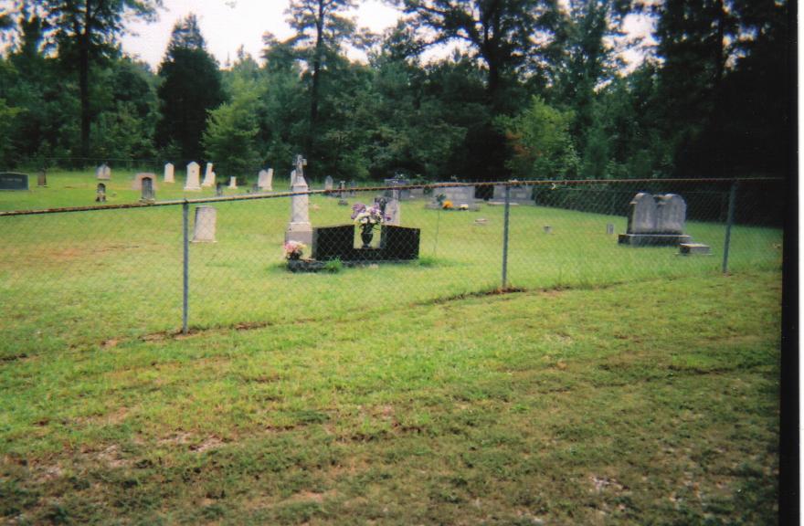
| Memorials | : | 0 |
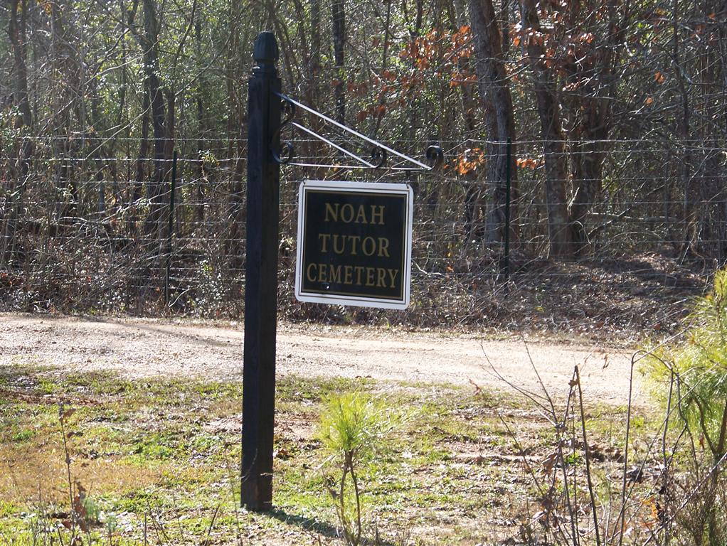
| Location | : | Randolph, Pontotoc County, USA |
| Coordinate | : | 34.1567001, -89.1847000 |
| Description | : | 12.7 miles on highway 9 south to Foshee Bend Road. Take a right on Foshee Bend Road and go 1.1 miles to the cemetery on the left." Foshee Bend Road is about a mile or 2 past the town of Randolph, and the cemetery is north of the highway off #9. |
frequently asked questions (FAQ):
-
Where is Noah Tutor Cemetery?
Noah Tutor Cemetery is located at Randolph, Pontotoc County ,Mississippi ,USA.
-
Noah Tutor Cemetery cemetery's updated grave count on graveviews.com?
0 memorials
-
Where are the coordinates of the Noah Tutor Cemetery?
Latitude: 34.1567001
Longitude: -89.1847000
Nearby Cemetories:
1. Johnston Cemetery
Pontotoc County, USA
Coordinate: 34.1589012, -89.1825027
2. Herndon Cemetery
Pontotoc County, USA
Coordinate: 34.1666985, -89.1830978
3. Hartwell Tutor Cemetery
Pontotoc County, USA
Coordinate: 34.1663940, -89.1908550
4. Carey Springs Cemetery
Pontotoc, Pontotoc County, USA
Coordinate: 34.1763992, -89.1936035
5. Randolph Cemetery
Pontotoc, Pontotoc County, USA
Coordinate: 34.1776650, -89.1661550
6. Coats Cemetery
Randolph, Pontotoc County, USA
Coordinate: 34.1802460, -89.1674640
7. Salmon Cemetery
Randolph, Pontotoc County, USA
Coordinate: 34.1836014, -89.1936035
8. Freeman Cemetery
Pontotoc County, USA
Coordinate: 34.1425340, -89.2191980
9. Hopewell Primitive Baptist Church Cemetery
Pontotoc, Pontotoc County, USA
Coordinate: 34.1564971, -89.2253489
10. Garner-Fleming Cemetery
Pontotoc County, USA
Coordinate: 34.1488030, -89.1370480
11. County Line Baptist Church Cemetery
Pontotoc County, USA
Coordinate: 34.1607710, -89.2350770
12. Bramlett Cemetery
Pontotoc County, USA
Coordinate: 34.1918983, -89.2253036
13. Oak Forest Cemetery
Randolph, Pontotoc County, USA
Coordinate: 34.1935997, -89.1444016
14. Harrison-Tutor Cemetery
Pontotoc County, USA
Coordinate: 34.2064018, -89.1947021
15. Bethel-New Robbs Cemetery
Robbs, Pontotoc County, USA
Coordinate: 34.1070250, -89.2067100
16. Amish Community Cemetery
Pontotoc County, USA
Coordinate: 34.1917839, -89.1310501
17. Robbs Chapel Cemetery
Robbs, Pontotoc County, USA
Coordinate: 34.0990920, -89.2052880
18. Judah Cemetery
Pontotoc County, USA
Coordinate: 34.1182130, -89.1248430
19. Buckhorn Cemetery
Pontotoc County, USA
Coordinate: 34.0951480, -89.1646210
20. Blount Cemetery
Pontotoc County, USA
Coordinate: 34.0931015, -89.1544037
21. Indian Creek Cemetery
Pontotoc County, USA
Coordinate: 34.1039009, -89.1239014
22. Spring Hill Cemetery
Spring Hill, Lafayette County, USA
Coordinate: 34.1986008, -89.2581024
23. Tallant-Sledge Cemetery
Pontotoc County, USA
Coordinate: 34.2199200, -89.2318850
24. Robbs Cemetery
Robbs, Pontotoc County, USA
Coordinate: 34.0877590, -89.2189190