
| Memorials | : | 1 |
| Location | : | Maryland, Ogle County, USA |
| Coordinate | : | 42.1723900, -89.5399399 |
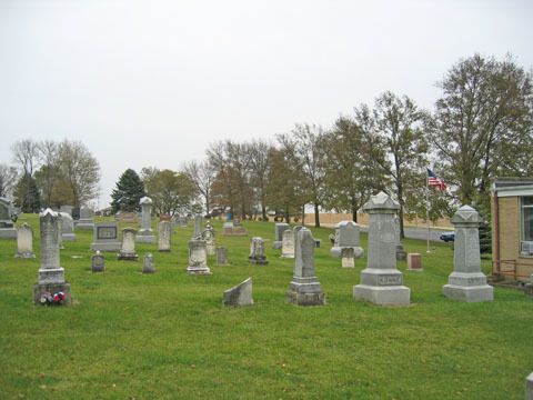
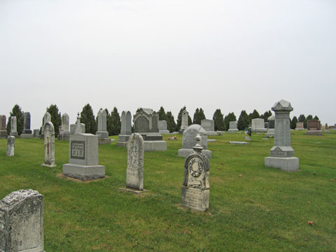
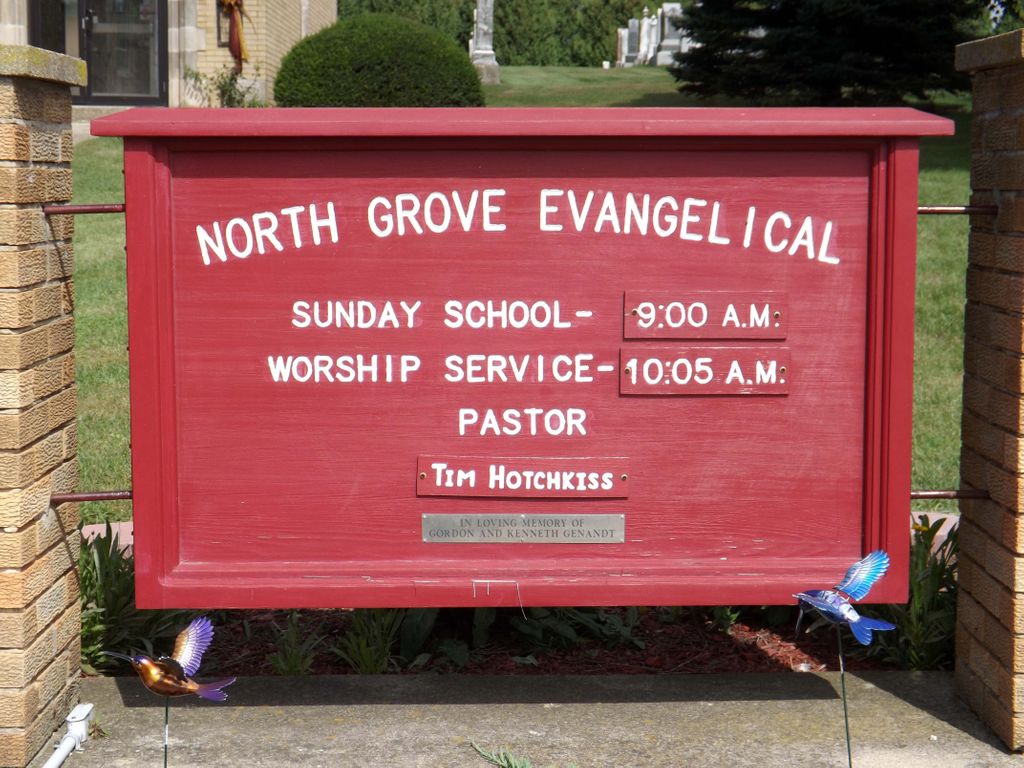
| Description | : | The name placed on this church when it was built in the 1800s is North Grove Zion Reformed Church. It has been called North Grove Evangelical Church since the 1960s. Locally, we call the cemetery North Grove Evangelical Church Cemetery as they continue to maintain the cemetery records. |
frequently asked questions (FAQ):
-
Where is North Grove Zion Reformed Cemetery?
North Grove Zion Reformed Cemetery is located at 10384 W. Coffman Rd Maryland, Ogle County ,Illinois , 61030USA.
-
North Grove Zion Reformed Cemetery cemetery's updated grave count on graveviews.com?
1 memorials
-
Where are the coordinates of the North Grove Zion Reformed Cemetery?
Latitude: 42.1723900
Longitude: -89.5399399

Nearby Cemetories:
1. Coffman Cemetery
Adeline, Ogle County, USA
Coordinate: 42.1730995, -89.5205994
2. Adeline Cemetery
Adeline, Ogle County, USA
Coordinate: 42.1434708, -89.4943466
3. Silver Creek Cemetery
German Valley, Stephenson County, USA
Coordinate: 42.2111626, -89.4925003
4. Hewitt Cemetery
Forreston, Ogle County, USA
Coordinate: 42.1201210, -89.5787430
5. Diddens Cemetery
Freeport, Stephenson County, USA
Coordinate: 42.2372000, -89.5423000
6. White Oak Cemetery
Forreston, Ogle County, USA
Coordinate: 42.1268997, -89.6025009
7. West Grove Cemetery
Forreston, Ogle County, USA
Coordinate: 42.0997887, -89.5292435
8. Cranes Grove Cemetery
Stephenson County, USA
Coordinate: 42.2372017, -89.5896988
9. North Grove Christian Cemetery
Egan, Ogle County, USA
Coordinate: 42.1811104, -89.4355621
10. North Grove Evangelical Cemetery
Leaf River, Ogle County, USA
Coordinate: 42.1585999, -89.4344025
11. Prairie Dell Cemetery
Forreston, Ogle County, USA
Coordinate: 42.1710587, -89.6483765
12. Forreston Grove Cemetery
Forreston, Ogle County, USA
Coordinate: 42.1159592, -89.6280365
13. Christian Reformed Church Cemetery
German Valley, Stephenson County, USA
Coordinate: 42.2319489, -89.4541168
14. Rice Cemetery
Mount Morris, Ogle County, USA
Coordinate: 42.1061172, -89.4517136
15. Florence United Methodist Church Cemetery
Florence, Stephenson County, USA
Coordinate: 42.2138901, -89.6600037
16. Egan Cemetery
Leaf River, Ogle County, USA
Coordinate: 42.1805992, -89.4056015
17. Lightsville Cemetery
Leaf River, Ogle County, USA
Coordinate: 42.1443100, -89.4085007
18. Haldane Cemetery
Haldane, Ogle County, USA
Coordinate: 42.0691986, -89.5706024
19. State Road Cemetery
Stephenson County, USA
Coordinate: 42.2764015, -89.5130997
20. Gund Cemetery
Freeport, Stephenson County, USA
Coordinate: 42.2797012, -89.5194016
21. West Branch Cemetery
Haldane, Ogle County, USA
Coordinate: 42.0630989, -89.5355988
22. County Home Cemetery
Freeport, Stephenson County, USA
Coordinate: 42.2589530, -89.6311250
23. Chapel Hill Memorial Gardens
Freeport, Stephenson County, USA
Coordinate: 42.2635994, -89.6335983
24. Ridott Center Cemetery
Ridott, Stephenson County, USA
Coordinate: 42.2764015, -89.4657974