
| Memorials | : | 30 |
| Location | : | Norwood Young America, Carver County, USA |
| Coordinate | : | 44.7685870, -93.9394160 |
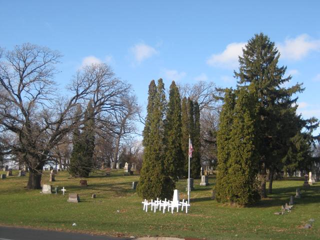
| Description | : | The eastern third here is Norwood Village Cemetery and is owned by the city of Norwood Young America. The western two-thirds is Forest Hill Cemetery, and is owned by the Forest Hill Cemetery Association. |
frequently asked questions (FAQ):
-
Where is Norwood Village Cemetery?
Norwood Village Cemetery is located at Norwood Young America, Carver County ,Minnesota ,USA.
-
Norwood Village Cemetery cemetery's updated grave count on graveviews.com?
29 memorials
-
Where are the coordinates of the Norwood Village Cemetery?
Latitude: 44.7685870
Longitude: -93.9394160
Nearby Cemetories:
1. Forest Hills Cemetery
Norwood Young America, Carver County, USA
Coordinate: 44.7689030, -93.9402790
2. Church of the Ascension Catholic Cemetery
Norwood Young America, Carver County, USA
Coordinate: 44.7705612, -93.9296188
3. Norwood-Young America City Cemetery
Norwood Young America, Carver County, USA
Coordinate: 44.7854800, -93.9095900
4. Saint Johns Lutheran Cemetery Old
Norwood Young America, Carver County, USA
Coordinate: 44.7863220, -93.9095790
5. Young America City Cemetery Old
Norwood Young America, Carver County, USA
Coordinate: 44.7865760, -93.9092680
6. Saint Patricks Catholic Cemetery
Norwood Young America, Carver County, USA
Coordinate: 44.7869940, -93.9085310
7. Saint Johns Lutheran Cemetery
Norwood Young America, Carver County, USA
Coordinate: 44.7886400, -93.9085800
8. Saint Paul Evangelical Reformed Church Cemetery
Hamburg, Carver County, USA
Coordinate: 44.7237940, -93.9302420
9. Emanuel Lutheran Cemetery
Hamburg, Carver County, USA
Coordinate: 44.7317330, -93.9854470
10. Ferguson Cemetery
Carver County, USA
Coordinate: 44.7989006, -93.9957962
11. Zion Evangelical Cemetery
Norwood Young America, Carver County, USA
Coordinate: 44.7320250, -93.8795360
12. Saint Johns UCC Cemetery
Bongards, Carver County, USA
Coordinate: 44.7684180, -93.8498890
13. Saint Pauls United Church of Christ Cemetery
Plato, McLeod County, USA
Coordinate: 44.7677000, -94.0334700
14. Saint Johns Lutheran Cemetery
Plato, McLeod County, USA
Coordinate: 44.7930900, -94.0399800
15. Zion Lutheran Cemetery
Cologne, Carver County, USA
Coordinate: 44.7363970, -93.8289830
16. Crow River Cemetery
New Germany, Carver County, USA
Coordinate: 44.8544200, -93.9492100
17. Assumption Lake Catholic Cemetery
Assumption, Sibley County, USA
Coordinate: 44.6878014, -93.8889008
18. Saint Pauls Lutheran Cemetery
Green Isle, Sibley County, USA
Coordinate: 44.6882020, -93.9981220
19. Saint Brendans Catholic Cemetery
Green Isle, Sibley County, USA
Coordinate: 44.6790009, -94.0029984
20. Saint Johns Lutheran Cemetery
Helen Township, McLeod County, USA
Coordinate: 44.7315730, -94.0813080
21. Church of God Cemetery
Lester Prairie, McLeod County, USA
Coordinate: 44.8595200, -94.0202600
22. Evangelical Lutheran Cemetery
Lester Prairie, McLeod County, USA
Coordinate: 44.8216700, -94.0715800
23. Norwegian Evangelical Lutheran Cemetery
McLeod County, USA
Coordinate: 44.8394490, -94.0591330
24. Swedish Lutheran Cemetery
McLeod County, USA
Coordinate: 44.8471300, -94.0547300