
| Memorials | : | 0 |
| Location | : | Noxapater, Winston County, USA |
| Coordinate | : | 32.9869003, -89.0603027 |
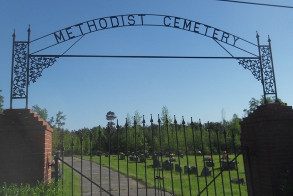
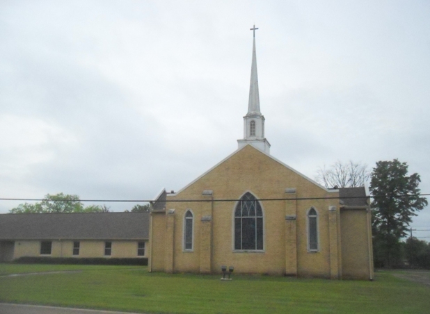
| Description | : | The directions to this cemetery: Turn left (east) on Highway 490. Turn right on Caroline Street (the street runs beside the church) and continue for.5 of a mile. The cemetery will be on the right with a nice fence around it. |
frequently asked questions (FAQ):
-
Where is Noxapater Methodist Cemetery?
Noxapater Methodist Cemetery is located at Noxapater, Winston County ,Mississippi ,USA.
-
Noxapater Methodist Cemetery cemetery's updated grave count on graveviews.com?
0 memorials
-
Where are the coordinates of the Noxapater Methodist Cemetery?
Latitude: 32.9869003
Longitude: -89.0603027

Nearby Cemetories:
1. Mount Carmel Baptist Cemetery
Noxapater, Winston County, USA
Coordinate: 32.9930992, -89.0667038
2. Sunrise Memorial Cemetery
Noxapater, Winston County, USA
Coordinate: 32.9793280, -89.0653900
3. Mount Vernon Cemetery
Noxapater, Winston County, USA
Coordinate: 32.9964470, -89.0854010
4. Hight Cemetery
Winston County, USA
Coordinate: 32.9599991, -89.0606003
5. Union Ridge Cemetery
Noxapater, Winston County, USA
Coordinate: 32.9571991, -89.0250015
6. Oak Grove # 2 Missionary Baptist Church Cemetery
Louisville, Winston County, USA
Coordinate: 33.0206150, -89.0216170
7. Woodruff Cemetery
Winston County, USA
Coordinate: 33.0210460, -89.0217450
8. Mount Pisgah Cemetery
Neshoba County, USA
Coordinate: 32.9309400, -89.0395900
9. Enon Baptist Church Cemetery
Claytown, Winston County, USA
Coordinate: 32.9951210, -88.9877220
10. Mount Hope Cemetery
Plattsburg, Winston County, USA
Coordinate: 32.9419700, -89.1122870
11. Shields Cemetery
Winston County, USA
Coordinate: 32.9858900, -88.9852770
12. Rocky Hill Cemetery
Louisville, Winston County, USA
Coordinate: 33.0102997, -88.9888992
13. Fort Necessity Cemetery
Noxapater, Winston County, USA
Coordinate: 32.9475170, -89.1229500
14. Mount Cannie M.B. Church Cemetery
Estes, Winston County, USA
Coordinate: 33.0466630, -89.0254240
15. Tabor Cemetery
Winston County, USA
Coordinate: 33.0572170, -89.0768180
16. Mount Pleasant #2 Missionary Baptist Cemetery
Noxapater, Winston County, USA
Coordinate: 32.9534680, -89.1363300
17. Old Enon Cemetery
Claytown, Winston County, USA
Coordinate: 32.9766312, -88.9746170
18. Snow Cemetery
Stallo, Neshoba County, USA
Coordinate: 32.9195660, -89.0953020
19. Old Oak Grove M.B. Church Cemetery #2
Nanih Waiya, Winston County, USA
Coordinate: 33.0209500, -88.9818830
20. Saint Marks Cemetery
Stallo, Neshoba County, USA
Coordinate: 32.9237100, -89.1115000
21. Flower Ridge Cemetery
Center Ridge, Winston County, USA
Coordinate: 33.0639000, -89.0653000
22. Campground Cemetery
Winston County, USA
Coordinate: 33.0410995, -89.1268997
23. Old Mount Ary Cemetery
Philadelphia, Neshoba County, USA
Coordinate: 32.9121850, -89.0947650
24. Mount Ary M. B. Church Cemetery
Stallo, Neshoba County, USA
Coordinate: 32.9118996, -89.0939026