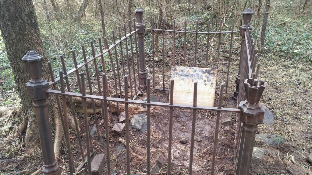
| Memorials | : | 18 |
| Location | : | Mineral, Louisa County, USA |
| Coordinate | : | 38.0569870, -77.8251210 |
| Description | : | From Mineral travel 2.3 miles down Fredericks Hall Road (Route 618), then turn left on to Johnson Road (Route 700), travel down Johnson Road for 4.6 miles, then turn left on to Kentucky Springs Road (Route 652), travel on Kentucky Springs Road for .8 miles, the destination will be on your right, 8736 Kentucky Springs Road. Notes: Cemetery located behind Joseph Molinaro’s house at 8736 Kentucky Springs Road. Must ask permission before heading to cemetery. History: This cemetery is on land originally owned by the Nuckolls family. The family home was burned to the ground. Its... Read More |
frequently asked questions (FAQ):
-
Where is Nuckolls Cemetery?
Nuckolls Cemetery is located at 8736 Kentucky Springs Road (Rt. 652) Mineral, Louisa County ,Virginia , 23117USA.
-
Nuckolls Cemetery cemetery's updated grave count on graveviews.com?
3 memorials
-
Where are the coordinates of the Nuckolls Cemetery?
Latitude: 38.0569870
Longitude: -77.8251210
Nearby Cemetories:
1. Laurel Hill Baptist Church Cemetery
Mineral, Louisa County, USA
Coordinate: 38.0469437, -77.8160782
2. Johnson Family Cemetery
Mineral, Louisa County, USA
Coordinate: 38.0399520, -77.8342170
3. Collins Graveyard
Louisa County, USA
Coordinate: 38.0586700, -77.7808890
4. Ware - Waller Cemetery
Mineral, Louisa County, USA
Coordinate: 38.0829040, -77.8562800
5. Elk Creek Baptist Church Cemetery
Mineral, Louisa County, USA
Coordinate: 38.0361730, -77.7831940
6. Talley Family Graveyard
Plum Tree, Louisa County, USA
Coordinate: 38.0272134, -77.7910938
7. Bowles Cemetery
Mineral, Louisa County, USA
Coordinate: 38.0451330, -77.8822450
8. Oak Grove Cemetery
Mineral, Louisa County, USA
Coordinate: 38.0995697, -77.8539140
9. Trinity Baptist Church Cemetery
Mineral, Louisa County, USA
Coordinate: 38.0790180, -77.8827250
10. Saint John Baptist Church Cemetery
Mineral, Louisa County, USA
Coordinate: 38.0874520, -77.8801390
11. Berryman - Talley Cemetery
Mineral, Louisa County, USA
Coordinate: 38.0353641, -77.8882377
12. Jerusalem Baptist Church Cemetery
Mineral, Louisa County, USA
Coordinate: 38.0837480, -77.8900270
13. True Apostolic Church of Christ Cemetery
Mineral, Louisa County, USA
Coordinate: 37.9979210, -77.8447418
14. Belle Isle Cemetery
Mineral, Louisa County, USA
Coordinate: 38.0002360, -77.7960920
15. Rising Sun Baptist Church Cemetery
Mineral, Louisa County, USA
Coordinate: 37.9988670, -77.8497238
16. Poindexter Family Cemetery
Mineral, Louisa County, USA
Coordinate: 38.0867530, -77.8967836
17. Smith Cemetery
Mineral, Louisa County, USA
Coordinate: 38.0643020, -77.9069730
18. Shelton Family Cemetery
Mineral, Louisa County, USA
Coordinate: 38.0049193, -77.8748458
19. McLeod Family Cemetery
Bumpass, Louisa County, USA
Coordinate: 38.0733410, -77.7439870
20. Samuel Wharton Family Cemetery
Mineral, Louisa County, USA
Coordinate: 38.1047300, -77.8895370
21. Johnson Family Cemetery
Mineral, Louisa County, USA
Coordinate: 38.0592610, -77.9136860
22. Butler Family Cemetery
Mineral, Louisa County, USA
Coordinate: 38.0176000, -77.9039000
23. Bethpage Christian Church Cemetery
Mineral, Louisa County, USA
Coordinate: 37.9820180, -77.8179330
24. Tolersville Tavern Burial Ground
Mineral, Louisa County, USA
Coordinate: 38.0132065, -77.9034500

