
| Memorials | : | 4 |
| Location | : | Douglas County, USA |
| Coordinate | : | 37.0477790, -92.4186630 |
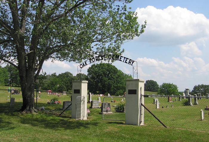
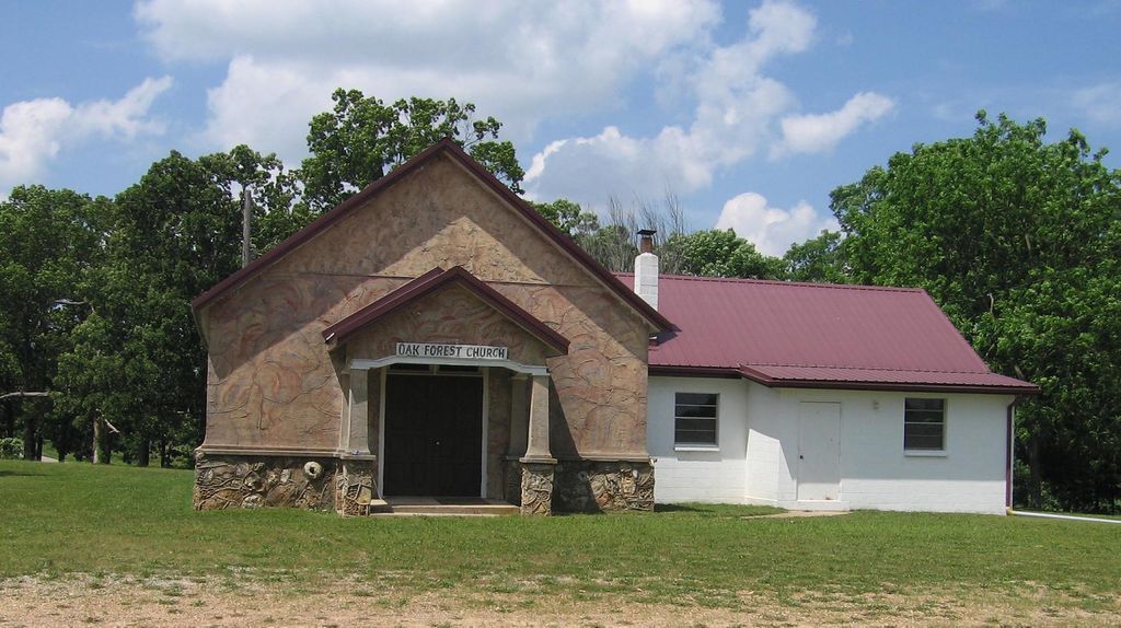
| Description | : | This is a history of the Oak Forest School, Oak Forest Church and Cemetery. The church and cemetery are located on Highway C about 7 miles south of Norwood, Missouri, in Clay Township, Douglas County. It contains a history of the church, pictures of the school, church, pictures of the people, their tombstones, obituaries and funeral cards for those buried in the cemetery. The Oak Forest Cemetery is located about 7 miles south of Norwood, Missouri, in Clay Township, Douglas County. To get there, head south from Norwood on Highway C. A large black sign marks the turnoff to the... Read More |
frequently asked questions (FAQ):
-
Where is Oak Forest Cemetery?
Oak Forest Cemetery is located at Douglas County ,Missouri ,USA.
-
Oak Forest Cemetery cemetery's updated grave count on graveviews.com?
2 memorials
-
Where are the coordinates of the Oak Forest Cemetery?
Latitude: 37.0477790
Longitude: -92.4186630

Nearby Cemetories:
1. Shiloh Cemetery
Douglas County, USA
Coordinate: 37.0272900, -92.4864000
2. Livingston Cemetery
Douglas County, USA
Coordinate: 37.0093994, -92.3356018
3. Denlow Cemetery
Denlow, Douglas County, USA
Coordinate: 36.9798317, -92.3702621
4. Mathis Cemetery
Douglas County, USA
Coordinate: 37.0036507, -92.3352814
5. Clever Creek Cemetery
Douglas County, USA
Coordinate: 36.9632988, -92.4263992
6. Fairview Cemetery
Olathia, Douglas County, USA
Coordinate: 37.0271420, -92.5221960
7. Goforth Cemetery
Douglas County, USA
Coordinate: 37.0086600, -92.5200900
8. Keith Cemetery
Douglas County, USA
Coordinate: 37.0400009, -92.5361023
9. Prior Cemetery
Douglas County, USA
Coordinate: 37.0071983, -92.3107986
10. Prairie Hollow Cemetery
Douglas County, USA
Coordinate: 37.0511246, -92.5700531
11. Call-Sprague Cemetery
Douglas County, USA
Coordinate: 36.9300003, -92.3544006
12. Clifty Cemetery
Prior, Douglas County, USA
Coordinate: 36.9935989, -92.2692032
13. Clifty Hall Cemetery
Douglas County, USA
Coordinate: 36.9938400, -92.2690500
14. Coy Cemetery
Douglas County, USA
Coordinate: 36.9552994, -92.5389023
15. Mount Everett Cemetery
Douglas County, USA
Coordinate: 37.0370903, -92.6050720
16. New Hope Cemetery
Ava, Douglas County, USA
Coordinate: 36.9002991, -92.3827972
17. Dyer Cemetery
Basher, Douglas County, USA
Coordinate: 36.9996986, -92.6007996
18. Evansdale Cemetery
Evans, Douglas County, USA
Coordinate: 36.8948784, -92.4386520
19. Pleasant Home Cemetery
Drury, Douglas County, USA
Coordinate: 36.9087200, -92.3275800
20. Laurie Cemetery
Douglas County, USA
Coordinate: 36.9235992, -92.5494003
21. Tedrick Cemetery
Buckhart, Douglas County, USA
Coordinate: 36.9016991, -92.3091965
22. Turkey Creek Cemetery
Ava, Douglas County, USA
Coordinate: 36.9453600, -92.5958100
23. Dobbs Cemetery
Ava, Douglas County, USA
Coordinate: 36.8974991, -92.5528030
24. Fairview Cemetery
Ann, Douglas County, USA
Coordinate: 37.0107900, -92.1883700