
| Memorials | : | 7 |
| Location | : | Fruitland, Gibson County, USA |
| Coordinate | : | 35.8852000, -88.9885480 |
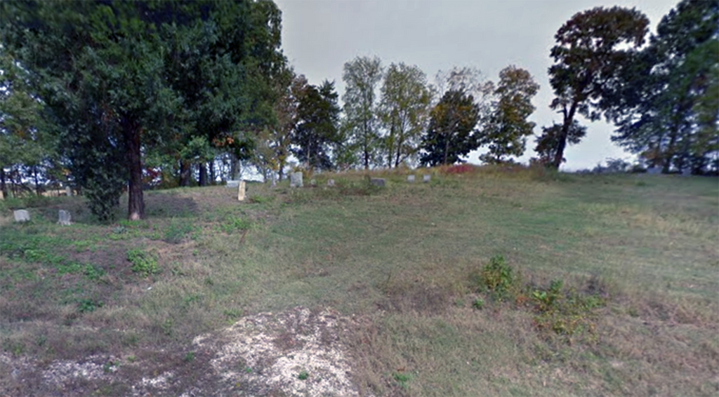
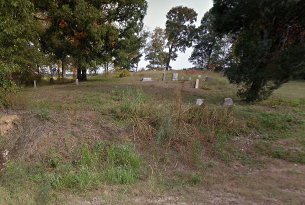
| Description | : | From Highway 45-West, at Fruitland, between Humboldt and Trenton, turn west on Fruitland-Edison-Frog Jump Road, go 2.9 miles to just before Center Baptist Church, turn south (left) onto Peter Smith Rd., go 1.1 miles and the cemetery is on the east (left). It seems to receives some care, but the grass barely keeps the steep slope from eroding. There are several broken stones, and several sunken places that could be graves without markers, and some of the markers are home-made. Believed to be associated with the Oak Grove MB Church a mile to the south, it has been... Read More |
frequently asked questions (FAQ):
-
Where is Oak Grove MB Church Cemetery?
Oak Grove MB Church Cemetery is located at Peter Smith Rd Fruitland, Gibson County ,Tennessee , 38343USA.
-
Oak Grove MB Church Cemetery cemetery's updated grave count on graveviews.com?
7 memorials
-
Where are the coordinates of the Oak Grove MB Church Cemetery?
Latitude: 35.8852000
Longitude: -88.9885480
Nearby Cemetories:
1. Smyrna Cemetery
Gibson County, USA
Coordinate: 35.8856010, -88.9891968
2. Jones Grove Cemetery
Humboldt, Gibson County, USA
Coordinate: 35.8796630, -88.9796610
3. Center Baptist Church Cemetery
Edison, Gibson County, USA
Coordinate: 35.8953018, -88.9875870
4. Smyrna Primitive Baptist Church Cemetery
Fruitland, Gibson County, USA
Coordinate: 35.8783530, -88.9786840
5. Old Gibson Primitive Baptist Church Cemetery
Fruitland, Gibson County, USA
Coordinate: 35.8838570, -88.9709760
6. Oak Grove Methodist Church Cemetery
Fruitland, Gibson County, USA
Coordinate: 35.8820900, -88.9653800
7. Wortham Cemetery
Christian Chapel, Gibson County, USA
Coordinate: 35.8791400, -89.0127300
8. Underwood Cemetery
Trenton, Gibson County, USA
Coordinate: 35.9069000, -88.9639000
9. Motley Cemetery
Gibson County, USA
Coordinate: 35.8535995, -88.9702988
10. Dial Cemetery
Humboldt, Gibson County, USA
Coordinate: 35.8698600, -89.0374100
11. Follis Chapel Cemetery
Gibson County, USA
Coordinate: 35.9301200, -88.9962000
12. Newhouse Cemetery
Gibson County, USA
Coordinate: 35.8466988, -88.9586029
13. McLeary Cemetery
Humboldt, Gibson County, USA
Coordinate: 35.8478012, -88.9499969
14. Jones Family Cemetery
Frog Jump, Gibson County, USA
Coordinate: 35.9322750, -89.0048020
15. Porter Grove Baptist Church Cemetery
Coxville, Crockett County, USA
Coordinate: 35.8322080, -89.0034930
16. Sharp Cemetery
Gibson County, USA
Coordinate: 35.9131012, -88.9308014
17. Porter Graveyard
Coxville, Crockett County, USA
Coordinate: 35.8324830, -89.0114610
18. Friendship Grove MB Church Cemetery
Brazil, Gibson County, USA
Coordinate: 35.8843220, -89.0600960
19. James Cemetery
Coxville, Crockett County, USA
Coordinate: 35.8268170, -88.9797220
20. Bowers Chapel Cemetery
Gibson County, USA
Coordinate: 35.8925018, -89.0606003
21. Salem Missionary Baptist Church Cemetery
Humboldt, Gibson County, USA
Coordinate: 35.8814000, -88.9147000
22. McLeary-James Graveyard
Coxville, Crockett County, USA
Coordinate: 35.8252360, -88.9943360
23. McDougald Cemetery
Gibson Wells, Gibson County, USA
Coordinate: 35.8802560, -89.0646810
24. Cox's Chapel Church of Christ Cemetery
Coxville, Crockett County, USA
Coordinate: 35.8222860, -89.0154960