
| Memorials | : | 0 |
| Location | : | Colquitt, Miller County, USA |
| Coordinate | : | 31.0860260, -84.8059830 |
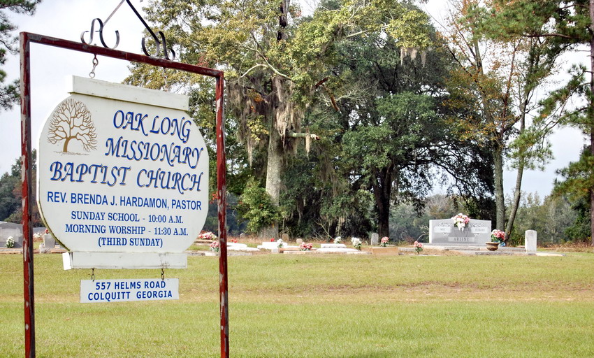
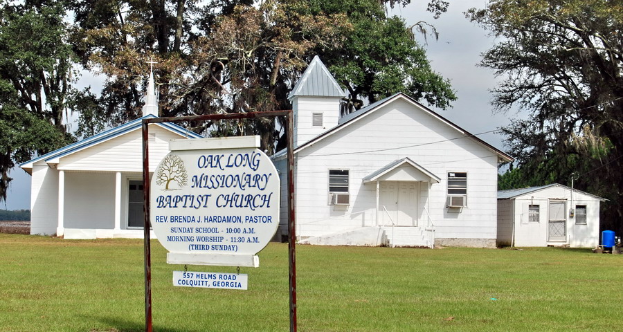
| Description | : | It has always been Oak Long or "Oaky Lawn" as the slaves use to call it back before the Civil War and thereafter. It is a Black church and cemetery. It is listed in the 1982 county cemetery survey as "Oaky Lawn" but the proper name is Oak Long Missionary Baptist Church Cemetery. |
frequently asked questions (FAQ):
-
Where is Oak Long Missionary Baptist Church Cemetery?
Oak Long Missionary Baptist Church Cemetery is located at 557 Helms Road Colquitt, Miller County ,Georgia ,USA.
-
Oak Long Missionary Baptist Church Cemetery cemetery's updated grave count on graveviews.com?
0 memorials
-
Where are the coordinates of the Oak Long Missionary Baptist Church Cemetery?
Latitude: 31.0860260
Longitude: -84.8059830
Nearby Cemetories:
1. Pugh Cemetery
Colquitt, Miller County, USA
Coordinate: 31.0853600, -84.8069600
2. New Home Freewill Baptist Church Cemetery
Miller County, USA
Coordinate: 31.0977993, -84.7947006
3. Lane Cemetery
Miller County, USA
Coordinate: 31.1081009, -84.7838974
4. Primitive Union Cemetery
Colquitt, Miller County, USA
Coordinate: 31.1117000, -84.8256000
5. Union Missionary Baptist Church Cemetery
Colquitt, Miller County, USA
Coordinate: 31.1172009, -84.8360977
6. Fiveash Cemetery
Miller County, USA
Coordinate: 31.0714300, -84.8599600
7. Hornsby Cemetery
Miller County, USA
Coordinate: 31.0727997, -84.7391968
8. Scarborough Cemetery
Colquitt, Miller County, USA
Coordinate: 31.0938200, -84.7327400
9. Newberry Family Cemetery
Colquitt, Miller County, USA
Coordinate: 31.1525290, -84.7861560
10. New Salem Cemetery
Miller County, USA
Coordinate: 31.1543999, -84.7953033
11. Pilgrims Rest Church Cemetery
Colquitt, Miller County, USA
Coordinate: 31.0788994, -84.7136002
12. Whites Bridge Cemetery
Miller County, USA
Coordinate: 31.0794400, -84.7133000
13. South Mount Zion Cemetery
Enterprise, Miller County, USA
Coordinate: 31.1528750, -84.8600370
14. Hand Cemetery
Colquitt, Miller County, USA
Coordinate: 31.1684853, -84.8255036
15. Rawls Cemetery
Colquitt, Miller County, USA
Coordinate: 31.1516991, -84.7399979
16. Church of Christ Cemetery
Colquitt, Miller County, USA
Coordinate: 31.0953007, -84.7042007
17. Pleasant Hill Free Will Baptist Church Cemetery
Colquitt, Miller County, USA
Coordinate: 31.1602993, -84.7510986
18. Mothers Home Baptist Church Cemetery
Miller County, USA
Coordinate: 31.0916996, -84.7011032
19. Lane Cemetery
Decatur County, USA
Coordinate: 31.0408001, -84.7142029
20. Swearingain Cemetery
Miller County, USA
Coordinate: 31.1306000, -84.7127991
21. Pine Grove Baptist Church Cemetery
Brinson, Decatur County, USA
Coordinate: 31.0269430, -84.7118400
22. Eternal Rest Memorial Gardens
Colquitt, Miller County, USA
Coordinate: 31.1630140, -84.7294990
23. Colquitt City Cemetery
Colquitt, Miller County, USA
Coordinate: 31.1702995, -84.7380981
24. Boykin Cemetery
Miller County, USA
Coordinate: 31.1025009, -84.6877975