
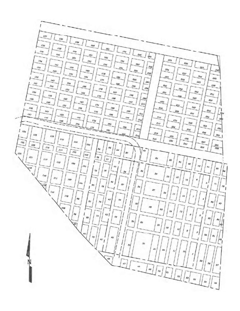
| Memorials | : | 201 |
| Location | : | Woodland, Cowlitz County, USA |
| Coordinate | : | 45.9182900, -122.7433900 |
| Description | : | The Kerns-Bozorth Cemetery is located about 1 mile northeast from the I-5 Freeway in Woodland. It is on a low hill with a view of the valley below. From 1853 to 1876, the burial ground for the local area was located on the bottom land southwest of the present cemetery. The exact location of the original cemetery is unknown. The graves were marked with wooden markers many of them destroyed when a fire swept through the field. The burials were mostly of children of the early pioneers of the Woodland area. When the Columbia River flooded in 1876 and water covered the... Read More |
frequently asked questions (FAQ):
-
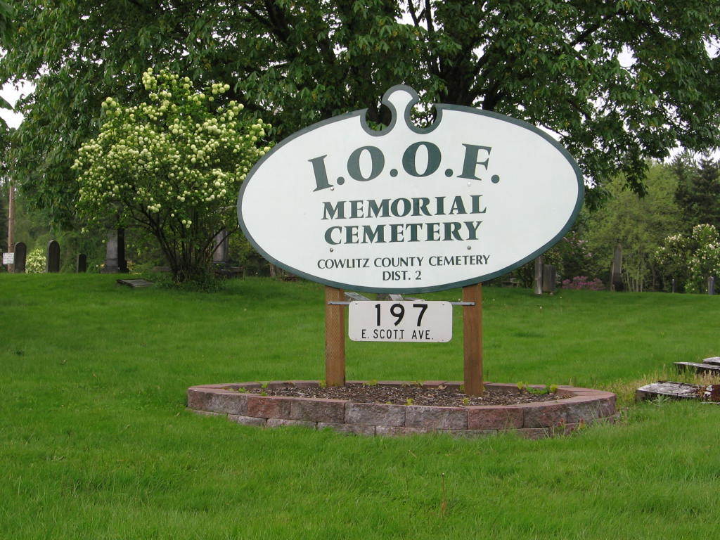
Where is Odd Fellows Cemetery?
Odd Fellows Cemetery is located at 197 East Scott Avenue Woodland, Cowlitz County ,Washington ,USA.
-
Odd Fellows Cemetery cemetery's updated grave count on graveviews.com?
201 memorials
-
Where are the coordinates of the Odd Fellows Cemetery?
Latitude: 45.9182900
Longitude: -122.7433900
Nearby Cemetories:
1. Red Rock Cemetery
Clark County, USA
Coordinate: 45.9173000, -122.7219000
2. Hayes Cemetery
Hayes, Clark County, USA
Coordinate: 45.9317017, -122.6781006
3. Kinder Cemetery
Deer Island, Columbia County, USA
Coordinate: 45.9138985, -122.8236008
4. Martins Bluff Cemetery
Cowlitz County, USA
Coordinate: 45.9610340, -122.8035450
5. Masonic Cemetery
Saint Helens, Columbia County, USA
Coordinate: 45.8777888, -122.8196074
6. Highland Cemetery
La Center, Clark County, USA
Coordinate: 45.9056015, -122.6371994
7. Frank Abel Cemetery
Woodland, Cowlitz County, USA
Coordinate: 45.9393700, -122.6353550
8. John Pollock Gravesite
La Center, Clark County, USA
Coordinate: 45.8551559, -122.6723022
9. Mount Zion Cemetery
La Center, Clark County, USA
Coordinate: 45.8667984, -122.6548004
10. McNulty Cemetery
Saint Helens, Columbia County, USA
Coordinate: 45.8512000, -122.8478600
11. Saint Marys Catholic Church Cemetery
Ridgefield, Clark County, USA
Coordinate: 45.8264999, -122.6824036
12. Yankton Hillcrest Cemetery
Saint Helens, Columbia County, USA
Coordinate: 45.8675003, -122.8755569
13. Old Yankton Cemetery
Saint Helens, Columbia County, USA
Coordinate: 45.8675003, -122.8756027
14. Ridgefield Cemetery
Ridgefield, Clark County, USA
Coordinate: 45.8125992, -122.7360992
15. Bayview Memorial Cemetery
Warren, Columbia County, USA
Coordinate: 45.8267730, -122.8416860
16. Gore Cemetery
Deer Island, Columbia County, USA
Coordinate: 45.9294100, -122.9117760
17. Pioneer Cemetery
Ridgefield, Clark County, USA
Coordinate: 45.8231010, -122.6389008
18. Voight Family Cemetery
Kalama, Cowlitz County, USA
Coordinate: 46.0340960, -122.6981890
19. Yale Memorial Cemetery
Ariel, Cowlitz County, USA
Coordinate: 45.9580727, -122.5778961
20. Bethany Memorial Cemetery
Warren, Columbia County, USA
Coordinate: 45.8209040, -122.8521900
21. Kalama IOOF Cemetery
Kalama, Cowlitz County, USA
Coordinate: 46.0233380, -122.8372450
22. Bethel Evangelical Methodist Church Cemetery
Ridgefield, Clark County, USA
Coordinate: 45.7935000, -122.6935000
23. Mountain View Cemetery
La Center, Clark County, USA
Coordinate: 45.9025002, -122.5513000
24. Neer City Cemetery
Goble, Columbia County, USA
Coordinate: 46.0250015, -122.8886032