
| Memorials | : | 2 |
| Location | : | Grays Chapel, Randolph County, USA |
| Coordinate | : | 35.7947200, -79.7300200 |
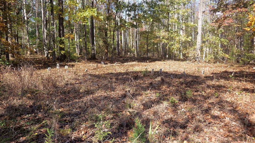
| Description | : | The Odell - Trogdon Cemetery is located on private property on Old Liberty Road (#2261) also known as old Highway 49 in Randolph County, North Carolina. Permission from land owner is necessary before visiting. Abandoned and almost completely hidden by trees and woods, the East Coast Allred Family Association, Inc. (ECAFA) membership was given permission to clean, restore, document and maintain this cemetery. This site has long been recognized as the Odell - Trogdon Cemetery as designated on a historical map of Randolph County, North Carolina produced by the late map maker Garland P. Stout of Greensboro, North... Read More |
frequently asked questions (FAQ):
-
Where is Odell Trogdon Cemetery?
Odell Trogdon Cemetery is located at 4000-4160 Old Liberty Road Grays Chapel, Randolph County ,North Carolina , 27248USA.
-
Odell Trogdon Cemetery cemetery's updated grave count on graveviews.com?
2 memorials
-
Where are the coordinates of the Odell Trogdon Cemetery?
Latitude: 35.7947200
Longitude: -79.7300200
Nearby Cemetories:
1. Whites Memorial Baptist Church Cemetery
Franklinville, Randolph County, USA
Coordinate: 35.7939680, -79.7149760
2. Faith Temple Baptist Church Cemetery
Franklinville, Randolph County, USA
Coordinate: 35.8023770, -79.7460950
3. Bethany United Methodist Church Cemetery #1
Franklinville, Randolph County, USA
Coordinate: 35.8101300, -79.7606200
4. Grays Chapel Cemetery
Grays Chapel, Randolph County, USA
Coordinate: 35.8183570, -79.6986060
5. Clear View Baptist Church Cemetery
Franklinville, Randolph County, USA
Coordinate: 35.7530800, -79.7234300
6. Cool Springs Baptist Church Cemetery
Franklinville, Randolph County, USA
Coordinate: 35.8072420, -79.6805660
7. J. E. Groce Memorial Cemetery
Worthville, Randolph County, USA
Coordinate: 35.8032620, -79.7813460
8. Cedar Falls Baptist Church Cemetery
Cedar Falls, Randolph County, USA
Coordinate: 35.7480800, -79.7357800
9. Liberty Road Baptist Church Cemetery
Randleman, Randolph County, USA
Coordinate: 35.7715500, -79.7808130
10. Cedar Falls United Methodist Church Cemetery
Asheboro, Randolph County, USA
Coordinate: 35.7472920, -79.7338990
11. Franklinville United Methodist Church Cemetery
Franklinville, Randolph County, USA
Coordinate: 35.7462900, -79.7037500
12. Billy Trogdon Cemetery
Asheboro, Randolph County, USA
Coordinate: 35.7392800, -79.7219100
13. First Baptist Church Cemetery
Franklinville, Randolph County, USA
Coordinate: 35.7482230, -79.6908630
14. Midway Wesleyan Church Cemetery
Randleman, Randolph County, USA
Coordinate: 35.8018900, -79.8006990
15. Country Holiness Cemetery
Randleman, Randolph County, USA
Coordinate: 35.8016800, -79.8016900
16. Giles Chapel United Methodist Church Cemetery
Asheboro, Randolph County, USA
Coordinate: 35.7462270, -79.7752450
17. New Salem United Methodist Church Cemetery
Randleman, Randolph County, USA
Coordinate: 35.8406311, -79.7853233
18. Randolph Memorial Park
Asheboro, Randolph County, USA
Coordinate: 35.7793999, -79.8071976
19. Patterson Grove Christian Church Cemetery
Ramseur, Randolph County, USA
Coordinate: 35.7743940, -79.6536550
20. God Outreach Ministries Cemetery
Asheboro, Randolph County, USA
Coordinate: 35.7473240, -79.7890130
21. Mount Lebanon United Methodist Church Cemetery
Randleman, Randolph County, USA
Coordinate: 35.8267230, -79.8039770
22. Whitehall Evangelical Methodist Church Cemetery
Randleman, Randolph County, USA
Coordinate: 35.7950100, -79.8153900
23. Pleasant Cross Christian Church Cemetery
Asheboro, Randolph County, USA
Coordinate: 35.7254000, -79.7268740
24. Saint Paul Methodist Episcopal South Cemetery
Randleman, Randolph County, USA
Coordinate: 35.8222200, -79.8090410