
| Memorials | : | 0 |
| Location | : | Urquhart, Early County, USA |
| Coordinate | : | 31.4289560, -84.9708610 |
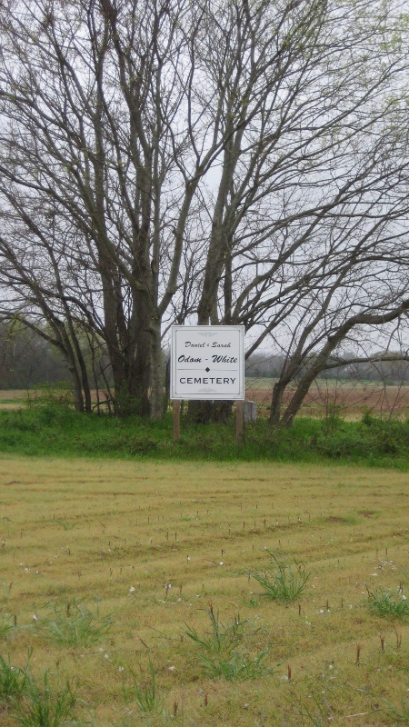
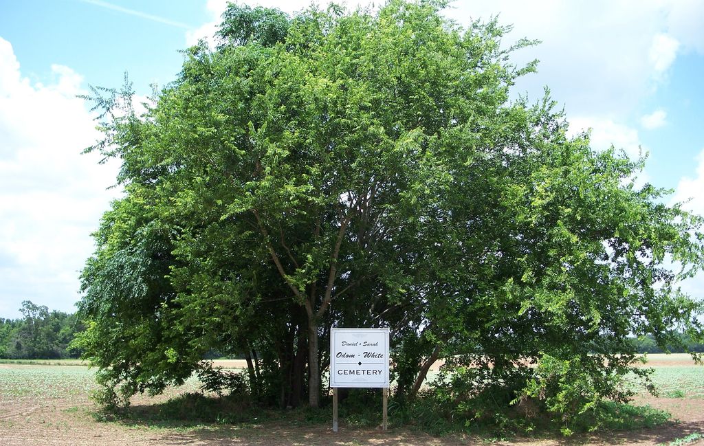
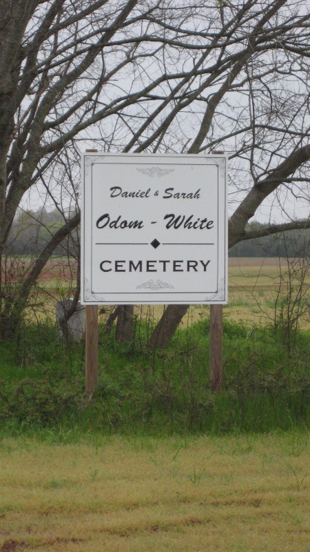
| Description | : | From Blakely, go north on GA 39 for approximately 3.2 miles until you reach Clark Road, which is a dirt road. This is the only place you can safely park. The cemetery is directly across from Clark Road in the field. Once you park on the dirt road, look back across the highway and you will see a clump of trees at the high point in the field. This is where Daniel and Sarah White are buried. These are the only two headstones, though 4-5 from White family may be there as well. |
frequently asked questions (FAQ):
-
Where is Odom-White Cemetery?
Odom-White Cemetery is located at Urquhart, Early County ,Georgia ,USA.
-
Odom-White Cemetery cemetery's updated grave count on graveviews.com?
0 memorials
-
Where are the coordinates of the Odom-White Cemetery?
Latitude: 31.4289560
Longitude: -84.9708610
Nearby Cemetories:
1. Enterprise Free Will Baptist Church Cemetery
Early County, USA
Coordinate: 31.4199790, -84.9629420
2. Saint Mathis Missionary Baptist Church Cemetery
Blakely, Early County, USA
Coordinate: 31.4639950, -84.9764760
3. Hayes Cemetery
Early County, USA
Coordinate: 31.4577999, -84.9458008
4. Mercier Family Cemetery
Early County, USA
Coordinate: 31.4661007, -84.9452972
5. Wesley Chapel AME Church Cemetery
Early County, USA
Coordinate: 31.3841991, -84.9368973
6. Pleasant Grove Cemetery #2
Early County, USA
Coordinate: 31.4609320, -85.0234670
7. Pleasant Grove AME Church Cemetery #1
Blakely, Early County, USA
Coordinate: 31.4674460, -85.0193790
8. Mount Olive Baptist Church Cemetery
Blakely, Early County, USA
Coordinate: 31.3745354, -84.9507221
9. Sardis Cemetery
Early County, USA
Coordinate: 31.4023962, -85.0321502
10. Blakely Cemetery
Blakely, Early County, USA
Coordinate: 31.3722000, -84.9389038
11. Oak Grove Church Cemetery
Blakely, Early County, USA
Coordinate: 31.4032290, -85.0418720
12. Bethel Church Cemetery #1
Clay County, USA
Coordinate: 31.4874992, -85.0186005
13. Friendship Missionary Baptist Church Cemetery
Rock Hill, Early County, USA
Coordinate: 31.3599390, -84.9996290
14. Colomokee Baptist Church Cemetery
Blakely, Early County, USA
Coordinate: 31.4613991, -84.8874969
15. New Prospect AME Church Cemetery
Blakely, Early County, USA
Coordinate: 31.3434960, -84.9830230
16. New Bethel Cemetery
Clay County, USA
Coordinate: 31.5030994, -85.0261002
17. Rosinvick Baptist Church Cemetery
Blakely, Early County, USA
Coordinate: 31.4556120, -84.8653610
18. Ebenezer AME Church Cemetery
Zetto, Clay County, USA
Coordinate: 31.5218800, -84.9545660
19. Mount Calvary Church Cemetery
Fort Gaines, Clay County, USA
Coordinate: 31.5233890, -84.9688790
20. Saint Pauls Church Cemetery
Blakely, Early County, USA
Coordinate: 31.3327400, -84.9606100
21. Saint Maryland Baptist Church Cemetery
Early County, USA
Coordinate: 31.3465530, -84.9107540
22. Evergreen Church Cemetery
Blakely, Early County, USA
Coordinate: 31.4735845, -84.8630114
23. Bryant-Neves Cemetery
Clay County, USA
Coordinate: 31.5293999, -84.9308014
24. Jerusalem African Methodist Episcopal Church Cemet
Blakely, Early County, USA
Coordinate: 31.3260930, -84.9401840