
| Memorials | : | 1 |
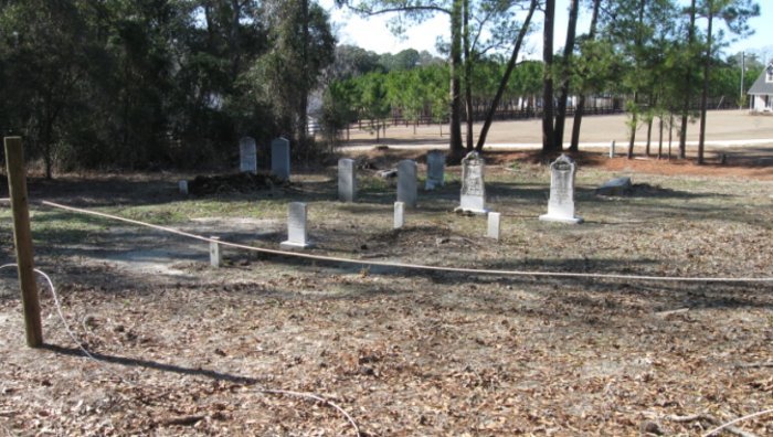
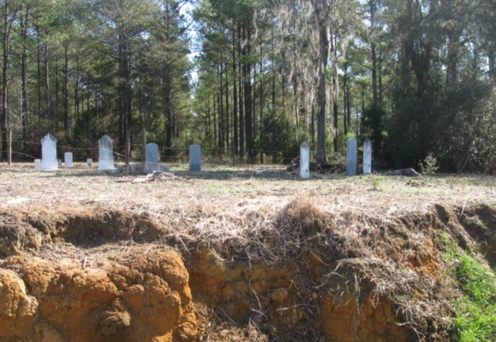
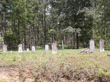
| Location | : | Hahira, Lowndes County, USA |
| Coordinate | : | 31.0035920, -83.4379600 |
| Description | : | West of Hahira: From I-75, go 2.9 miles west on GA 122. Turn right(north) onto Folsom Road and go 2.4 miles. Cemetery on the right and is visible from the dirt road. |
frequently asked questions (FAQ):
-
Where is Old Folsom Family Cemetery?
Old Folsom Family Cemetery is located at Hahira, Lowndes County ,Georgia ,USA.
-
Old Folsom Family Cemetery cemetery's updated grave count on graveviews.com?
1 memorials
-
Where are the coordinates of the Old Folsom Family Cemetery?
Latitude: 31.0035920
Longitude: -83.4379600
Nearby Cemetories:
1. Mary Turner Lynching Site
Lowndes County, USA
Coordinate: 31.0016710, -83.4582560
2. Salem United Methodist Church Cemetery
Hahira, Lowndes County, USA
Coordinate: 31.0230300, -83.4295980
3. Vickers Cemetery
Hahira, Lowndes County, USA
Coordinate: 30.9824700, -83.4280070
4. Miller Cemetery
Lowndes County, USA
Coordinate: 30.9757996, -83.4310989
5. Berry Wells Family Cemetery
Shiloh, Lowndes County, USA
Coordinate: 30.9747390, -83.4400460
6. Gornto Cemetery
Brooks County, USA
Coordinate: 31.0011005, -83.4914017
7. Mathis Cemetery
Cecil, Cook County, USA
Coordinate: 31.0450000, -83.4061111
8. Jerusalem Cemetery
Cecil, Cook County, USA
Coordinate: 31.0396996, -83.3910980
9. Friendship Cemetery
Hahira, Lowndes County, USA
Coordinate: 30.9732880, -83.3786710
10. Corinth Cemetery
Morven, Brooks County, USA
Coordinate: 30.9458008, -83.4638977
11. Redding Cemetery
Lowndes County, USA
Coordinate: 30.9417000, -83.4347000
12. Hall Cemetery
Morven, Brooks County, USA
Coordinate: 30.9641991, -83.4944000
13. Sand Ridge Cemetery
Sand Hill, Brooks County, USA
Coordinate: 31.0390680, -83.5027170
14. Camp Ground Cemetery Mount Zion Church
Morven, Brooks County, USA
Coordinate: 30.9600000, -83.4980000
15. Shiloh United Methodist Church Cemetery
Hahira, Lowndes County, USA
Coordinate: 30.9386190, -83.4083150
16. Barnes Cemetery
Hahira, Lowndes County, USA
Coordinate: 30.9830970, -83.3537670
17. Fellowship Baptist Church Cemetery
Cecil, Cook County, USA
Coordinate: 31.0427560, -83.3574660
18. Bostick Cemetery
Lowndes County, USA
Coordinate: 31.0143310, -83.3456910
19. Greggs Baptist Church Cemetery
Adel, Cook County, USA
Coordinate: 31.0703400, -83.4901050
20. County Line AME Church Cemetery
Cook County, USA
Coordinate: 31.0423200, -83.3525410
21. New Life Baptist Church Cemetery
Adel, Cook County, USA
Coordinate: 31.0802440, -83.4785090
22. Hodges Cemetery
Lowndes County, USA
Coordinate: 30.9561005, -83.3533020
23. Barfield-Hodges Cemetery
Hahira, Lowndes County, USA
Coordinate: 30.9347970, -83.3710210
24. Old Orange Grove Church Cemetery
Lowndes County, USA
Coordinate: 30.9162920, -83.4117290