| Memorials | : | 4 |
| Location | : | Westfield, Hamilton County, USA |
| Coordinate | : | 40.0404396, -86.1274490 |
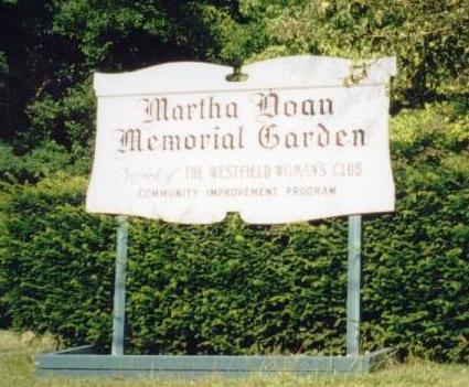
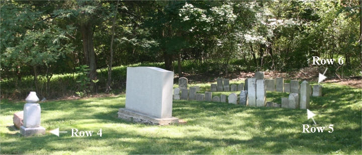
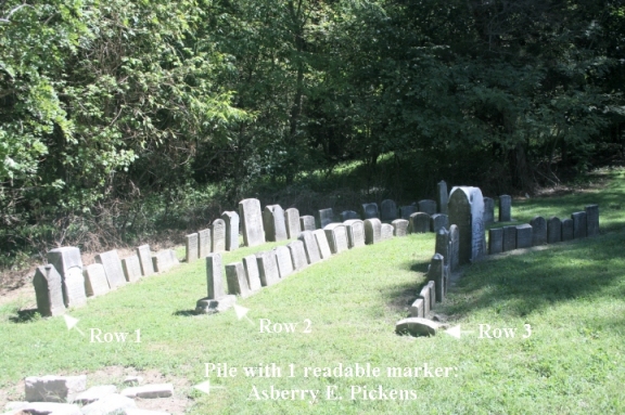
| Description | : | The cemetery is located in Washington Township on the east side of S Union Street about 350 feet north of its intersection with Roosevelt Street. Indiana Cemetery Locations, Volume 2, published by the Indiana Genealogical Society (01 April 2006), gives the primary cemetery name as Memorial Park Cemetery with alternate names of Friends Cemetery, Martha Doan Cemetery, and Old Westfield Cemetery. The cemetery is listed in the Cemetery and Burial Grounds Registry of the Indiana Department of Natural Resources (DNR) and in the State Historical Architectural and Archaeological Research Database (SHAARD) with Cemetery Record Number CR-29-107 (Memorial Park... Read More |
frequently asked questions (FAQ):
-
Where is Old Friends Cemetery Park?
Old Friends Cemetery Park is located at S Union Street Westfield, Hamilton County ,Indiana ,USA.
-
Old Friends Cemetery Park cemetery's updated grave count on graveviews.com?
4 memorials
-
Where are the coordinates of the Old Friends Cemetery Park?
Latitude: 40.0404396
Longitude: -86.1274490
Nearby Cemetories:
1. Anti-Slavery Friends Cemetery
Westfield, Hamilton County, USA
Coordinate: 40.0466614, -86.1286926
2. Summit Lawn Cemetery
Westfield, Hamilton County, USA
Coordinate: 40.0297012, -86.1260986
3. Hamilton Memorial Park
Noblesville, Hamilton County, USA
Coordinate: 40.0431557, -86.1034775
4. Indianapolis Hebrew Congregation Cemetery North
Westfield, Hamilton County, USA
Coordinate: 40.0220757, -86.1357498
5. Chester Friends Cemetery
Westfield, Hamilton County, USA
Coordinate: 40.0717010, -86.1286011
6. Greenwood Friends Cemetery
Hamilton County, USA
Coordinate: 40.0640890, -86.1641860
7. Pleasant View Cemetery
Washington Township, Hamilton County, USA
Coordinate: 40.0816994, -86.1240997
8. Tharp-Mott Cemetery
Noblesville, Hamilton County, USA
Coordinate: 40.0507280, -86.0716540
9. Ballard Pleasant View Cemetery
Hamilton County, USA
Coordinate: 40.0216103, -86.1798019
10. Gray Cemetery
Noblesville, Hamilton County, USA
Coordinate: 40.0007858, -86.0885849
11. Carmel Cemetery
Carmel, Hamilton County, USA
Coordinate: 39.9901505, -86.1275253
12. Eagletown Cemetery
Eagletown, Hamilton County, USA
Coordinate: 40.0450554, -86.1951904
13. Carmel Cemetery Old
Carmel, Hamilton County, USA
Coordinate: 39.9862289, -86.1262894
14. Thomas B Moore Cemetery
Hortonville, Hamilton County, USA
Coordinate: 40.0927780, -86.1561110
15. Moore Cemetery
Sheridan, Hamilton County, USA
Coordinate: 40.0933600, -86.1560500
16. Saint Michaels Episcopal Church Columbarium
Noblesville, Hamilton County, USA
Coordinate: 40.0626370, -86.0482080
17. Saint Christopher's Episcopal Columbarium
Carmel, Hamilton County, USA
Coordinate: 39.9787310, -86.1531540
18. Weaver Cemetery
Hamilton County, USA
Coordinate: 40.0144005, -86.0466995
19. Hinkle Creek Cemetery
Noblesville, Hamilton County, USA
Coordinate: 40.1022339, -86.0911179
20. Cornerstone Lutheran Church Columbarium
Carmel, Hamilton County, USA
Coordinate: 39.9794710, -86.0884590
21. Poplar Ridge Cemetery
Carmel, Hamilton County, USA
Coordinate: 39.9822006, -86.1746979
22. Kirkendall Cemetery
Carmel, Hamilton County, USA
Coordinate: 39.9944080, -86.0591700
23. Indiana Veteran's Memorial
Carmel, Hamilton County, USA
Coordinate: 39.9691700, -86.1318890
24. Mundy Cemetery
Hamilton County, USA
Coordinate: 40.1117420, -86.1469800


