
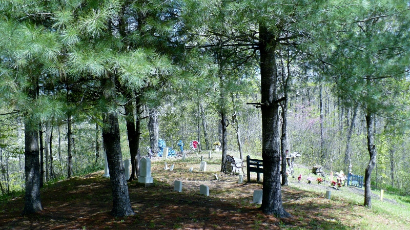
| Memorials | : | 0 |
| Location | : | Chavies, Perry County, USA |
| Coordinate | : | 37.3841910, -83.2791780 |
| Description | : | From Hwy. 15 North turn onto the Ten Mile Creek Road. After you turn onto Ten Mile immediately make a left turn up the hill on the graveled road. Follow the road to the top of the hill when the road forks. Take the right road to the 'Old' Grigsby Cemetery. |
frequently asked questions (FAQ):
-
Where is Old Grigsby Cemetery?
Old Grigsby Cemetery is located at Ten Mile Creek Road Chavies, Perry County ,Kentucky ,USA.
-
Old Grigsby Cemetery cemetery's updated grave count on graveviews.com?
0 memorials
-
Where are the coordinates of the Old Grigsby Cemetery?
Latitude: 37.3841910
Longitude: -83.2791780
Nearby Cemetories:
1. Miller Cemetery
Chavies, Perry County, USA
Coordinate: 37.3854780, -83.2733360
2. Grigsby-Smith Cemetery
Chavies, Perry County, USA
Coordinate: 37.3857590, -83.2731650
3. Spring Point Cemetery
Chavies, Perry County, USA
Coordinate: 37.3749800, -83.2634500
4. Miller Town Cemetery
Dice, Perry County, USA
Coordinate: 37.3879400, -83.2543000
5. Combs Family Cemetery
Manuel, Perry County, USA
Coordinate: 37.3537000, -83.2795000
6. Eli Neace Memorial Cemetery
Chavies, Perry County, USA
Coordinate: 37.3537652, -83.2969366
7. White Cemetery
Manuel, Perry County, USA
Coordinate: 37.3509660, -83.2721670
8. Stidham Cemetery
Engle, Perry County, USA
Coordinate: 37.3513300, -83.2635500
9. Jones Family Cemetery
Perry County, USA
Coordinate: 37.3771900, -83.2357600
10. Mudlick Cemetery
Perry County, USA
Coordinate: 37.3500330, -83.2665810
11. White Family Cemetery
Chavies, Perry County, USA
Coordinate: 37.3483560, -83.2889030
12. Cager Miller Family Cemetery
Chavies, Perry County, USA
Coordinate: 37.3462300, -83.2873300
13. Davidson Baptist Church Cemetery
Hazard, Perry County, USA
Coordinate: 37.3505270, -83.3028110
14. Sandlin - Davidson Cemetery
Chavies, Perry County, USA
Coordinate: 37.3580800, -83.3160700
15. Combs-Whitaker Cemetery
Perry County, USA
Coordinate: 37.3439000, -83.2804000
16. Cockerell Fork Cemetery
Perry County, USA
Coordinate: 37.4082985, -83.2350006
17. Hughes-Whitaker Cemetery
Perry County, USA
Coordinate: 37.3409540, -83.2878530
18. Neace Family Cemetery
Bonnyman, Perry County, USA
Coordinate: 37.3392240, -83.2648680
19. Sturgill - Miller Cemetery
Dice, Perry County, USA
Coordinate: 37.3623853, -83.2272572
20. Noble Cemetery
Bonnyman, Perry County, USA
Coordinate: 37.3392310, -83.2576020
21. Miller Cemetery
Bonnyman, Perry County, USA
Coordinate: 37.3384870, -83.2539080
22. Engle-Deaton Cemetery
Bonnyman, Perry County, USA
Coordinate: 37.3649600, -83.2192000
23. Neace Family Cemetery
Bonnyman, Perry County, USA
Coordinate: 37.3364200, -83.2515400
24. John and Bruce White Cemetery
Breathitt County, USA
Coordinate: 37.4038810, -83.3410730