
| Memorials | : | 116 |
| Location | : | Wichita, Sedgwick County, USA |
| Coordinate | : | 37.7242600, -97.2967400 |
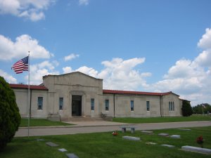
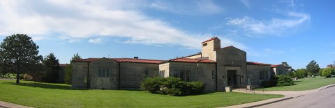
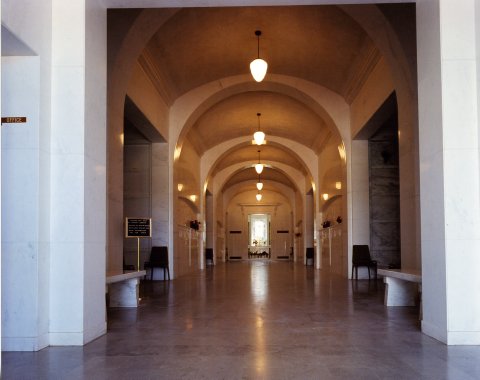
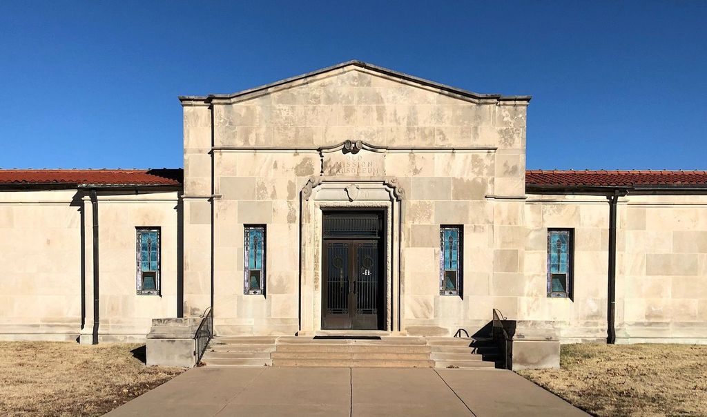
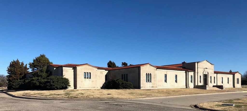
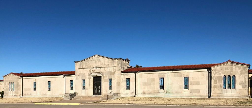
| Description | : | Old Mission Mausoleum is located on one acre of land within the Old Mission Cemetery, 21st Street and Hillside Avenue, Wichita, Kansas. The Old Mission Mausoleum has always been a separate and distinct entity from the Old Mission Cemetery. The founder of the mausoleum was Mr. George A. Saxton. During 1918 he purchased the one acre of land within the Old Mission Cemetery with the express purpose of establishing a business enterprise by constructing a community mausoleum. This mausoleum was to be open to all upon payment of the purchase price of a crypt or a family room. A family... Read More |
frequently asked questions (FAQ):
-
Where is Old Mission Mausoleum?
Old Mission Mausoleum is located at 3424 E. 21st Street N Wichita, Sedgwick County ,Kansas , 67208USA.
-
Old Mission Mausoleum cemetery's updated grave count on graveviews.com?
114 memorials
-
Where are the coordinates of the Old Mission Mausoleum?
Latitude: 37.7242600
Longitude: -97.2967400
Nearby Cemetories:
1. Old Mission Cemetery
Wichita, Sedgwick County, USA
Coordinate: 37.7243996, -97.2964020
2. Mission Chapel Mausoleum
Wichita, Sedgwick County, USA
Coordinate: 37.7231200, -97.2955100
3. Wichita Park Cemetery and Mausoleum
Wichita, Sedgwick County, USA
Coordinate: 37.7277985, -97.2960968
4. Wichita Hebrew Cemetery
Wichita, Sedgwick County, USA
Coordinate: 37.7201004, -97.2798004
5. White Chapel Memorial Gardens
Wichita, Sedgwick County, USA
Coordinate: 37.7162018, -97.2806015
6. Maple Grove Cemetery
Wichita, Sedgwick County, USA
Coordinate: 37.7036018, -97.2949982
7. Highland Cemetery
Wichita, Sedgwick County, USA
Coordinate: 37.7028008, -97.3007965
8. Temple Emanuel Cemetery
Wichita, Sedgwick County, USA
Coordinate: 37.7014000, -97.3008000
9. Saint James Episcopal Church Columbarium
Wichita, Sedgwick County, USA
Coordinate: 37.6865600, -97.2930000
10. East Heights United Methodist Memorial Garden
Wichita, Sedgwick County, USA
Coordinate: 37.6854100, -97.2845500
11. Shirley Tilford Memorial Garden
Wichita, Sedgwick County, USA
Coordinate: 37.6942700, -97.3359600
12. Saint Johns Episcopal Church Columbarium
Wichita, Sedgwick County, USA
Coordinate: 37.6918950, -97.3339670
13. Saint Stephen's Episcopal Church Columbarium
Wichita, Sedgwick County, USA
Coordinate: 37.6999272, -97.2505590
14. Calvary Cemetery
Wichita, Sedgwick County, USA
Coordinate: 37.6781006, -97.2949982
15. Mount Saint Mary Convent Cemetery
Wichita, Sedgwick County, USA
Coordinate: 37.6704000, -97.2904000
16. Ascension Cemetery
Bel Aire, Sedgwick County, USA
Coordinate: 37.7675018, -97.2533035
17. Lutheran Cemetery
Wichita, Sedgwick County, USA
Coordinate: 37.7664986, -97.2443008
18. Greenwich Cemetery
Wichita, Sedgwick County, USA
Coordinate: 37.7518997, -97.2266998
19. Kensington Gardens Cemetery
Wichita, Sedgwick County, USA
Coordinate: 37.7230988, -97.2040024
20. Pierpont Cemetery
Sedgwick County, USA
Coordinate: 37.7011400, -97.2077500
21. Kechi Township Cemetery
Park City, Sedgwick County, USA
Coordinate: 37.8022003, -97.3000031
22. Lakeview Cemetery & Mausoleum
Wichita, Sedgwick County, USA
Coordinate: 37.7086601, -97.1978989
23. Adorers of The Blood of Christ Convent Cemetery
Wichita, Sedgwick County, USA
Coordinate: 37.6677700, -97.3787800
24. Cornerstone Pentecostal Holiness Church
Wichita, Sedgwick County, USA
Coordinate: 37.6578700, -97.3705700