
| Memorials | : | 0 |
| Location | : | Peoria, Maricopa County, USA |
| Phone | : | 623-937-4339 |
| Coordinate | : | 33.6124000, -112.2137000 |
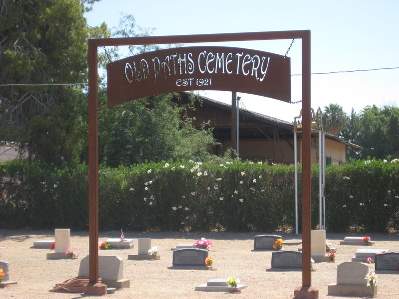
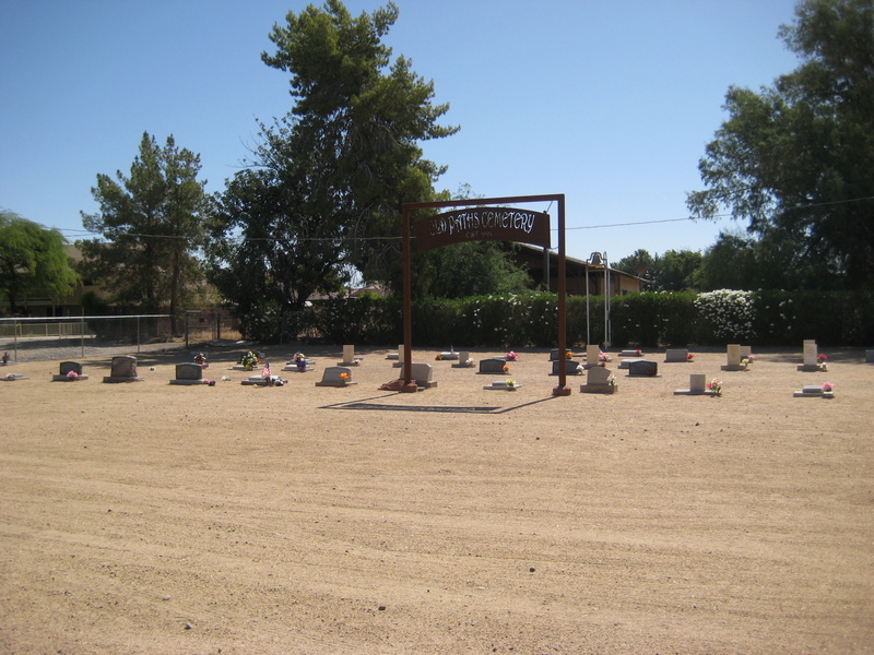
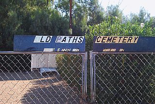
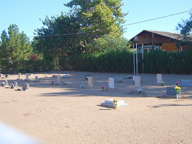
| Description | : | Established 1927. Old Paths Cemetery is located in the area of 73rd Ave and Thunderbird Road in Peoria. The area was known as Weedville. The cemetery is in an unincorporated part of the county encircled by the City of Peoria. Information about the Cemetery and Founder of Weedville, Rev. Ora Weed, can be found on the city of Peoria website (Historic Peoria Places, Weedville). Also, a book entitled Arizona Liars Journal, by Jim Cook, includes historical data about the family and area on page 59. The Old Paths name was taken from a passage in Jeremiah, "ask for the old path, which... Read More |
frequently asked questions (FAQ):
-
Where is Old Paths Cemetery?
Old Paths Cemetery is located at 7237 W. Cemetery Road (73rd Ave & TBird) Peoria, Maricopa County ,Arizona , 85381USA.
-
Old Paths Cemetery cemetery's updated grave count on graveviews.com?
0 memorials
-
Where are the coordinates of the Old Paths Cemetery?
Latitude: 33.6124000
Longitude: -112.2137000
Nearby Cemetories:
1. Bellevue Heights Church Columbarium
Sun City, Maricopa County, USA
Coordinate: 33.6336360, -112.2628940
2. All Saints of the Desert Episcopal Church Cemetery
Sun City, Maricopa County, USA
Coordinate: 33.6340000, -112.2643000
3. Church of the Palms UCC Memorial Garden
Sun City, Maricopa County, USA
Coordinate: 33.5974998, -112.2711105
4. Garden of Memories Columbarium and Garden
Peoria, Maricopa County, USA
Coordinate: 33.5814000, -112.2623000
5. Lakeview United Methodist Church Columbarium
Sun City, Maricopa County, USA
Coordinate: 33.6057549, -112.2797546
6. Arrowhead Memorial Gardens
Glendale, Maricopa County, USA
Coordinate: 33.6685500, -112.2238000
7. West Resthaven Park Cemetery
Glendale, Maricopa County, USA
Coordinate: 33.5522003, -112.1931000
8. Rest haven Memorial Park
Glendale, Maricopa County, USA
Coordinate: 33.5541251, -112.1840380
9. Glendale Memorial Park
Glendale, Maricopa County, USA
Coordinate: 33.5518990, -112.1908035
10. Faith Presbyterian Church Prayer Garden
Sun City, Maricopa County, USA
Coordinate: 33.6311990, -112.2881170
11. Saint Christopher Episcopal Church Memorial Garden
Sun City, Maricopa County, USA
Coordinate: 33.5796000, -112.2809000
12. Congregational Church of Sun City Columbarium
Sun City, Maricopa County, USA
Coordinate: 33.6513000, -112.2780000
13. Sunland Memorial Park
Sun City, Maricopa County, USA
Coordinate: 33.6282997, -112.2917023
14. Our Savior Lutheran Church Columbarium
Sun City, Maricopa County, USA
Coordinate: 33.5734230, -112.2804520
15. American Lutheran Church Columbarium
Sun City, Maricopa County, USA
Coordinate: 33.6415000, -112.2886000
16. Sunland Pet Rest Cemetery
Sun City, Maricopa County, USA
Coordinate: 33.6267760, -112.2953280
17. First United Methodist Church Columbarium
Sun City, Maricopa County, USA
Coordinate: 33.5740210, -112.2861820
18. Willowbrook Church Columbarium
Sun City, Maricopa County, USA
Coordinate: 33.6596000, -112.2814000
19. Shepherd of the Valley United Methodist Church
Phoenix, Maricopa County, USA
Coordinate: 33.5959600, -112.1250450
20. Shepherd of the Desert Lutheran Church Columbarium
Sun City, Maricopa County, USA
Coordinate: 33.5842890, -112.2981500
21. Russian Molokan Cemetery
Maricopa County, USA
Coordinate: 33.5307999, -112.2189026
22. Trinity Mennonite Church Columbarium
Glendale, Maricopa County, USA
Coordinate: 33.5468000, -112.1529000
23. Sunwest Cemetery
El Mirage, Maricopa County, USA
Coordinate: 33.6222140, -112.3304200
24. Saint Marys Episcopal Church Cemetery
Phoenix, Maricopa County, USA
Coordinate: 33.5321080, -112.1431430