
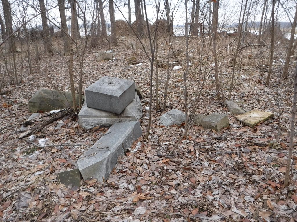
| Memorials | : | 2 |
| Location | : | Sharpsburg, Christian County, USA |
| Coordinate | : | 39.6091800, -89.3786250 |
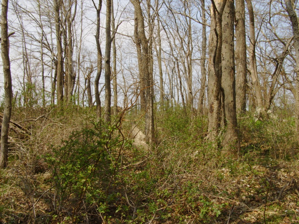
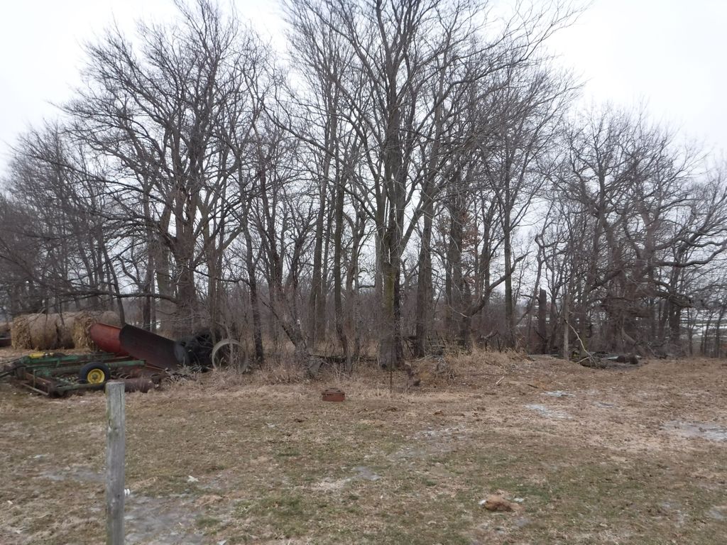
| Description | : | This is located on a farmer's property (You must inquire at the home for permission to access cemetery). This personal property is at the end of County Road 840 E in Christian County, Illinois. Approach from County Road 1800 N where the roads t just a few paces from (new) Walnut Hill Cemetery (Google GPS 39.611413,-89.376714) County Road 840 E goes south. about a half mile and ends in a curve at the farm property. If given permssion, you will be directed to drive or walk north through farm gates to a stand of trees where the cemetary is located.... Read More |
frequently asked questions (FAQ):
-
Where is Old Walnut Hill Cemetery?
Old Walnut Hill Cemetery is located at County Road 840 E Sharpsburg, Christian County ,Illinois , 62568USA.
-
Old Walnut Hill Cemetery cemetery's updated grave count on graveviews.com?
2 memorials
-
Where are the coordinates of the Old Walnut Hill Cemetery?
Latitude: 39.6091800
Longitude: -89.3786250
Nearby Cemetories:
1. Walnut Hill Cemetery
Sharpsburg, Christian County, USA
Coordinate: 39.6120110, -89.3766970
2. Ralston Cemetery
Bulpitt, Christian County, USA
Coordinate: 39.6083000, -89.4154070
3. Bethel Cemetery
Sharpsburg, Christian County, USA
Coordinate: 39.6285320, -89.3466140
4. Langleyville Cemetery
Langleyville, Christian County, USA
Coordinate: 39.5622190, -89.3587970
5. Blueville Cemetery
Edinburg, Christian County, USA
Coordinate: 39.6622910, -89.3939270
6. Edinburg Cemetery
Edinburg, Christian County, USA
Coordinate: 39.6622000, -89.3991000
7. Bethany Cemetery
Edinburg, Christian County, USA
Coordinate: 39.6213000, -89.4492000
8. Achenbach Cemetery
Jeisyville, Christian County, USA
Coordinate: 39.5539230, -89.4293700
9. Finley Cemetery
Edinburg, Christian County, USA
Coordinate: 39.6344869, -89.4645312
10. Buckhart Reformed Church Cemetery
Christian County, USA
Coordinate: 39.6847100, -89.3116700
11. Taylor Cemetery
Rochester, Sangamon County, USA
Coordinate: 39.6594945, -89.4800930
12. Oak Hill Cemetery
Taylorville, Christian County, USA
Coordinate: 39.5410995, -89.2899780
13. Martin Cemetery
Rochester, Sangamon County, USA
Coordinate: 39.6860000, -89.4557000
14. Young-Denton Cemetery
Taylorville, Christian County, USA
Coordinate: 39.5294910, -89.3064785
15. Glen Haven Memorial Gardens
Taylorville, Christian County, USA
Coordinate: 39.5675350, -89.2592840
16. Kay the Elephant Burial Site
Taylorville, Christian County, USA
Coordinate: 39.5177994, -89.2973022
17. Breckenridge Cemetery
Cotton Hill, Sangamon County, USA
Coordinate: 39.6906087, -89.4854075
18. Grove City Methodist Church Cemetery
Grove City, Christian County, USA
Coordinate: 39.7069435, -89.2927780
19. Thomas Anderson Cemetery
Palmer, Christian County, USA
Coordinate: 39.4922218, -89.4130173
20. Durbin Cemetery
Palmer, Christian County, USA
Coordinate: 39.4913400, -89.4185900
21. Mount Zion Cemetery
Stonington, Christian County, USA
Coordinate: 39.6697006, -89.2391968
22. Fraley Cemetery
Taylorville, Christian County, USA
Coordinate: 39.5505981, -89.2356033
23. Anderson Cemetery
Vanderville, Christian County, USA
Coordinate: 39.4868760, -89.3371380
24. Brush Creek Cemetery
Palmer, Christian County, USA
Coordinate: 39.4852982, -89.3447037