
| Memorials | : | 0 |
| Location | : | Flint Hill, Bedford County, USA |
| Coordinate | : | 37.2485399, -79.6255937 |
frequently asked questions (FAQ):
-
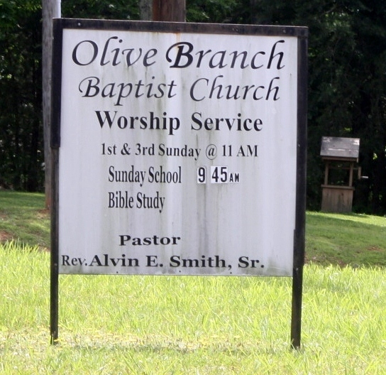
Where is Olive Branch Baptist Church Cemetery?
Olive Branch Baptist Church Cemetery is located at Joppa Mill Road (Route747) Flint Hill, Bedford County ,Virginia , 24121USA.
-
Olive Branch Baptist Church Cemetery cemetery's updated grave count on graveviews.com?
0 memorials
-
Where are the coordinates of the Olive Branch Baptist Church Cemetery?
Latitude: 37.2485399
Longitude: -79.6255937
Nearby Cemetories:
1. Lloyd Family Cemetery
Chamblissburg, Bedford County, USA
Coordinate: 37.2406598, -79.6656647
2. Wills Cemetery
Chamblissburg, Bedford County, USA
Coordinate: 37.2429169, -79.6784434
3. Crenshaw-Pate Cemetery
Bedford County, USA
Coordinate: 37.2952500, -79.6334600
4. James E. Loyd Cemetery
Goodview, Bedford County, USA
Coordinate: 37.2240906, -79.6814880
5. Jack Huddleston Cemetery
Chamblissburg, Bedford County, USA
Coordinate: 37.2698670, -79.6839060
6. Jim Chattin Cemetery
Chamblissburg, Bedford County, USA
Coordinate: 37.2555000, -79.6967900
7. Mount Olivet Southern Baptist Church Cemetery
Bedford, Bedford County, USA
Coordinate: 37.2761450, -79.5602720
8. Holy Land Cemetery
Bedford, Bedford County, USA
Coordinate: 37.3027670, -79.5847710
9. Atkinson Cemetery
Bedford County, USA
Coordinate: 37.2981100, -79.5740600
10. Morgans Baptist Church Cemetery
Bedford, Bedford County, USA
Coordinate: 37.1896961, -79.5920278
11. Mount Olivet Missionary Baptist Church Cemetery
Bedford, Bedford County, USA
Coordinate: 37.2793050, -79.5496640
12. Parrish Chapel United Methodist Church Cemetery
Chamblissburg, Bedford County, USA
Coordinate: 37.2536082, -79.7123941
13. Meador Family Cemetery
Diamond Hill, Bedford County, USA
Coordinate: 37.1906810, -79.6765960
14. Church of the Great Shepherd Cemetery
Bedford, Bedford County, USA
Coordinate: 37.2255209, -79.5409872
15. Meador-Mitchell Family Cemetery
Diamond Hill, Bedford County, USA
Coordinate: 37.1814503, -79.6588492
16. McConnehey-Updike Cemetery
Chestnut Fork, Bedford County, USA
Coordinate: 37.2116187, -79.5452689
17. McGhee Family Cemetery
Centerville, Bedford County, USA
Coordinate: 37.3175350, -79.5905440
18. Diamond Hill Church Cemetery
Diamond Hill, Bedford County, USA
Coordinate: 37.1927740, -79.6885941
19. Green Spring Baptist Church Cemetery
Goodview, Bedford County, USA
Coordinate: 37.2152204, -79.7105807
20. Meador-Hannabass Cemetery
Goodview, Bedford County, USA
Coordinate: 37.1831220, -79.6733710
21. Daniel L. Hannabass Cemetery
Diamond Hill, Bedford County, USA
Coordinate: 37.1912619, -79.6897810
22. John McLain Sr Cemetery
Diamond Hill, Bedford County, USA
Coordinate: 37.1780345, -79.6660586
23. Gibbs Family Cemetery
Bedford County, USA
Coordinate: 37.3081700, -79.5630800
24. Dickinson-McLain-Watson Cemetery
Goodview, Bedford County, USA
Coordinate: 37.1924260, -79.6981240