
| Memorials | : | 7 |
| Location | : | Colerain Township, Hamilton County, USA |
| Phone | : | (513) 385-7500 |
| Website | : | www.colerain.org |
| Coordinate | : | 39.2193620, -84.6099650 |
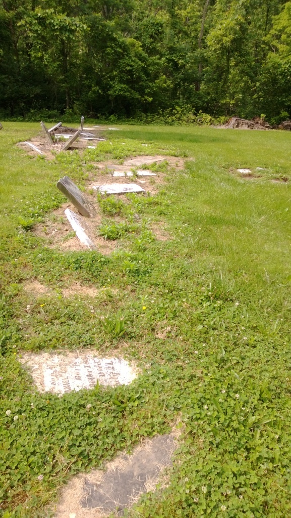
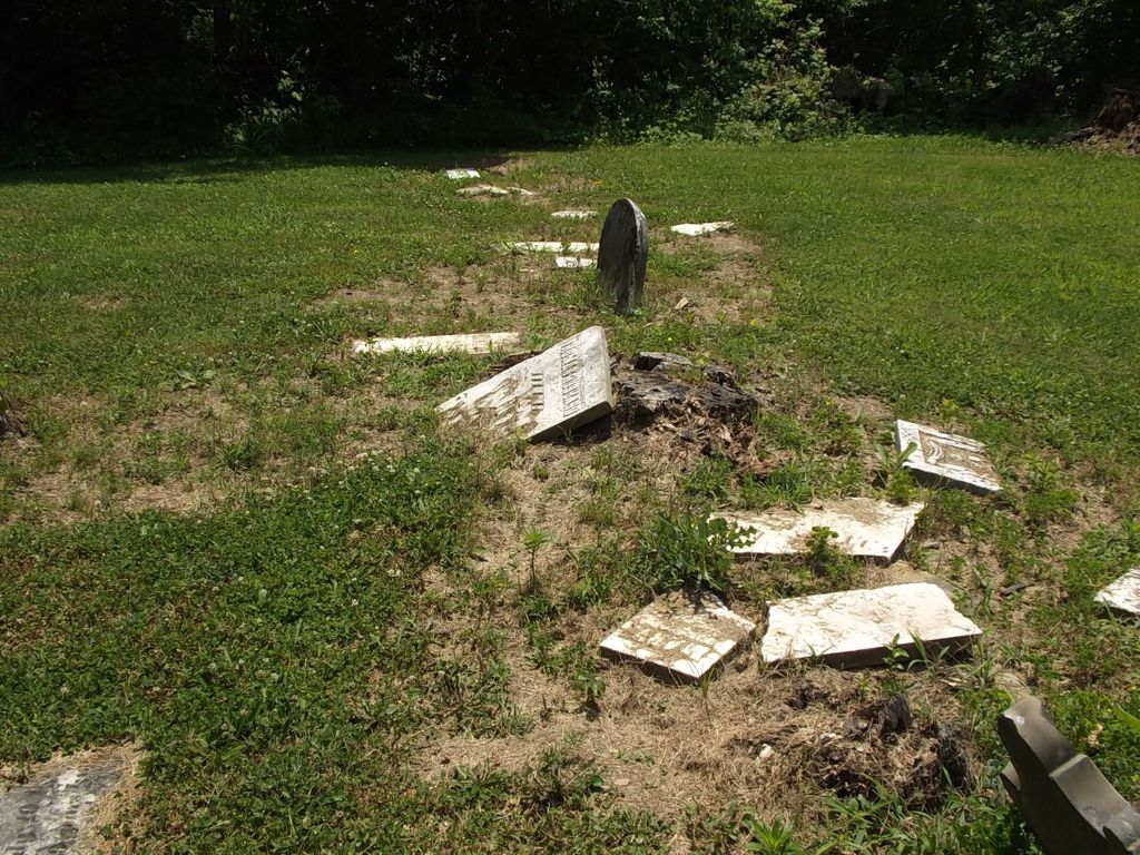
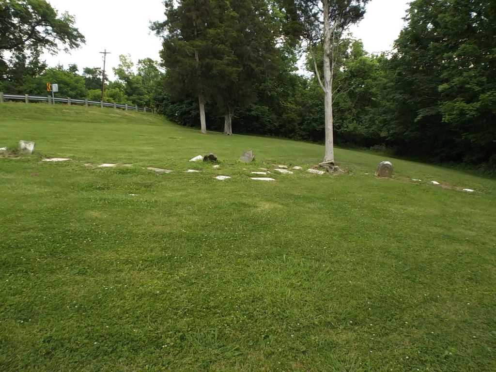
| Description | : | The Olive Branch Methodist Churchyard is located on the west side of Blue Rock Road about 500 feet from Galbraith Road. The cemetery is maintained by: Colerain Township Trustees 4200 Springdale Road Colerain Township, Ohio 45251 (513) 385-7500 Information on the cemetery is available on the Colerain Township website under the heading “Historical Documents”. The cemetery is located in Colerain Township, Hamilton County, Ohio, and is # 4642 in “Ohio Cemeteries 1803-2003”, compiled by the Ohio Genealogical Society (Olive Branch Cemetery / White Oak Township Cemetery / Groesbeck United Methodist Church Cemetery / Colerain Township Cemetery ). |
frequently asked questions (FAQ):
-
Where is Olive Branch Methodist Churchyard?
Olive Branch Methodist Churchyard is located at 4125 Blue Rock Road Colerain Township, Hamilton County ,Ohio , 45249USA.
-
Olive Branch Methodist Churchyard cemetery's updated grave count on graveviews.com?
7 memorials
-
Where are the coordinates of the Olive Branch Methodist Churchyard?
Latitude: 39.2193620
Longitude: -84.6099650
Nearby Cemetories:
1. White Oak Christian Churchyard
Cincinnati, Hamilton County, USA
Coordinate: 39.2212770, -84.6073990
2. Barnes Family Cemetery
Colerain Township, Hamilton County, USA
Coordinate: 39.2153600, -84.6018680
3. Saint James Cemetery
White Oak, Hamilton County, USA
Coordinate: 39.2048000, -84.6012000
4. Saint Paul Evangelical Churchyard Cemetery
Colerain Township, Hamilton County, USA
Coordinate: 39.2313576, -84.6247253
5. Trinity Evangelical Lutheran Cemetery
Colerain Township, Hamilton County, USA
Coordinate: 39.2143340, -84.6359600
6. Bethel Cemetery
Autumn Acres, Hamilton County, USA
Coordinate: 39.2283160, -84.6355570
7. Gutzwillers Grove Cemetery
Hamilton County, USA
Coordinate: 39.2036018, -84.5875015
8. Dean Family Cemetery
Colerain Township, Hamilton County, USA
Coordinate: 39.2298126, -84.6450272
9. Asbury Cemetery
White Oak, Hamilton County, USA
Coordinate: 39.1889420, -84.6053696
10. Mullen Family Cemetery
Colerain Township, Hamilton County, USA
Coordinate: 39.2313980, -84.6464160
11. United Brethren in Christ Cemetery
Dent, Hamilton County, USA
Coordinate: 39.1986700, -84.6395530
12. Compton Cemetery
Colerain Township, Hamilton County, USA
Coordinate: 39.2367700, -84.5760700
13. Jessup Cemetery
Mount Airy, Hamilton County, USA
Coordinate: 39.1970870, -84.5794270
14. Lingo Family Cemetery
Cincinnati, Hamilton County, USA
Coordinate: 39.1903360, -84.5896670
15. Arlington Memorial Gardens
Mount Healthy, Hamilton County, USA
Coordinate: 39.2280998, -84.5614014
16. Bevis Cedar Grove Cemetery
Bevis, Hamilton County, USA
Coordinate: 39.2580986, -84.6027985
17. Saint John the Baptist Cemetery
Bevis, Hamilton County, USA
Coordinate: 39.2595780, -84.6198000
18. United Brethren Cemetery
Bevis, Hamilton County, USA
Coordinate: 39.2592390, -84.6313520
19. Gard-Brown Cemetery
North Bend, Hamilton County, USA
Coordinate: 39.2035200, -84.5553300
20. Laboiteaux-Cary Cemetery
North College Hill, Hamilton County, USA
Coordinate: 39.2181015, -84.5500031
21. Hammitt Family Cemetery
Colerain Township, Hamilton County, USA
Coordinate: 39.2342960, -84.6692800
22. Springdale Road Baptist Cemetery
Hamilton County, USA
Coordinate: 39.2580986, -84.5717010
23. Hoffner Cemetery
Mount Healthy, Hamilton County, USA
Coordinate: 39.2297668, -84.5468903
24. Saint Bernard Catholic Cemetery
Colerain Township, Hamilton County, USA
Coordinate: 39.2140999, -84.6751938