
| Memorials | : | 2 |
| Location | : | Kershaw, Lancaster County, USA |
| Coordinate | : | 34.5130530, -80.4850410 |
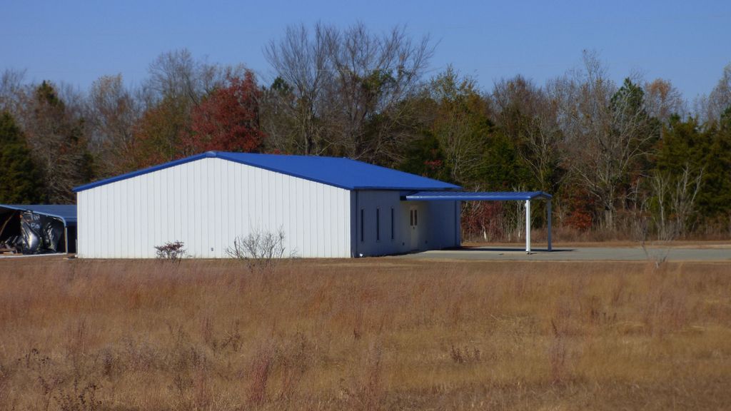
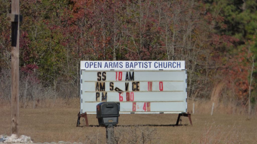
| Description | : | Located passed the intersection of Providence Road on the left of the church building (blue and white metal building) in a slightly overgrown open field. |
frequently asked questions (FAQ):
-
Where is Open Arms Baptist Church Cemetery?
Open Arms Baptist Church Cemetery is located at 5401 Lockhart Road Kershaw, Lancaster County ,South Carolina , 29067USA.
-
Open Arms Baptist Church Cemetery cemetery's updated grave count on graveviews.com?
0 memorials
-
Where are the coordinates of the Open Arms Baptist Church Cemetery?
Latitude: 34.5130530
Longitude: -80.4850410
Nearby Cemetories:
1. Mount Olive Baptist Church Cemetery
Kershaw, Lancaster County, USA
Coordinate: 34.5065720, -80.4878190
2. Shiloh United Methodist Church Cemetery
Abney Crossroads, Kershaw County, USA
Coordinate: 34.4968750, -80.5019250
3. Buffalo Baptist Church Cemetery
Mount Pisgah, Kershaw County, USA
Coordinate: 34.5528720, -80.4903030
4. Sam Roberts Cemetery
Kershaw County, USA
Coordinate: 34.5549430, -80.4910710
5. Prodigal Freewill Baptist Church Cemetery
Kershaw County, USA
Coordinate: 34.5600530, -80.5095960
6. Oak Ridge Baptist Church Cemetery
Kershaw County, USA
Coordinate: 34.4934182, -80.5432949
7. Oak Ridge Baptist Church Cemetery
Kershaw, Lancaster County, USA
Coordinate: 34.4933300, -80.5478870
8. Stroud Cemetery
Kershaw County, USA
Coordinate: 34.5677986, -80.4705963
9. Bethel Hill Baptist Church Cemetery
Bethune, Kershaw County, USA
Coordinate: 34.4794950, -80.4297730
10. Shamrock Baptist Church Cemetery
Bethune, Kershaw County, USA
Coordinate: 34.4679209, -80.4417579
11. Providence Baptist Church Cemetery
Jordan Mill, Kershaw County, USA
Coordinate: 34.4420070, -80.4867210
12. Haile Gold Mine Baptist Church Cemetery
Kershaw, Lancaster County, USA
Coordinate: 34.5839800, -80.5087390
13. Mill Creek Baptist Church Cemetery
Bethune, Kershaw County, USA
Coordinate: 34.4425000, -80.4350000
14. Kershaw City Cemetery
Kershaw, Lancaster County, USA
Coordinate: 34.5539610, -80.5723390
15. House Of Prayer Church Cemetery
Bethune, Kershaw County, USA
Coordinate: 34.5632990, -80.3929720
16. Faith Family Church Cemetery
Jefferson, Chesterfield County, USA
Coordinate: 34.5953700, -80.4354500
17. Pine Grove Freewill Baptist Church Cemetery
Kershaw County, USA
Coordinate: 34.5979290, -80.4413560
18. Pine Grove Free Will Baptist Church Cemetery
Jefferson, Chesterfield County, USA
Coordinate: 34.5980190, -80.4413200
19. Mount Pisgah Baptist Church Cemetery
Mount Pisgah, Kershaw County, USA
Coordinate: 34.5783234, -80.4057922
20. Sandy Grove United Methodist Church Cemetery
Jefferson, Chesterfield County, USA
Coordinate: 34.5958430, -80.4332500
21. Belk Cemetery
Kershaw, Lancaster County, USA
Coordinate: 34.5605870, -80.5831860
22. Crossroads Baptist Church Cemetery
Kershaw, Lancaster County, USA
Coordinate: 34.6021580, -80.4470700
23. Boone Family Cemetery
Westville, Kershaw County, USA
Coordinate: 34.4238853, -80.5348282
24. Highland Heights Cemetery
Kershaw, Lancaster County, USA
Coordinate: 34.5691300, -80.5838490