| Memorials | : | 0 |
| Location | : | Mount Washington, Bullitt County, USA |
| Coordinate | : | 38.0389850, -85.5551320 |
| Description | : | The site of this destroyed cemetery and vanished church building seems to have been the south side of what was a sharp turn in Old Mill Road, a.k.a. KY Hwy. 44. When the highway was straightened a little bit here, they left part of the old roadbed to serve the houses there, and the loop of the old road was named Half Moon Drive. The USGS topographic maps of the area only date back to 1905/1907, and at that time, no church house or cemetery are shown here. But by the 1997 topographic map update, an unnamed... Read More |
frequently asked questions (FAQ):
-
Where is Original Hall Cemetery?
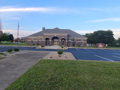
Original Hall Cemetery is located at 151 Half Moon Drive Mount Washington, Bullitt County ,Kentucky , 40047USA.
-
Original Hall Cemetery cemetery's updated grave count on graveviews.com?
0 memorials
-
Where are the coordinates of the Original Hall Cemetery?
Latitude: 38.0389850
Longitude: -85.5551320
Nearby Cemetories:
1. Hall Cemetery
Mount Washington, Bullitt County, USA
Coordinate: 38.0410210, -85.5522600
2. Perkins Cemetery
Mount Washington, Bullitt County, USA
Coordinate: 38.0400009, -85.5438995
3. Showalter Cemetery
Mount Washington, Bullitt County, USA
Coordinate: 38.0457993, -85.5432968
4. Saint Francis Cemetery
Mount Washington, Bullitt County, USA
Coordinate: 38.0489510, -85.5396240
5. Mount Washington Cemetery
Mount Washington, Bullitt County, USA
Coordinate: 38.0503006, -85.5381012
6. Newkirk Family Cemetery
Mount Washington, Bullitt County, USA
Coordinate: 38.0226520, -85.5690250
7. Owens Cemetery
Mount Washington, Bullitt County, USA
Coordinate: 38.0466995, -85.5800018
8. Highland Memory Gardens
Mount Washington, Bullitt County, USA
Coordinate: 38.0625000, -85.5547028
9. Bethel United Methodist Cemetery
Mount Washington, Bullitt County, USA
Coordinate: 38.0317730, -85.5954080
10. Ridgway Cemetery #2
Shepherdsville, Bullitt County, USA
Coordinate: 38.0328800, -85.6054560
11. Markwell Cemetery
Mount Washington, Bullitt County, USA
Coordinate: 38.0727997, -85.5224991
12. Greenwell Cemetery
Shepherdsville, Bullitt County, USA
Coordinate: 37.9959080, -85.5695850
13. Gentey Cemetery
Shepherdsville, Bullitt County, USA
Coordinate: 38.0555992, -85.6185989
14. Ridgway Cemetery #1
Shepherdsville, Bullitt County, USA
Coordinate: 38.0215120, -85.6191220
15. Givhan Cemetery
Shepherdsville, Bullitt County, USA
Coordinate: 38.0211210, -85.6196350
16. Kings Church Cemetery
Mount Washington, Bullitt County, USA
Coordinate: 38.0740620, -85.4994440
17. William Swearingen Cemetery
Shepherdsville, Bullitt County, USA
Coordinate: 37.9964430, -85.6020020
18. James Swearingen Cemetery
Shepherdsville, Bullitt County, USA
Coordinate: 37.9932750, -85.6080210
19. Jones Cemetery
Bullitt County, USA
Coordinate: 38.0018997, -85.6183014
20. Pleasant Grove Cemetery
Shepherdsville, Bullitt County, USA
Coordinate: 38.0202020, -85.6305600
21. Smith-Hubbs Cemetery
Shepherdsville, Bullitt County, USA
Coordinate: 38.0598850, -85.6311150
22. Grandell Cemetery
Bullitt County, USA
Coordinate: 38.0508003, -85.6352997
23. Fairmount Cemetery
Fairmount, Jefferson County, USA
Coordinate: 38.1049995, -85.5691986
24. Stallings Cemetery
Bullitt County, USA
Coordinate: 38.0153008, -85.6355972

