
| Memorials | : | 0 |
| Location | : | Osterlars, Bornholm Kommune, Denmark |
| Phone | : | +45 40 38 42 06 |
| Website | : | www.oesterlarskirke.dk |
| Coordinate | : | 55.1712695, 14.9610189 |
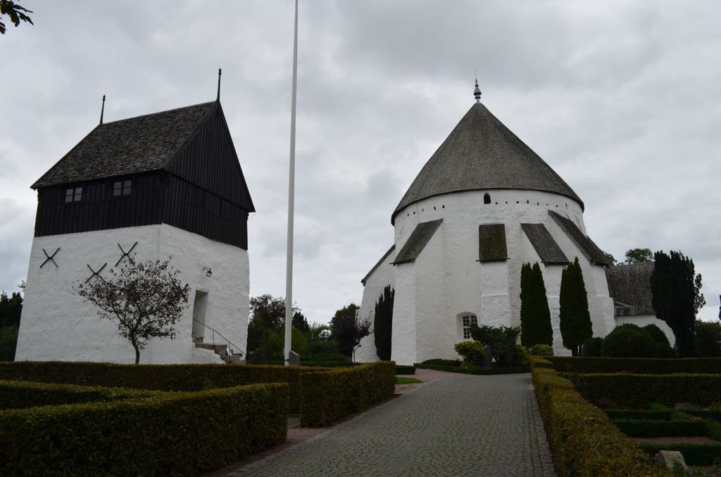
| Description | : | The Osterlars Church is the biggest and the most famous of the four Round churches of the Danish Island Bornholm. It was built around 1150, but has been rebuilt and reinforced several times. The church is surrounded by the cemetery. The Osterlars Church was an important location of the Danish movie "The Lost Treasure of the Knights Templar" in 2006 (Original: "Tempelriddernes skat"). |
frequently asked questions (FAQ):
-
Where is Osterlars Kirke Cemetery?
Osterlars Kirke Cemetery is located at Vietsvej 25, 3760 Gudhjem, Denmark Osterlars, Bornholm Kommune ,Hovedstaden ,Denmark.
-
Osterlars Kirke Cemetery cemetery's updated grave count on graveviews.com?
0 memorials
-
Where are the coordinates of the Osterlars Kirke Cemetery?
Latitude: 55.1712695
Longitude: 14.9610189
Nearby Cemetories:
1. Gudhjem ældre Kirkegård
Gudhjem, Bornholm Kommune, Denmark
Coordinate: 55.2108790, 14.9718290
2. Østermarie Kirke Cemetery
Ostermarie, Bornholm Kommune, Denmark
Coordinate: 55.1383060, 15.0156390
3. Klemensker Cemetery
Klemensker, Bornholm Kommune, Denmark
Coordinate: 55.1751455, 14.8026038
4. Svaneke Kirkegård
Svaneke, Bornholm Kommune, Denmark
Coordinate: 55.1342841, 15.1425681
5. Sankt Ols Kirke Cemetery
Olsker, Bornholm Kommune, Denmark
Coordinate: 55.2359568, 14.8008453
6. Ny Kirke
Nyker, Bornholm Kommune, Denmark
Coordinate: 55.1394109, 14.7690348
7. Nylars Kirke Cemetery
Nylars, Bornholm Kommune, Denmark
Coordinate: 55.0738040, 14.8142911
8. St Knuds Kirke Cemetery
Ronne, Bornholm Kommune, Denmark
Coordinate: 55.1070522, 14.7524946
9. Den Russiske Kirkegård
Allinge, Bornholm Kommune, Denmark
Coordinate: 55.2765461, 14.7960415
10. Pedersker Kirkegård
Pedersker, Bornholm Kommune, Denmark
Coordinate: 55.0267340, 14.9764950
11. Östra Nöbbelöv Old Cemetery
Ostra Nobbelov, Simrishamns kommun, Sweden
Coordinate: 55.5178100, 14.3045800
12. Simris gamla kyrkogård
Simris, Simrishamns kommun, Sweden
Coordinate: 55.5352780, 14.3216670
13. Simris nya kyrkogård
Simris, Simrishamns kommun, Sweden
Coordinate: 55.5342230, 14.3198200
14. Simrishamn Northern Cemetery
Simrishamn, Simrishamns kommun, Sweden
Coordinate: 55.5652780, 14.3350560
15. Järrestads kyrkogård
Jarrestad, Simrishamns kommun, Sweden
Coordinate: 55.5380560, 14.2855560
16. Vallby Cemetery
Simrishamns kommun, Sweden
Coordinate: 55.4976700, 14.2058300
17. Old Gladsax Cemetery
Gladsax, Simrishamns kommun, Sweden
Coordinate: 55.5613000, 14.2865700
18. Östra Tommarp New Cemetery
Ostra Tommarp, Simrishamns kommun, Sweden
Coordinate: 55.5329100, 14.2382400
19. Östra Tommarp Old Cemetery
Ostra Tommarp, Simrishamns kommun, Sweden
Coordinate: 55.5329100, 14.2382400
20. Östra Vemmerlöv Cemetery
Ostra Vemmerlov, Simrishamns kommun, Sweden
Coordinate: 55.5796100, 14.2357100
21. Östra Wemmerlöv
Garsnas, Simrishamns kommun, Sweden
Coordinate: 55.5800533, 14.2358324
22. Stiby Cemetery
Stiby, Simrishamns kommun, Sweden
Coordinate: 55.5556400, 14.1718000
23. Rörum North Cemetery
Rorum, Simrishamns kommun, Sweden
Coordinate: 55.6308800, 14.2488200
24. Smedstorp Cemetery
Smedstorp, Tomelilla kommun, Sweden
Coordinate: 55.5613000, 14.1094000