
| Memorials | : | 2 |
| Location | : | Dolton, Turner County, USA |
| Coordinate | : | 43.4871320, -97.3732960 |
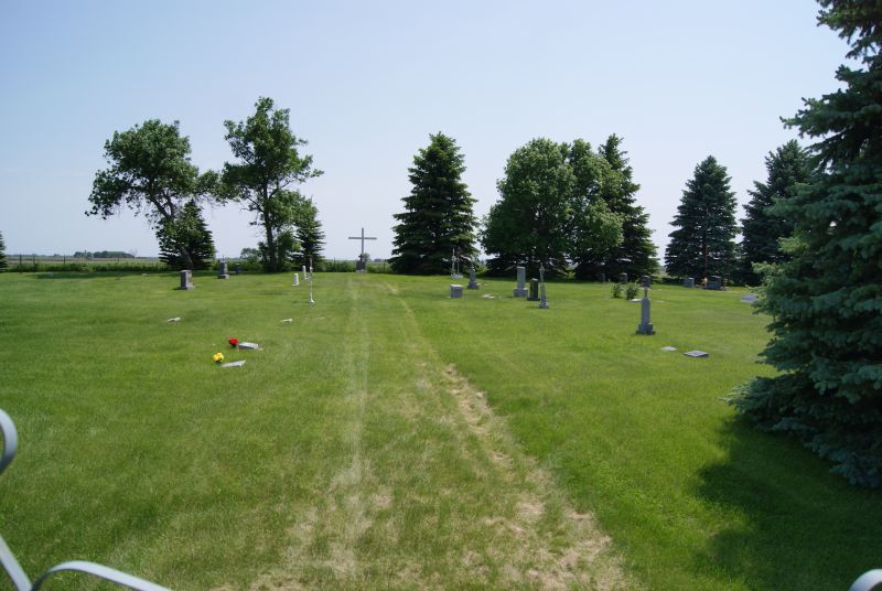
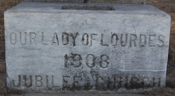
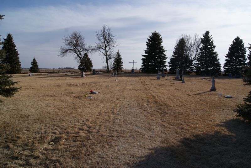
| Description | : | The Cemetery was donated to the Diocese of Sioux Falls, Bishop Thomas O'Gorman in 1908 by Amelia Braun Kappenman, wife of John Kappenman, from part of the original Kappenman Homestead 160 acres John Kappenman owner of the original homestead died Nov. 28, 1905 had been buried in St. Stephens Catholic Cemetery in Bridgewater, SD Cemetery, was disinterred and reburied in Our Lady of Lourdes Catholic Cemetery in 1909. He was the second person buried there. The first was a Holden child, the son of John and Anna Marie Kappenman Holden. Locally: The Cemetery is referred to as The... Read More |
frequently asked questions (FAQ):
-
Where is Our Lady of Lourdes Catholic Cemetery?
Our Lady of Lourdes Catholic Cemetery is located at Dolton, Turner County ,South Dakota ,USA.
-
Our Lady of Lourdes Catholic Cemetery cemetery's updated grave count on graveviews.com?
2 memorials
-
Where are the coordinates of the Our Lady of Lourdes Catholic Cemetery?
Latitude: 43.4871320
Longitude: -97.3732960
Nearby Cemetories:
1. Rose Hill Cemetery
McCook County, USA
Coordinate: 43.5119019, -97.3478012
2. Adrian Cemetery
Freeman, Hutchinson County, USA
Coordinate: 43.4730320, -97.4196550
3. Mennonite Cemetery
Dolton, Turner County, USA
Coordinate: 43.4472008, -97.3788986
4. West Vermillion Cemetery
Marion, Turner County, USA
Coordinate: 43.4706001, -97.3189011
5. Dick Cemetery
Turner County, USA
Coordinate: 43.4528008, -97.3319016
6. Riverside Cemetery
Canistota, McCook County, USA
Coordinate: 43.5360985, -97.3283005
7. Anna Koerner Burial Site
Hutchinson County, USA
Coordinate: 43.4290258, -97.4196065
8. Tieszen Cemetery
Marion, Turner County, USA
Coordinate: 43.4219017, -97.3388977
9. Pleasant Prairie Cemetery
Bridgewater, McCook County, USA
Coordinate: 43.5430984, -97.4496994
10. First Church of God Cemetery
Marion, Turner County, USA
Coordinate: 43.4447000, -97.2727000
11. Buller-Ensz Cemetery
Turner County, USA
Coordinate: 43.4186000, -97.2828500
12. Saint Marys Catholic Cemetery
Marion, Turner County, USA
Coordinate: 43.4371986, -97.2596970
13. Monroe Reformed Church Cemetery
McCook County, USA
Coordinate: 43.5004100, -97.2358170
14. Saint Stephens Cemetery
Bridgewater, McCook County, USA
Coordinate: 43.5574989, -97.4766998
15. Hutterthal Mennonite Church Cemetery
Freeman, Hutchinson County, USA
Coordinate: 43.4041400, -97.4605000
16. Kleinkassel Cemetery
Hutchinson County, USA
Coordinate: 43.4369011, -97.4997025
17. Tschetter Cemetery
Freeman, Hutchinson County, USA
Coordinate: 43.3866997, -97.4197006
18. Spring Valley Baptist Cemetery
Spring Valley Township, McCook County, USA
Coordinate: 43.5325920, -97.2290730
19. Hofer Cemetery
Freeman, Hutchinson County, USA
Coordinate: 43.4726830, -97.5299150
20. Greenwood Cemetery
Marion, Turner County, USA
Coordinate: 43.4150009, -97.2493973
21. Bridgewater Cemetery
Bridgewater, McCook County, USA
Coordinate: 43.5541600, -97.5059400
22. Schrag Farm Cemetery
Bridgewater, McCook County, USA
Coordinate: 43.4760720, -97.5570940
23. Rasmussen Cemetery
Bridgewater, McCook County, USA
Coordinate: 43.5283012, -97.5567017
24. Canistota Cemetery
Canistota, McCook County, USA
Coordinate: 43.6035995, -97.2671967