
| Memorials | : | 0 |
| Location | : | Livingston, Park County, USA |
| Coordinate | : | 45.6860470, -110.4924250 |
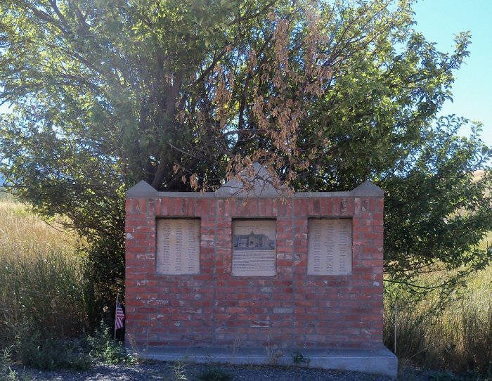
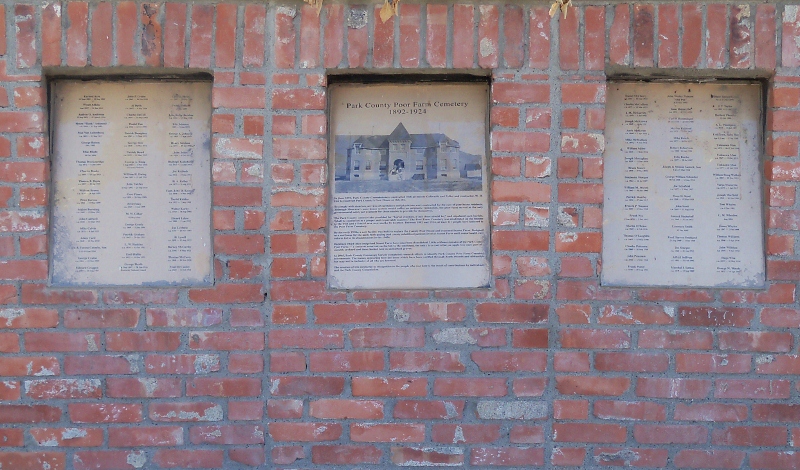
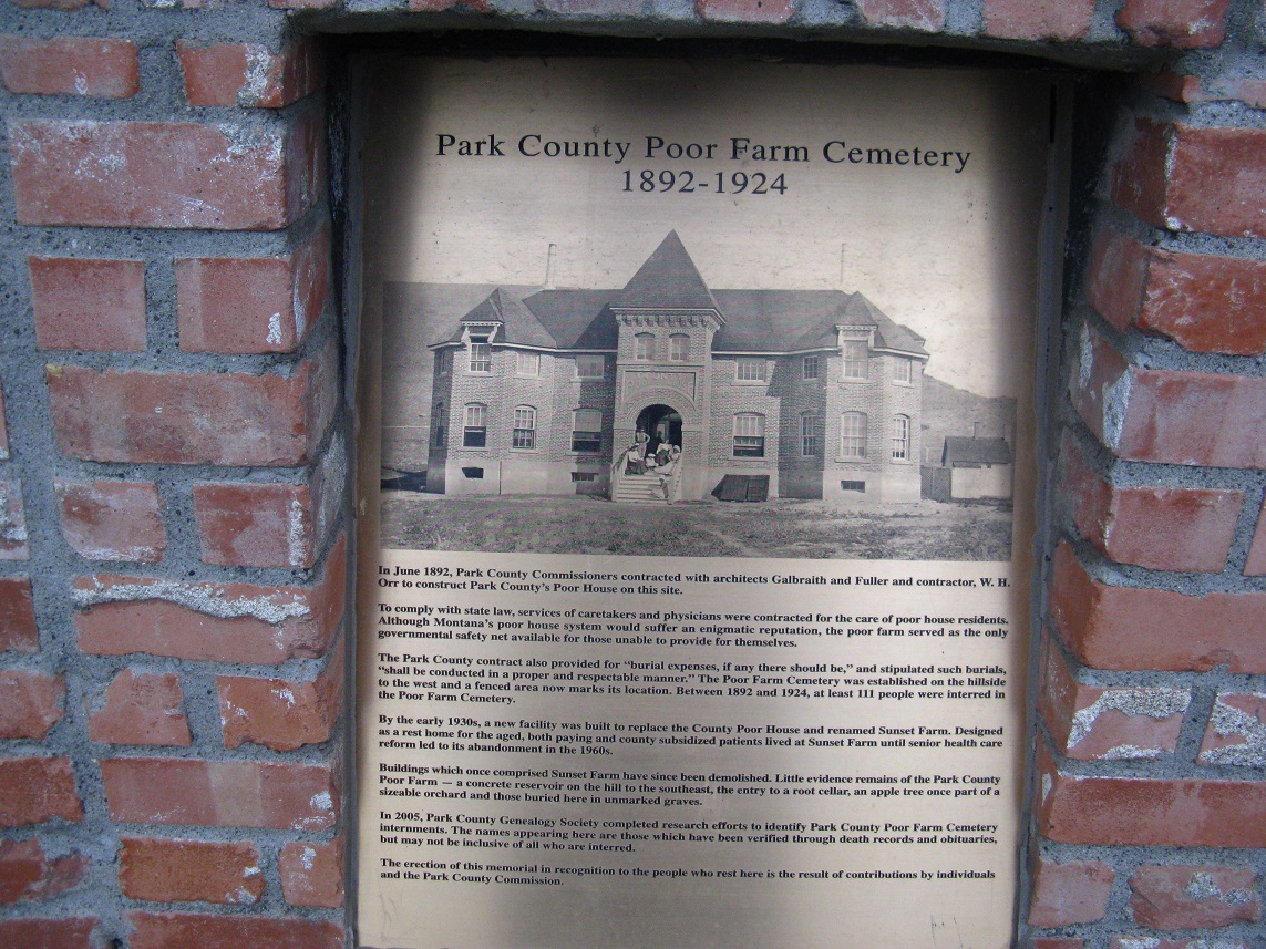
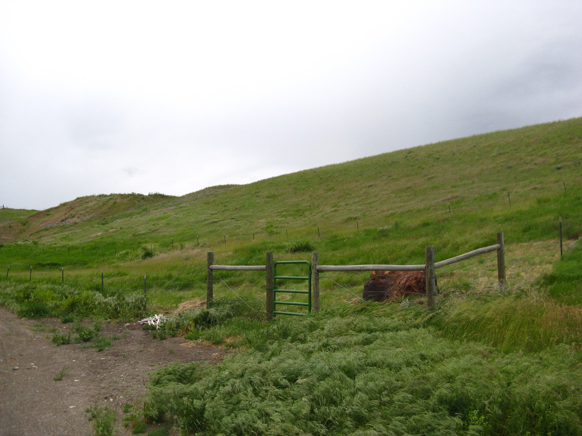
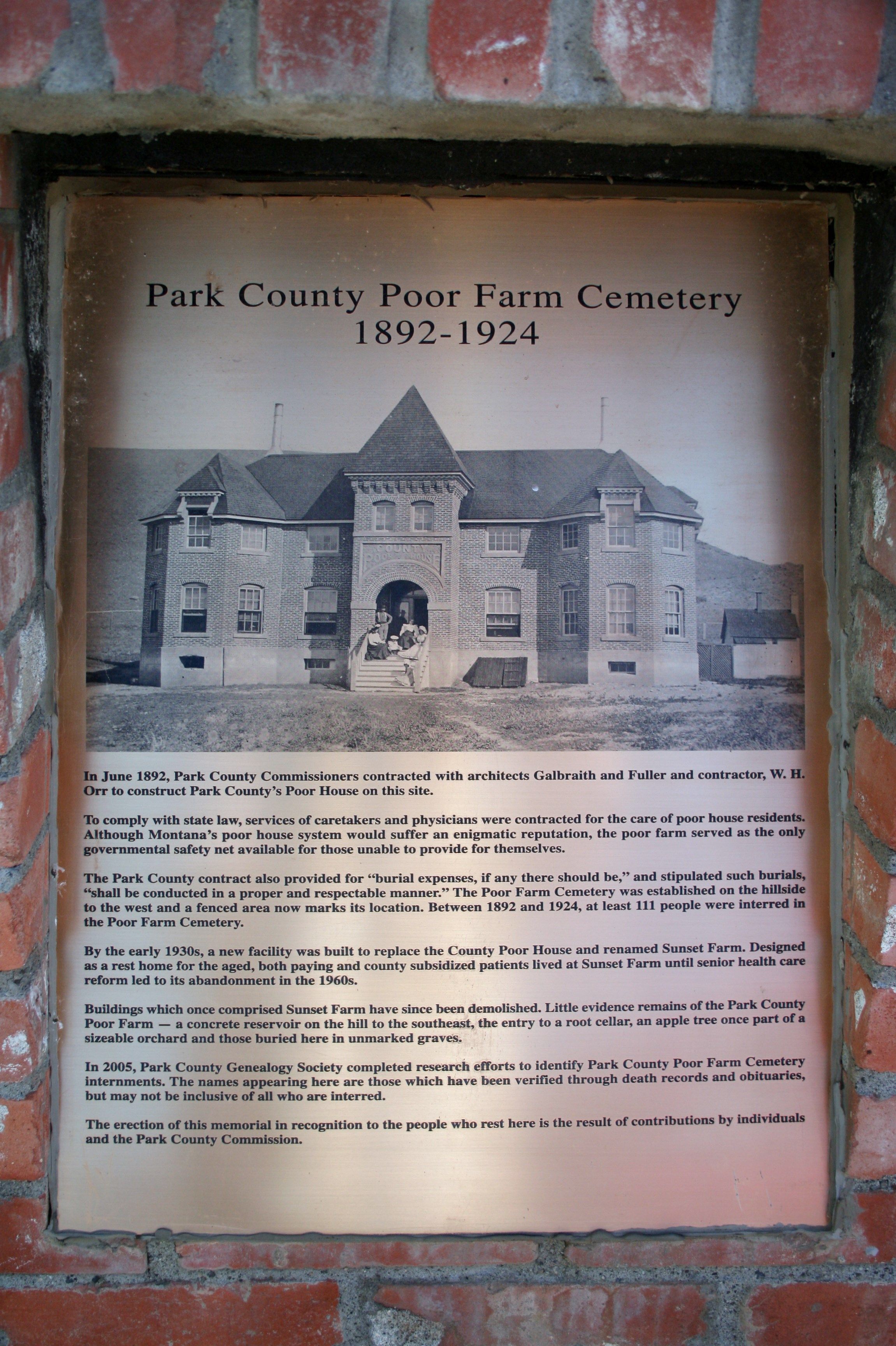
| Description | : | Summary of Park County Poor Farm Cemetery plaque In June 1892, Park County Commissioners contracted with architects to construct Park County's Poor House. Services of caretakers and physicians were contracted for the care of poor house residents. The Poor Farm served as the only governmental safety net available for those unable to provide for themselves. The Park County Contract also provided for "burial expenses, if any there should be," and stipulated such burials "shall be conducted in a proper and respectable manner," and the Poor Farm Cemetery was established on the hillside to the west of the house. Between... Read More |
frequently asked questions (FAQ):
-
Where is Park County Poor Farm Cemetery?
Park County Poor Farm Cemetery is located at 23 Chicken Creek Lane Livingston, Park County ,Montana , 59047USA.
-
Park County Poor Farm Cemetery cemetery's updated grave count on graveviews.com?
0 memorials
-
Where are the coordinates of the Park County Poor Farm Cemetery?
Latitude: 45.6860470
Longitude: -110.4924250
Nearby Cemetories:
1. Calvary Cemetery
Livingston, Park County, USA
Coordinate: 45.6913986, -110.5282974
2. Mountain View Cemetery
Livingston, Park County, USA
Coordinate: 45.6617012, -110.5883026
3. Bruffey Cemetery
Livingston, Park County, USA
Coordinate: 45.6206200, -110.3741910
4. Park View Memorial Gardens
Livingston, Park County, USA
Coordinate: 45.5739288, -110.5668182
5. Strickland Cemetery
Livingston, Park County, USA
Coordinate: 45.5435982, -110.6168976
6. Cokedale Cemetery
Livingston, Park County, USA
Coordinate: 45.6402140, -110.7229940
7. Hunters Hot Springs Cemetery
Hunters Hot Springs, Park County, USA
Coordinate: 45.7551000, -110.2570000
8. Rock Creek Cemetery
Park County, USA
Coordinate: 45.8944016, -110.4993973
9. Saint Margarets Cemetery
Clyde Park, Park County, USA
Coordinate: 45.9000810, -110.6005990
10. Clyde Park Cemetery
Clyde Park, Park County, USA
Coordinate: 45.9000850, -110.6013180
11. Shorthill Cemetery
Park County, USA
Coordinate: 45.4558500, -110.5771600
12. Trail Creek Cemetery
Park County, USA
Coordinate: 45.4750140, -110.7036280
13. Leffingwell Family Cemetery
Clyde Park, Park County, USA
Coordinate: 45.8702570, -110.7753240
14. Magee Cemetery
Livingston, Park County, USA
Coordinate: 45.3988900, -110.6061100
15. Wilsall Cemetery
Wilsall, Park County, USA
Coordinate: 45.9824982, -110.6549988
16. Woosley Family Cemetery
Gallatin County, USA
Coordinate: 45.9535000, -110.8525000
17. Sedan Cemetery
Bozeman, Gallatin County, USA
Coordinate: 45.9536018, -110.8531036
18. Sunset Hills Cemetery
Bozeman, Gallatin County, USA
Coordinate: 45.6735992, -111.0235977
19. Saint James Episcopal Church Columbarium
Bozeman, Gallatin County, USA
Coordinate: 45.6774010, -111.0373590
20. Holy Rosary Cemetery
Bozeman, Gallatin County, USA
Coordinate: 45.7000008, -111.0464020
21. Emigrant Cemetery
Park County, USA
Coordinate: 45.3438988, -110.7585983
22. Springhill Cemetery
Springhill, Gallatin County, USA
Coordinate: 45.8408012, -111.0068970
23. Mountain View Cemetery
Big Timber, Sweet Grass County, USA
Coordinate: 45.8243660, -109.9660960
24. Chico Cemetery
Park County, USA
Coordinate: 45.3274994, -110.7249985