
| Memorials | : | 0 |
| Location | : | Battiest, McCurtain County, USA |
| Coordinate | : | 34.3823395, -94.9575806 |
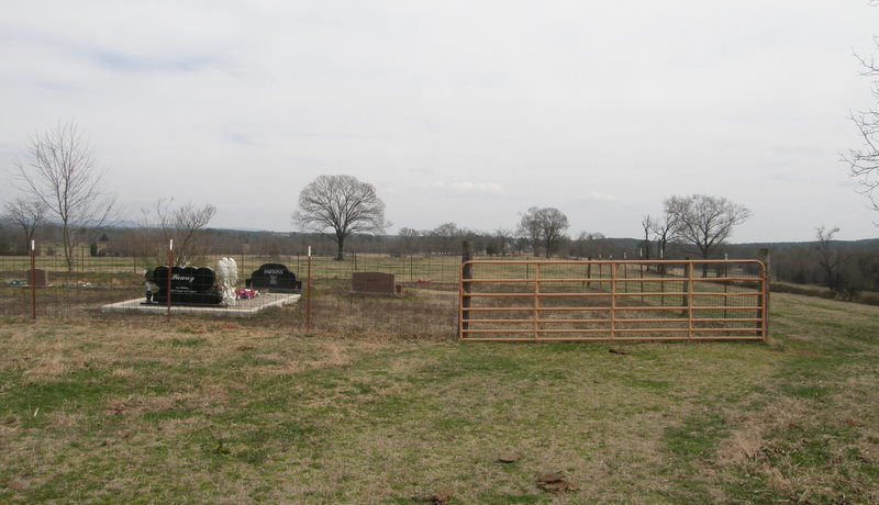
| Description | : | This cemetery is located behind the Sterling Parsons home place in the pasture. It is fenced. |
frequently asked questions (FAQ):
-
Where is Parsons Family Cemetery?
Parsons Family Cemetery is located at Battiest, McCurtain County ,Oklahoma ,USA.
-
Parsons Family Cemetery cemetery's updated grave count on graveviews.com?
0 memorials
-
Where are the coordinates of the Parsons Family Cemetery?
Latitude: 34.3823395
Longitude: -94.9575806
Nearby Cemetories:
1. Battiest Cemetery
Battiest, McCurtain County, USA
Coordinate: 34.3887405, -94.9259109
2. Old Parsons Cemetery
Battiest, McCurtain County, USA
Coordinate: 34.4013901, -94.9015808
3. Bethel Hill Cemetery
Bethel, McCurtain County, USA
Coordinate: 34.3566160, -94.8938080
4. County Line Cemetery
Pushmataha County, USA
Coordinate: 34.3889008, -95.0472031
5. Bethel Cemetery
Bethel, McCurtain County, USA
Coordinate: 34.3663406, -94.8458633
6. Kulli-Chito Presbyterian Church Cemetery
Bethel, McCurtain County, USA
Coordinate: 34.3805542, -94.8361130
7. Fewell Cemetery
Pushmataha County, USA
Coordinate: 34.5208015, -95.0382996
8. Sherwood Cemetery
Sherwood, McCurtain County, USA
Coordinate: 34.3318100, -94.7816530
9. Rock Creek Cemetery
Honobia, Le Flore County, USA
Coordinate: 34.5378600, -94.9367800
10. Ludlow Cemetery
Le Flore County, USA
Coordinate: 34.5331001, -94.8664017
11. Nolia Cemetery
Nashoba, Pushmataha County, USA
Coordinate: 34.4688988, -95.1600037
12. John Isic Cardner Grave
Pushmataha County, USA
Coordinate: 34.2649940, -95.1472820
13. Curb Isbel Grave
Pushmataha County, USA
Coordinate: 34.3509440, -95.2027500
14. Dickson Solomon Grave
Pushmataha County, USA
Coordinate: 34.3341611, -95.1993330
15. Wilson Chapel Cemetery
McCurtain County, USA
Coordinate: 34.2002983, -95.1003036
16. Old Ringold Cemetery
McCurtain County, USA
Coordinate: 34.2150002, -95.1502991
17. Octavia Cemetery
Octavia, Le Flore County, USA
Coordinate: 34.5155983, -94.7149963
18. Nashoba Indian Cemetery
Pushmataha County, USA
Coordinate: 34.4849900, -95.2352700
19. Nanih Chito Cemetery
McCurtain County, USA
Coordinate: 34.4215200, -94.6472310
20. Black Fork Cemetery
Nashoba, Pushmataha County, USA
Coordinate: 34.4831009, -95.2482986
21. Myers Cemetery
Pushmataha County, USA
Coordinate: 34.6511002, -95.0077972
22. Old Smithville Cemetery
Smithville, McCurtain County, USA
Coordinate: 34.4654320, -94.6410390
23. Smithville Cemetery
Smithville, McCurtain County, USA
Coordinate: 34.4651500, -94.6387500
24. Buffalo Cemetery
Watson, McCurtain County, USA
Coordinate: 34.3959900, -94.6139200