
| Memorials | : | 171 |
| Location | : | Peel Island, Redland City, Australia |
| Coordinate | : | -27.4954200, 153.3460100 |
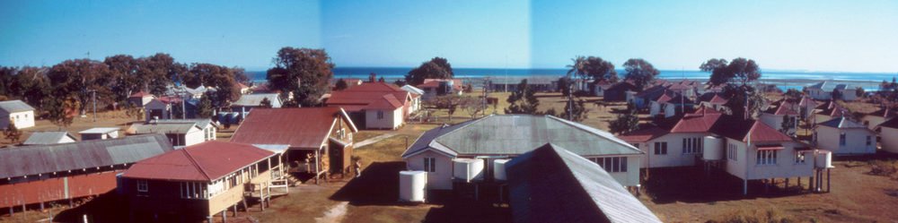
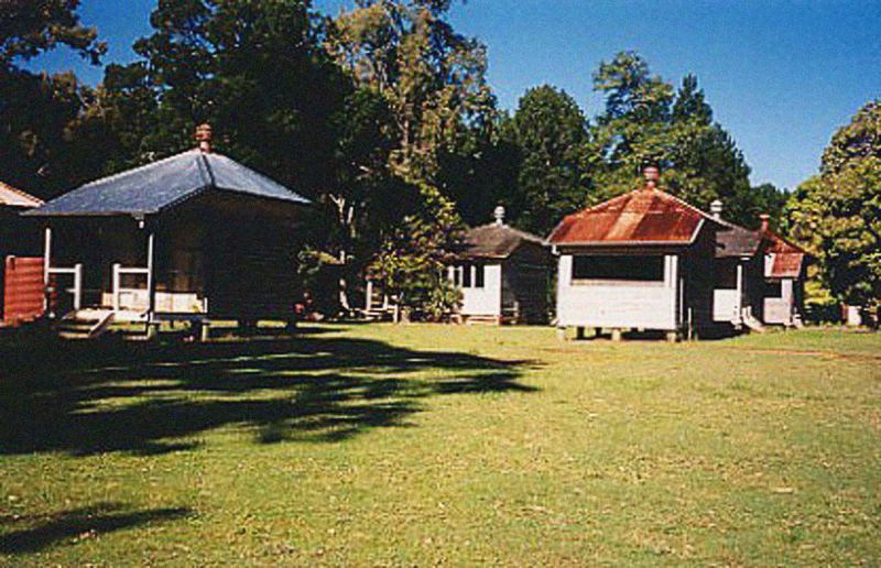
| Description | : | History Description Peel Island was known variously to Aboriginal groups as Turkroor, Dairkooreeba, Chercrooba. The island was charted by Matthew Flinders in 1799. In 1873 the island was proclaimed a reserve for quarantine purposes. A quarantine station was established on the south east corner of the island and was in regular use throughout the 1870s and 1880s as the colony received a constant stream of immigrant ships. With a decline in immigration in the 1890s and an improvement in public health, the quarantine station fell into disuse. Between 1910 and 1916 the buildings were use as an inebriates' home. In 1906 an... Read More |
frequently asked questions (FAQ):
-
Where is Peel Island Cemetery?
Peel Island Cemetery is located at Peel Island, Redland City ,Queensland ,Australia.
-
Peel Island Cemetery cemetery's updated grave count on graveviews.com?
171 memorials
-
Where are the coordinates of the Peel Island Cemetery?
Latitude: -27.4954200
Longitude: 153.3460100
Nearby Cemetories:
1. Dunwich Cemetery
Dunwich, Redland City, Australia
Coordinate: -27.4943961, 153.4037894
2. Dunwich Benevolent Asylum Cemetery
Dunwich, Redland City, Australia
Coordinate: -27.4947600, 153.4040300
3. Moongalba Aboriginal Cemetery
Dunwich, Redland City, Australia
Coordinate: -27.4919558, 153.4061137
4. Dunwich Lazarat Cemetery
Dunwich, Redland City, Australia
Coordinate: -27.5077854, 153.4141340
5. Coochiemudlo Island Pine Ridge Chapel
Coochiemudlo Island, Redland City, Australia
Coordinate: -27.5735700, 153.3301700
6. Redlands Pioneer Cemetery
Cleveland, Redland City, Australia
Coordinate: -27.5284472, 153.2566800
7. Cleveland Cemetery
Cleveland, Redland City, Australia
Coordinate: -27.5293750, 153.2544708
8. Saint Mary Mackillop Church Cremation Wall
Redland City, Australia
Coordinate: -27.4974639, 153.2285363
9. St. Mary Mackillop Columbarium
Redland City, Australia
Coordinate: -27.4974353, 153.2284627
10. Redland Bay Cemetery
Redland Bay, Redland City, Australia
Coordinate: -27.6098000, 153.2892590
11. St Helena Island Prisoners' Cemetery
Brisbane City, Australia
Coordinate: -27.3944260, 153.2310660
12. St Helena Island Warders' Children's Cemetery
Brisbane City, Australia
Coordinate: -27.3944260, 153.2310660
13. Serpentine Creek Cemetery
Carbrook, Logan City, Australia
Coordinate: -27.6695213, 153.3011932
14. Great Southern Garden of Remembrance
Carbrook, Logan City, Australia
Coordinate: -27.6526660, 153.2393650
15. Hemmant Cemetery and Crematorium
Brisbane, Brisbane City, Australia
Coordinate: -27.4678001, 153.1339111
16. Mount Cotton Lutheran Cemetery
Carbrook, Logan City, Australia
Coordinate: -27.6591409, 153.2333731
17. Gibson Island Plague Cemetery (Defunct)
Brisbane City, Australia
Coordinate: -27.4303333, 153.1269444
18. Tingalpa Christ Church Cemetery
Tingalpa, Brisbane City, Australia
Coordinate: -27.4727272, 153.1117449
19. Dennis Family Cemetery
Logan Village, Logan City, Australia
Coordinate: -27.6250600, 153.1566000
20. Rochedale Catholic Church Cemetery
Rochedale, Brisbane City, Australia
Coordinate: -27.5926510, 153.1217540
21. Alberton Cemetery
Alberton, Gold Coast City, Australia
Coordinate: -27.7112160, 153.2663420
22. Saint Mark's Anglican Cemetery
Daisy Hill, Logan City, Australia
Coordinate: -27.6434090, 153.1489350
23. Eagleby Cemetery
Eagleby, Logan City, Australia
Coordinate: -27.6949654, 153.2108917
24. St John’s Lutheran Church Cemetery
Eight Mile Plains, Brisbane City, Australia
Coordinate: -27.5875960, 153.1031940