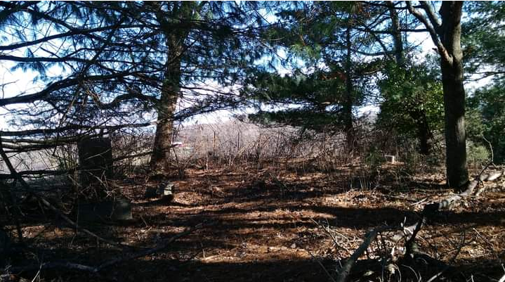
| Memorials | : | 0 |
| Location | : | Fincastle, Botetourt County, USA |
| Description | : | Peter Shaver Cemetery is located on private property. Cemetery is known also as Old Peter Shaver Cemetery. & Old Shaver Cemetery. Property is know as both Peter Shaver / Rieley Farm / Home Place. Peter Shaver started this cemetery on his property. Peter Shaver held services at the Shaver School House located by Highway 220, which later became Trinity Lutheran Church & Trinity Cemetery. Trinity Lutheran Church, Trinity Cemtery, & Trinity Store properties were donated to the community. References: 1. Botetourt County History Before 1900 Through Cemetery Records - Jacqueline H Radar 2. Related Families of Botetourt County... Read More |
frequently asked questions (FAQ):
-
Where is Peter Shaver Cemetery?
Peter Shaver Cemetery is located at No GPS information available Add GPS482 Shavers Farm Road (Rt 670) Fincastle, Botetourt County ,Virginia , 24090USA.
-
Peter Shaver Cemetery cemetery's updated grave count on graveviews.com?
0 memorials
Nearby Cemetories:
1. Anderson Cemetery
Botetourt County, USA
2. Benjamin Franklin Moomaw Cemetery
Botetourt County, USA
Coordinate: 37.7487190, -79.7982530
3. Blue Ridge Church of the Brethren Cemetery
Blue Ridge, Botetourt County, USA
4. Glade Creek Cemetery
Blue Ridge, Botetourt County, USA
Coordinate: 37.6089000, -79.8102000
5. Hill Crest Cemetery
Blue Ridge, Botetourt County, USA
6. Old Glade Creek Cemetery
Blue Ridge, Botetourt County, USA
Coordinate: 37.6420800, -79.7978930
7. Saunders Family Cemetery
Blue Ridge, Botetourt County, USA
Coordinate: 37.6416450, -79.8025290
8. Scanlon Family Cemetery
Blue Ridge, Botetourt County, USA
Coordinate: 37.6171130, -79.8364830
9. Tosher-Tosh Cemetery
Blue Ridge, Botetourt County, USA
Coordinate: 37.6855320, -79.8072950
10. Carvins Cove
Botetourt County, USA
Coordinate: 37.6939100, -79.8962400
11. Coyner Springs Cemetery
Coyner Springs, Botetourt County, USA
Coordinate: 37.6322224, -79.7323000
12. Smith Family Cemetery
Coyner Springs, Botetourt County, USA
Coordinate: 37.6033380, -79.8589600
13. Allen-Carper Cemetery
Eagle Rock, Botetourt County, USA
14. Bethel Cemetery
Eagle Rock, Botetourt County, USA
Coordinate: 37.7487190, -79.7982530
15. Cemetery
Eagle Rock, Botetourt County, USA
16. Clark Family Cemetery
Eagle Rock, Botetourt County, USA
Coordinate: 37.6089000, -79.8102000
17. Daniels' Mountain Cemetery
Eagle Rock, Botetourt County, USA
18. Eagle Rock Baptist Church Cemetery
Eagle Rock, Botetourt County, USA
Coordinate: 37.6420800, -79.7978930
19. Emmanuel Episcopal Church Cemetery
Eagle Rock, Botetourt County, USA
Coordinate: 37.6416450, -79.8025290
20. Forest Grove Baptist Church Cemetery
Eagle Rock, Botetourt County, USA
Coordinate: 37.6171130, -79.8364830
21. Galatia Presbyterian Church Cemetery
Eagle Rock, Botetourt County, USA
Coordinate: 37.6855320, -79.8072950
22. Longdale Cemetery
Eagle Rock, Botetourt County, USA
Coordinate: 37.6939100, -79.8962400
23. Mount Bethel Church of the Brethren Cemetery
Eagle Rock, Botetourt County, USA
Coordinate: 37.6322224, -79.7323000
24. Mount Moriah Cemetery
Eagle Rock, Botetourt County, USA
Coordinate: 37.6033380, -79.8589600

