
| Memorials | : | 0 |
| Location | : | Dahlem, Landkreis Bitburg-Prüm, Germany |
| Coordinate | : | 49.9146277, 6.5922906 |
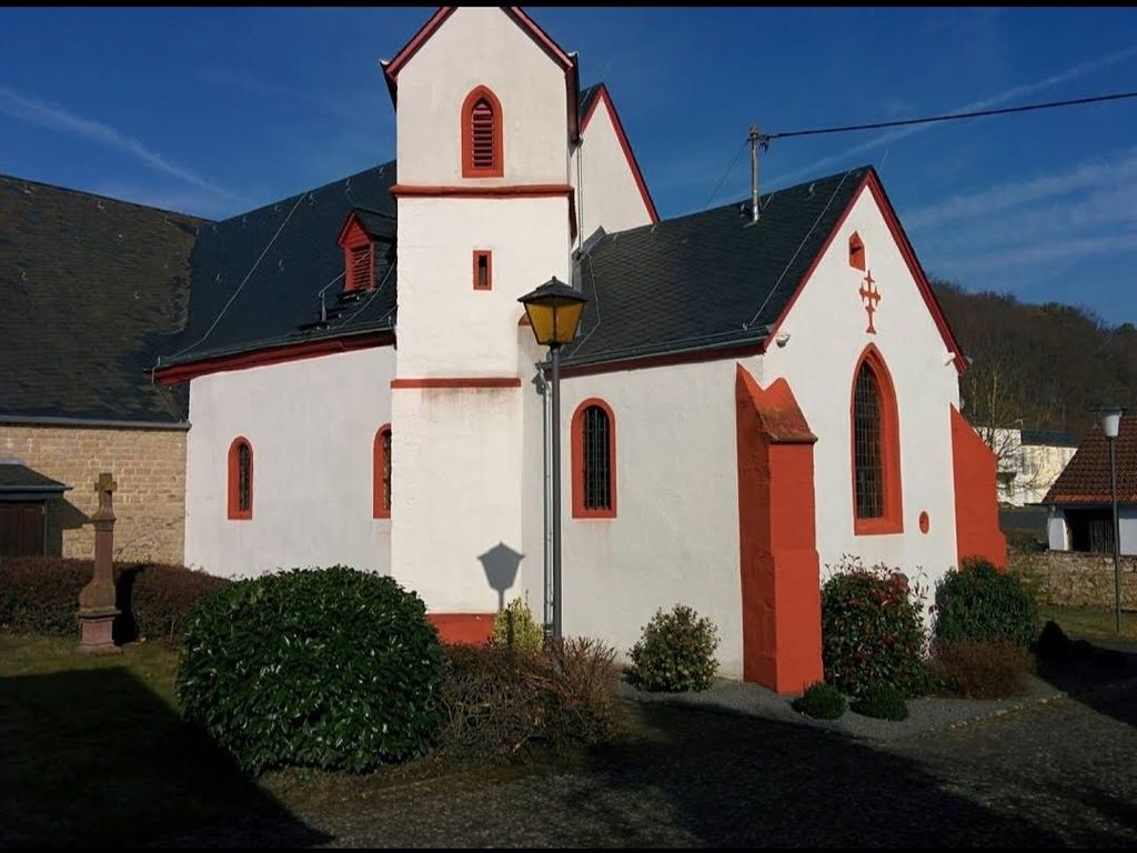
| Description | : | Cemetery in Dahlem 54636 Germany. It is apart of the Pfarrirche Catholic Church. |
frequently asked questions (FAQ):
-
Where is Pfarrkirche Cemetery?
Pfarrkirche Cemetery is located at kirchweg 5 Dahlem, Landkreis Bitburg-Prüm ,Rheinland-Pfalz , 54636Germany.
-
Pfarrkirche Cemetery cemetery's updated grave count on graveviews.com?
0 memorials
-
Where are the coordinates of the Pfarrkirche Cemetery?
Latitude: 49.9146277
Longitude: 6.5922906
Nearby Cemetories:
1. Friedhof in Speicher
Speicher, Landkreis Bitburg-Prüm, Germany
Coordinate: 49.9384766, 6.6430635
2. Friedhof Orenhofen
Orenhofen, Landkreis Bitburg-Prüm, Germany
Coordinate: 49.8999649, 6.6548794
3. St. Martin
Schleidweiler, Landkreis Trier-Saarburg, Germany
Coordinate: 49.8806000, 6.6610700
4. Friedhof St Jakobus Niederstedem
Niederstedem, Landkreis Bitburg-Prüm, Germany
Coordinate: 49.9298764, 6.4992017
5. Friedhof Zemmer
Zemmer, Landkreis Trier-Saarburg, Germany
Coordinate: 49.8902267, 6.6905727
6. Friedhof Dudeldof
Dudeldorf, Landkreis Bitburg-Prüm, Germany
Coordinate: 49.9796964, 6.6423442
7. Friedhof Badem
Badem, Landkreis Bitburg-Prüm, Germany
Coordinate: 50.0001948, 6.6087484
8. Friedhof Niederkail
Niederkail, Landkreis Bernkastel-Wittlich, Germany
Coordinate: 49.9743502, 6.7408463
9. Kriegsgraberstatte Holsthum
Holsthum, Landkreis Bitburg-Prüm, Germany
Coordinate: 49.8884310, 6.4169130
10. Saint Remigius Kirchhof
Oberweis, Landkreis Bitburg-Prüm, Germany
Coordinate: 49.9637413, 6.4211011
11. Stifts Kirche - Kyllburg
Landkreis Bitburg-Prüm, Germany
Coordinate: 50.0357000, 6.5859670
12. St. Maximin Friedhof - Kyllburg
Landkreis Bitburg-Prüm, Germany
Coordinate: 50.0387170, 6.5876330
13. Friedhof Oberkail
Oberkail, Landkreis Bitburg-Prüm, Germany
Coordinate: 50.0346016, 6.6798981
14. Sankt Luzia Katholischer Friedhof
Ferschweiler, Landkreis Bitburg-Prüm, Germany
Coordinate: 49.8618207, 6.4030748
15. Friedhof Landscheid
Landscheid, Landkreis Bernkastel-Wittlich, Germany
Coordinate: 49.9867014, 6.7736202
16. Friedhof Schwarzenborn
Schwarzenborn, Landkreis Bernkastel-Wittlich, Germany
Coordinate: 50.0360514, 6.7104565
17. Friedhof Kenn
Kenn, Landkreis Trier-Saarburg, Germany
Coordinate: 49.7990684, 6.7250886
18. Saint Willibrord's Basilica
Echternach, Canton d'Echternach, Luxembourg
Coordinate: 49.8138890, 6.4225000
19. Hauptfriedhof
Trier, Stadtkreis Trier, Germany
Coordinate: 49.7665490, 6.6543280
20. Cimetiere d'Echternach
Echternach, Canton d'Echternach, Luxembourg
Coordinate: 49.8117738, 6.4148465
21. Schleid
Schleid, Landkreis Bitburg-Prüm, Germany
Coordinate: 50.0562000, 6.4934800
22. Begräbniswald Niederweiler
Niederweiler, Landkreis Bitburg-Prüm, Germany
Coordinate: 50.0328880, 6.4308070
23. Sankt Michael Katholischer Friedhof
Bollendorf, Landkreis Bitburg-Prüm, Germany
Coordinate: 49.8525044, 6.3617986
24. Hohe Domkirche St. Peter zu Trier
Trier, Stadtkreis Trier, Germany
Coordinate: 49.7561110, 6.6430560