
| Memorials | : | 0 |
| Location | : | Audubon, Montgomery County, USA |
| Coordinate | : | 40.1162920, -75.4538440 |
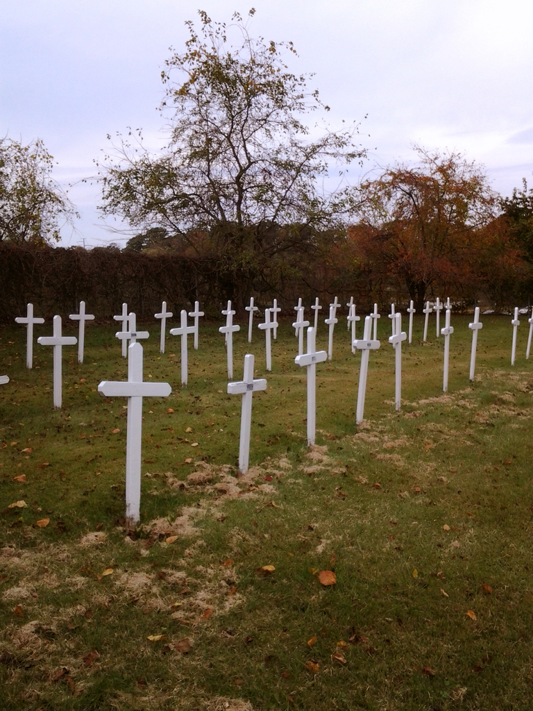
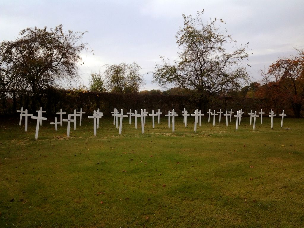
| Description | : | Located north of Pawlings Road, tucked by the curve in Route 422, this small cemetery holds the remains of nearly 50 men and boys who lived and worked at the Philadelphia Boy's Protectory, now St. Gabriel's Hall. Whether for financial reasons, or a lack of family to claim their remains, those buried here had no other place for interment. Most graves are marked with simple wooden crosses; several have name plates. Information about those buried there was obtained from a listing compiled by a late member of the Christian Brothers, who operated St. Gabriel's Hall. That information has since been transferred... Read More |
frequently asked questions (FAQ):
-
Where is Philadelphia Protectory for Boys Cemetery?
Philadelphia Protectory for Boys Cemetery is located at 1350 Pawlings Road Audubon, Montgomery County ,Pennsylvania , 19401USA.
-
Philadelphia Protectory for Boys Cemetery cemetery's updated grave count on graveviews.com?
0 memorials
-
Where are the coordinates of the Philadelphia Protectory for Boys Cemetery?
Latitude: 40.1162920
Longitude: -75.4538440
Nearby Cemetories:
1. Wetherills Cemetery
Audubon, Montgomery County, USA
Coordinate: 40.1202000, -75.4374000
2. Washington Memorial Chapel Churchyard
Valley Forge, Montgomery County, USA
Coordinate: 40.1059685, -75.4393616
3. Marine Circle of Trees Memorial
Phoenixville, Chester County, USA
Coordinate: 40.1041440, -75.4740980
4. Saint Paul's Episcopal Church Cemetery
Oaks, Montgomery County, USA
Coordinate: 40.1360397, -75.4490814
5. Green Tree Church of the Brethren Cemetery
Oaks, Montgomery County, USA
Coordinate: 40.1351000, -75.4679000
6. Valley Forge Baptist Church Cemetery
Valley Forge, Chester County, USA
Coordinate: 40.0993614, -75.4716797
7. First Presbyterian of Port Kennedy Churchyard
King of Prussia, Montgomery County, USA
Coordinate: 40.1035614, -75.4188309
8. Valley Forge National Historic Park
Valley Forge, Montgomery County, USA
Coordinate: 40.1006203, -75.4206085
9. Anderson Family Burying Ground
Phoenixville, Chester County, USA
Coordinate: 40.1043700, -75.4963600
10. Upper Providence Friends Meeting Burial Ground
Oaks, Montgomery County, USA
Coordinate: 40.1489000, -75.4758000
11. Schuylkill Friends Meeting Cemetery
Phoenixville, Chester County, USA
Coordinate: 40.1212000, -75.5018000
12. Norris Family Burial Ground
West Norriton, Montgomery County, USA
Coordinate: 40.1212000, -75.4026000
13. Valley Friends Meeting Burial Ground
Wayne, Chester County, USA
Coordinate: 40.0825386, -75.4152985
14. Holy Ghost Cemetery
Mont Clare, Montgomery County, USA
Coordinate: 40.1439018, -75.5010986
15. Saint John's Evangelical Lutheran Church Columbarium Garden
Phoenixville, Chester County, USA
Coordinate: 40.1128856, -75.5142815
16. Saint Michael's Greek Catholic Cemetery
Mont Clare, Montgomery County, USA
Coordinate: 40.1417999, -75.5053635
17. B'nai Jacob Cemetery
Mont Clare, Montgomery County, USA
Coordinate: 40.1425018, -75.5057983
18. Saint Ann Roman Catholic Church Crypt
Phoenixville, Chester County, USA
Coordinate: 40.1272874, -75.5145145
19. Phoenixville Mennonite Cemetery
Phoenixville, Chester County, USA
Coordinate: 40.1327000, -75.5161000
20. Saint Mary of the Assumption Roman Catholic Cemetery
Phoenixville, Chester County, USA
Coordinate: 40.1397018, -75.5149994
21. Great Valley Baptist Church Cemetery
Devon, Chester County, USA
Coordinate: 40.0660591, -75.4322205
22. Providence Mennonite Church Cemetery
Collegeville, Montgomery County, USA
Coordinate: 40.1679400, -75.4705100
23. Diamond Rock Mennonite Cemetery
Malvern, Chester County, USA
Coordinate: 40.0749000, -75.4986000
24. Morris Cemetery
Phoenixville, Chester County, USA
Coordinate: 40.1258011, -75.5242004